world.wikisort.org - Czech
Loučná pod Klínovcem (until 1947 Český Wiesenthal; German: Böhmisch Wiesenthal) is a town in Chomutov District in the Ústí nad Labem Region of the Czech Republic. It has about 100 inhabitants and it is the second least populated town in the country.
Loučná pod Klínovcem | |
|---|---|
Town | |
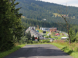
 Road to Loučná pod Klínovcem | |
 Loučná pod Klínovcem Location in the Czech Republic | |
| Coordinates: 50°24′46″N 12°59′23″E | |
| Country | |
| Region | Ústí nad Labem |
| District | Chomutov |
| First mentioned | 1431 |
| Government | |
| • Mayor | Jana Müllerová (Ind.) |
| Area | |
| • Total | 20.89 km2 (8.07 sq mi) |
| Elevation | 865 m (2,838 ft) |
| Population (2022-01-01)[1] | |
| • Total | 135 |
| • Density | 6.5/km2 (17/sq mi) |
| Time zone | UTC+1 (CET) |
| • Summer (DST) | UTC+2 (CEST) |
| Postal code | 431 91 |
| Website | www |
Administrative parts
The town is made up of two parts, Háj and Loučná.
Geography
Loučná pod Klínovcem is located about 30 kilometres (19 mi) west of Chomutov and 21 km (13 mi) north of Karlovy Vary. The town lies on the border with Germany, the German part of the divided town is called Oberwiesenthal. It lies in the Ore Mountains. The highest point of the municipal territory is a contour line below the top of the Klínovec Mountain, at 1,227 metres (4,026 ft) above sea level.
History
The first written mention of Loučná pod Klínovcem is from 1431, under its German name Wiesenthal. The village was probably founded in the 14th century. The village was destroyed during the Hussite Wars and was abandoned. At the beginning of the 16th century, mining developed in the area, Loučná pod Klínovcem was resettled and its importance began to grow.[2]
Transport
There is the road border crossing Loučná / Oberwiesenthal with Germany.
Sport
There is a large ski resort on the slopes of Klínovec.[3]
Notable people
- Hans Erich Slany (1926–2013), German industrial designer
References
- "Population of Municipalities – 1 January 2022". Czech Statistical Office. 2022-04-29.
- "Občan" (in Czech). Obec Loučná pod Klínovcem. Retrieved 2022-09-13.
- "Ski map". Skiareál Klínovec. Retrieved 2022-09-13.
External links
На других языках
[de] Loučná pod Klínovcem
Loučná pod Klínovcem (bis 1947 Český Wiesenthal, deutsch Böhmisch Wiesenthal) ist eine Stadt im Ústecký kraj in Tschechien.- [en] Loučná pod Klínovcem
Другой контент может иметь иную лицензию. Перед использованием материалов сайта WikiSort.org внимательно изучите правила лицензирования конкретных элементов наполнения сайта.
WikiSort.org - проект по пересортировке и дополнению контента Википедии

