world.wikisort.org - Czech
Jablonné v Podještědí (until 1946 Německé Jablonné; German: Deutsch Gabel, until 1901 Gabel) is a town in Liberec District in the Liberec Region of the Czech Republic. It has about 3,700 inhabitants. The town centre is well preserved and is protected by law as an urban monument zone.
Jablonné v Podještědí | |
|---|---|
Town | |
 View over the Míru Square towards Lusatian Mountains | |
 Flag Coat of arms | |
 Jablonné v Podještědí Location in the Czech Republic | |
| Coordinates: 50°45′56″N 14°45′39″E | |
| Country | |
| Region | Liberec |
| District | Liberec |
| First mentioned | 1241 |
| Government | |
| • Mayor | Jiří Rýdl |
| Area | |
| • Total | 57.87 km2 (22.34 sq mi) |
| Elevation | 315 m (1,033 ft) |
| Population (2022-01-01)[1] | |
| • Total | 3,685 |
| • Density | 64/km2 (160/sq mi) |
| Time zone | UTC+1 (CET) |
| • Summer (DST) | UTC+2 (CEST) |
| Postal code | 471 25 |
| Website | www |
Administrative parts
Town parts of Markvartice and Zámecká and villages of Česká Ves, Heřmanice v Podještědí, Kněžice, Lada v Podještědí, Lvová, Petrovice, Pole, Postřelná and Valdov are administrative parts of Jablonné v Podještědí.
Geography
Jablonné v Podještědí is located about 20 km (12 mi) west of Liberec, on the border with Germany. It lies mostly in the Ralsko Uplands, but the northern part of the municipal territory extends into the Lusatian Mountains. The highest point is the mountain Hvozd at 749 m (2,457 ft) above sea level, located on the Czech-German border. The Panenský Stream flows through the town. There are several ponds in the vicinity of the town.
History
Jablonné v Podještědí was founded by German colonizers in the 12th century. Its advantageous location on the trade route from Zittau to Prague helped the development from a village to a town, and for several centuries it became an important place of trade and customs. Around 1240, Lemberk Castle was founded by Havel of Markvartice for guarding the trade route.[2]
Until 1918, the town was part of the Austrian monarchy (Austria side after the compromise of 1867), head of the Gabel District (later Gabel bei Niemes), one of the 94 Bezirkshauptmannschaften in Bohemia.[3] In 1918, it became a part of independent Czechoslovakia.
In 1938, Jablonné was ceded to Nazi Germany as a result of the Munich Agreement. Until 1945, it was administered as a part of the Regierungsbezirk Aussig of Reichsgau Sudetenland. In May 1945, after the liberation of Czechoslovakia, it returned under Czechoslovak administration.
Demographics
|
|
| ||||||||||||||||||||||||||||||||||||||||||||||||||||||
| Source: Censuses[4][5] | ||||||||||||||||||||||||||||||||||||||||||||||||||||||||
Transport
There is a road border crossing Petrovice / Lückendorf with Germany.
Sights

Jablonné v Podještědí is known for the Lemberk Castle, which is located in the Lvová village. It is open to the public.
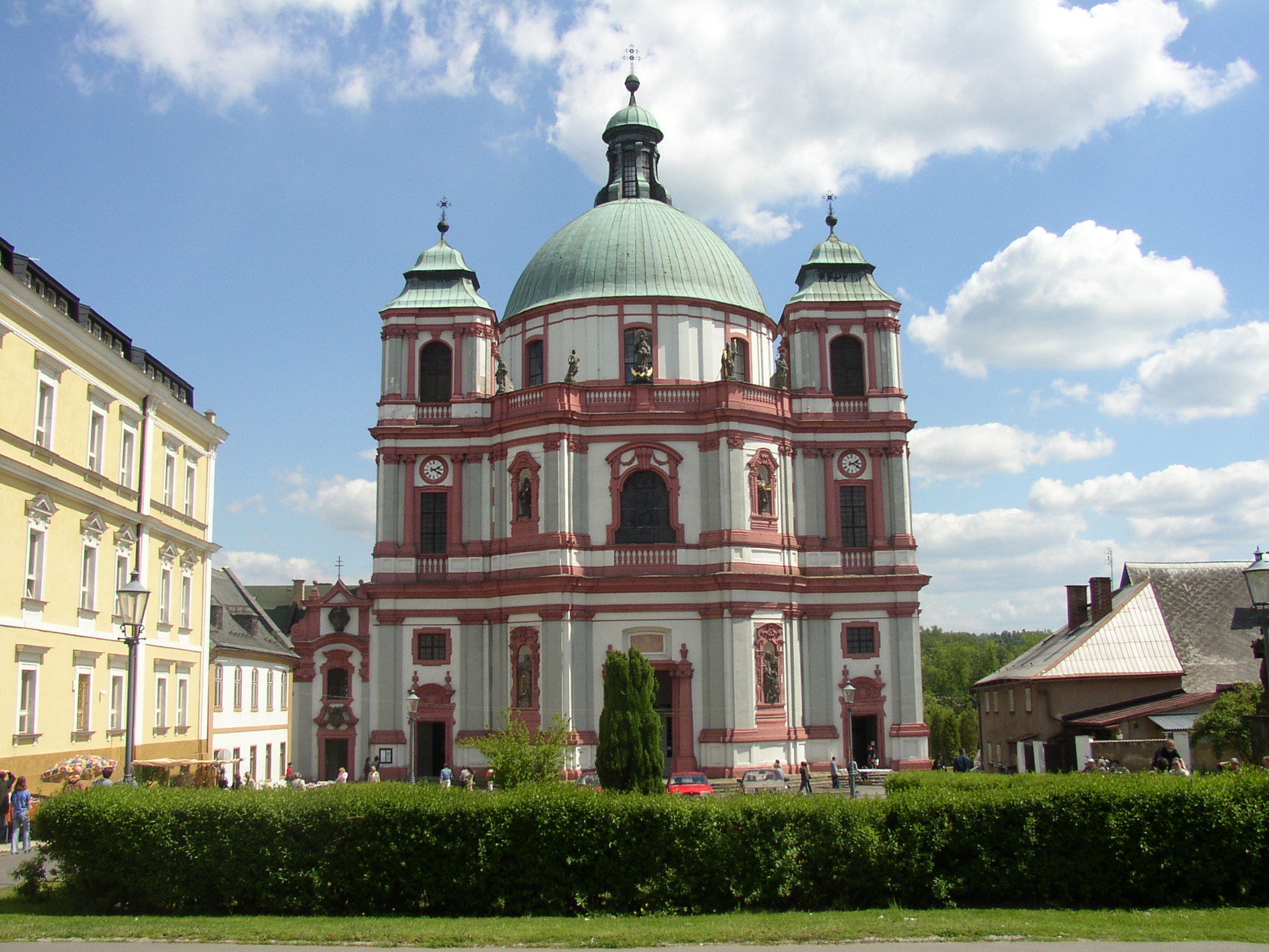
Basilica of Saints Lawrence and Zdislava is a basilica minor, built at the beginning of the 18th century. It is one of the leading buildings of Baroque architecture in Central Europe. The dome is 34 m (112 ft) high.[6]
Notable people
- Zdislava Berka (c. 1220–1252), saint, died here
- Karl von Ergert (1795–1865), Austrian military officer
- Josef Johann Mann (1804–1889), entomologist
- Franz Ergert (1858–1931), Austrian industrialist
- Wenzel Bürger (1869–1946), German architect
- Alfred Gürtler (1875–1933), Austrian economist and politician
- Hildegard Neumann (1919–2010), Nazi officer
- Gert Willner (1940–2000), German politician
Gallery
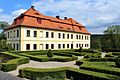 Palme's manor
 Basilica of Saints Lawrence and Zdislava
 Chapel in Petrovice


References
- "Population of Municipalities – 1 January 2022". Czech Statistical Office. 2022-04-29.
- "Historie" (in Czech). Město Jablonné v Podještědí. Retrieved 2021-08-16.
- Die postalischen Abstempelungen auf den österreichischen Postwertzeichen-Ausgaben 1867, 1883 und 1890, Wilhelm Klein, 1967
- "Historický lexikon obcí České republiky 1869–2011 – Okres Liberec" (in Czech). Czech Statistical Office. 2015-12-21. pp. 7–8.
- "Population Census 2021: Population by sex". Public Database. Czech Statistical Office. 2021-03-27.
- "Bazilika minor sv. Vavřince a sv. Zdislavy" (in Czech). Město Jablonné v Podještědí. Retrieved 2021-08-16.
External links
Authority control | |
|---|---|
| General |
|
| National libraries | |
На других языках
[de] Jablonné v Podještědí
Jablonné v Podještědí (deutsch Deutsch Gabel, bis 1901 Gabel) ist eine Stadt in der Tschechischen Republik.- [en] Jablonné v Podještědí
Другой контент может иметь иную лицензию. Перед использованием материалов сайта WikiSort.org внимательно изучите правила лицензирования конкретных элементов наполнения сайта.
WikiSort.org - проект по пересортировке и дополнению контента Википедии