world.wikisort.org - Czech
Boží Dar (German: Gottesgab) is a small town in Karlovy Vary District in the Karlovy Vary Region of the Czech Republic. It has about 200 inhabitants. Situated in the Ore Mountains at 1,028 m (3,373 ft) above sea level, it is considered the highest town in the Czech Republic.
Boží Dar | |
|---|---|
Town | |
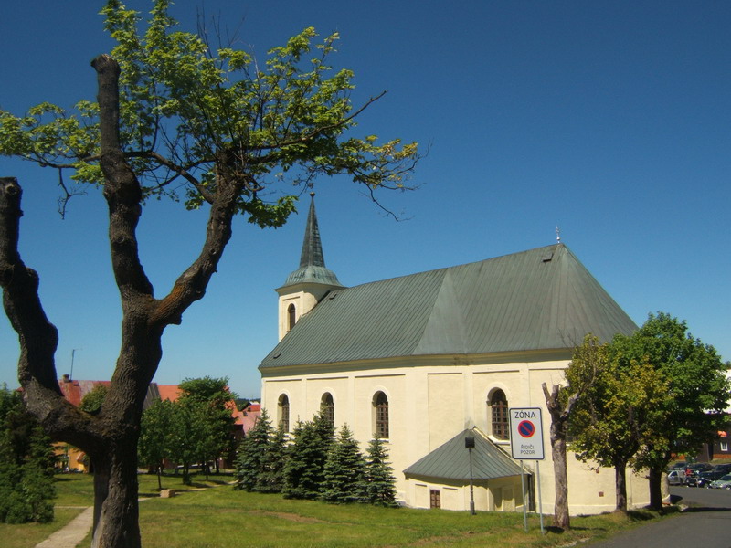
 Panorama of the town | |
 Coat of arms | |
 Boží Dar Location in the Czech Republic | |
| Coordinates: 50°24′35″N 12°55′28″E | |
| Country | |
| Region | Karlovy Vary |
| District | Karlovy Vary |
| Founded | 1533 |
| Government | |
| • Mayor | Jan Horník (STAN) |
| Area | |
| • Total | 37.91 km2 (14.64 sq mi) |
| Elevation | 1,028 m (3,373 ft) |
| Population (2022-01-01)[1] | |
| • Total | 227 |
| • Density | 6.0/km2 (16/sq mi) |
| Time zone | UTC+1 (CET) |
| • Summer (DST) | UTC+2 (CEST) |
| Postal code | 362 62 |
| Website | www |
Administrative parts
Villages of Ryžovna and Zlatý Kopec are administrative parts of Boží Dar.
Geography

Boží Dar is located about 20 kilometres (12 mi) north of Karlovy Vary, on the border with Germany. The municipality lies in the Ore Mountains. The highest point of the municipal territory is near the summit of the Božídarský Špičák mountain, almost at 1,115 metres (3,658 ft) above sea level. The area around the Božídarský Špičák with peat bogs is protected as the Božídarské rašeliniště National Nature Reserve.[2]
The Černá creek flows across the municipal territory. The Myslivny Reservoir is supplied by the creek.
History
The remote area in the Saxon Barony of Schwarzenberg was settled after silver and tin mining began about 1517. Boží Dar, under its original German name Gottesgab (both literally meaning "Gift of God"), was founded as a mining town by decree of the Wettin elector John Frederick I of Saxony, who acquired the lordship in 1533. Together with neighbouring Horní Blatná, John Frederick had to cede the town to the Habsburg lands of the Bohemian Crown in 1547 after the Schmalkaldic War and his defeat in the Battle of Mühlberg.[3]
The peak of mining dates back to the 1550s and 1560s, when the town had over 2,000 inhabitants. In 1580, Emperor Rudolf II. promoted Boží Dar to the royal mining town. During the Thirty Years' War, the town was looted several times. In 1643, it was plundered by the Swedes. After the decline of mining in the 17th and 18th centuries, the original important mining town gradually turned into a mountain town, whose inhabitants subsisted on various domestic productions.[3]
After World War I, Boží Dar became part of the First Czechoslovak Republic. It was mainly settled by Sudeten Germans and was one of the municipalities in Sudetenland annexed during the German occupation of Czechoslovakia in 1938. After World War II the German population was expelled.[3] The historic town privileges were lost in the 1950s, but restored in 2006.
Demographics
|
|
| ||||||||||||||||||||||||||||||||||||||||||||||||||||||
| Source: Censuses[4][5] | ||||||||||||||||||||||||||||||||||||||||||||||||||||||||
Transport
Boží Dar is the site of a road border crossing to Oberwiesenthal in Saxony.
Sport
Boží Dar lies in one of the most important winter sport regions in the Czech Republic.The town is known for two ski resorts with several downhill runs and four ski lifts.[6]
Notable people
- Kaspar Eberhard (1523–1575), Lutheran theologian; local pastor in 1554
- Nikos Kazantzakis (1883–1957), Greek writer; spent several months in Myslivny in 1929–1932
- Lukáš Bauer (born 1977), cross country skier; lives here
References
- "Population of Municipalities – 1 January 2022". Czech Statistical Office. 2022-04-29.
- "Božídarský Špičák" (in Czech). Město Boží Dar. Retrieved 2022-06-07.
- "Historie Božího Daru" (in Czech). Město Boží Dar. Retrieved 2022-06-07.
- "Historický lexikon obcí České republiky 1869–2011 – Okres Karlovy Vary" (in Czech). Czech Statistical Office. 2015-12-21. pp. 3–4.
- "Population Census 2021: Population by sex". Public Database. Czech Statistical Office. 2021-03-27.
- "Ski resort". Skiareál Boží Dar. Retrieved 2022-06-07.
External links
| Wikimedia Commons has media related to Boží Dar. |
Authority control | |
|---|---|
| General |
|
| National libraries | |
Другой контент может иметь иную лицензию. Перед использованием материалов сайта WikiSort.org внимательно изучите правила лицензирования конкретных элементов наполнения сайта.
WikiSort.org - проект по пересортировке и дополнению контента Википедии