world.wikisort.org - Czech
Bdín is a municipality and village in Rakovník District in the Central Bohemian Region of the Czech Republic. It has about 70 inhabitants.
Bdín | |
|---|---|
Municipality | |
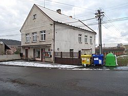
 Municipal office | |
 Bdín Location in the Czech Republic | |
| Coordinates: 50°12′51″N 13°51′32″E | |
| Country | |
| Region | Central Bohemian |
| District | Rakovník |
| First mentioned | 1318 |
| Area | |
| • Total | 2.12 km2 (0.82 sq mi) |
| Elevation | 360 m (1,180 ft) |
| Population (2022-01-01)[1] | |
| • Total | 72 |
| • Density | 34/km2 (88/sq mi) |
| Time zone | UTC+1 (CET) |
| • Summer (DST) | UTC+2 (CEST) |
| Postal code | 270 54 |
| Website | www |
Etymology
The name is derived from the Old Czech personal name Bda, meaning "Bda's court".[2]
Geography
Bdín is located about 15 km (9 mi) northeast of Rakovník and 39 km (24 mi) northwest of Prague. It lies in the geomorphological mesoregion of Džbán. The highest point is a contour line at 476 m (1,562 ft) above sea level. The Bakovský Stream flows through the municipality.
History
The first written mention of Bdín is from 1318.[2]
Sights
Bdín is poor in monuments. The most notable sights are a wooden bellfry and a bust of John Amos Comenius from 1913.[2]
References
- "Population of Municipalities – 1 January 2022". Czech Statistical Office. 2022-04-29.
- "Bdín nabízí klidné útočiště" (in Czech). Deník.cz. Retrieved 2022-11-09.
External links
Wikimedia Commons has media related to Bdín.
На других языках
[de] Bdín
Bdín (deutsch Bdin, 1939–45 Wacht) ist eine Gemeinde im Okres Rakovník in Tschechien. Sie liegt acht Kilometer nördlich von Nové Strašecí und gehört zum Okres Rakovník.- [en] Bdín
Текст в блоке "Читать" взят с сайта "Википедия" и доступен по лицензии Creative Commons Attribution-ShareAlike; в отдельных случаях могут действовать дополнительные условия.
Другой контент может иметь иную лицензию. Перед использованием материалов сайта WikiSort.org внимательно изучите правила лицензирования конкретных элементов наполнения сайта.
Другой контент может иметь иную лицензию. Перед использованием материалов сайта WikiSort.org внимательно изучите правила лицензирования конкретных элементов наполнения сайта.
2019-2025
WikiSort.org - проект по пересортировке и дополнению контента Википедии
WikiSort.org - проект по пересортировке и дополнению контента Википедии