world.wikisort.org - Cuba
Taguasco (Spanish pronunciation: [taˈɣwasko]) is a municipality and town in the Sancti Spíritus Province of Cuba.
Taguasco | |
|---|---|
Municipality | |
 | |
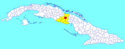 Taguasco municipality (red) within Sancti Spíritus Province (yellow) and Cuba | |
| Coordinates: 22°00′18″N 79°15′54″W | |
| Country | Cuba |
| Province | Sancti Spíritus |
| Area | |
| • Total | 518 km2 (200 sq mi) |
| Elevation | 100 m (300 ft) |
| Population (2004)[2] | |
| • Total | 36,365 |
| • Density | 70.2/km2 (182/sq mi) |
| Time zone | UTC-5 (EST) |
| Area code | +53-41 |
| Website | https://taguasco.gob.cu/ |
Geography
It is located 20 kilometres (12 mi) north-east of Sancti Spiritus, the provincial capital, and is bisected by Carretera Central highway between Cabaiguán and Jatibonico.
Demographics
In 2004, the municipality of Taguasco had a population of 36,365.[2] With a total area of 518 km2 (200 sq mi),[1] it has a population density of 70.2/km2 (182/sq mi).
See also
- Municipalities of Cuba
- List of cities in Cuba
References
- Statoids (July 2003). "Municipios of Cuba". Retrieved 2007-10-07.
- Atenas.cu (2004). "2004 Population trends, by Province and Municipality" (in Spanish). Archived from the original on 2006-07-14. Retrieved 2007-10-07.
External links
![]() Media related to Taguasco at Wikimedia Commons
Media related to Taguasco at Wikimedia Commons
Places adjacent to Taguasco | ||||||||||||||||
|---|---|---|---|---|---|---|---|---|---|---|---|---|---|---|---|---|
| ||||||||||||||||
Municipalities in Sancti Spíritus Province | ||
|---|---|---|
This Cuban location article is a stub. You can help Wikipedia by expanding it. |
Текст в блоке "Читать" взят с сайта "Википедия" и доступен по лицензии Creative Commons Attribution-ShareAlike; в отдельных случаях могут действовать дополнительные условия.
Другой контент может иметь иную лицензию. Перед использованием материалов сайта WikiSort.org внимательно изучите правила лицензирования конкретных элементов наполнения сайта.
Другой контент может иметь иную лицензию. Перед использованием материалов сайта WikiSort.org внимательно изучите правила лицензирования конкретных элементов наполнения сайта.
2019-2026
WikiSort.org - проект по пересортировке и дополнению контента Википедии
WikiSort.org - проект по пересортировке и дополнению контента Википедии