world.wikisort.org - Cuba
Perico is a municipality and town in the Matanzas Province of Cuba. It is located south of Marti, north of Colón and east of Jovellanos.
Perico | |
|---|---|
Municipality | |
 A rural road near town's centre | |
 Coat of arms | |
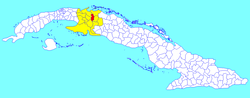 Perico municipality (red) within Matanzas Province (yellow) and Cuba | |
| Coordinates: 22°46′31″N 81°00′55″W | |
| Country | Cuba |
| Province | Matanzas |
| Founded | 1874[1] |
| Established | 1879 |
| Area | |
| • Total | 278 km2 (107 sq mi) |
| Elevation | 35 m (115 ft) |
| Population (2004)[3] | |
| • Total | 31,147 |
| • Density | 112.0/km2 (290/sq mi) |
| Time zone | UTC-5 (EST) |
| Area code | +53-52 |
Geography
The municipality is divided into the barrios of Altamisal, Norte, Quintana, Roque, Sur and Tinguaro.[1]
It counts the hamlets (consejos populares) of España Republicana, meaning Republican Spain, and Máximo Gómez, named after the military commander in Cuban War of Independence.
History
Perico was founded in 1874[1] near a garrison of the Spanish Colonial Civil Guard. The name was changed in 1885 to Miguel de Cervantes, then restored to Perico in 1899.[4]
Demographics
In 2004, the municipality of Perico had a population of 31,147.[3] With a total area of 278 km2 (107 sq mi),[2] it has a population density of 112.0/km2 (290/sq mi).
Transport
Perico is crossed by the Carretera Central highway and counts a railway station of the main line from Havana to Santiago de Cuba.
Notable people
- Félix Navarro Rodríguez, dissident[5] He was later released.
- Minnie Miñoso, famed American League baseball player.
- Blanca Rosa Gil (1937-), famous Cuban bolero singer.
See also
- Municipalities of Cuba
- List of cities in Cuba
References
- Guije.com. "Perico" (in Spanish). Retrieved 2007-10-07.
- Statoids (July 2003). "Municipios of Cuba". Retrieved 2007-10-07.
- Atenas.cu (2004). "2004 Population trends, by Province and Municipality" (in Spanish). Archived from the original on 2007-09-27. Retrieved 2007-10-07.
- Municipalities in Matanzas. "Perico" (in Spanish). Archived from the original on December 16, 2004. Retrieved 2007-10-02.
- "Prisoners of conscience: 71 longing for freedom". Amnesty International. 18 March 2005. Retrieved 25 July 2012.
External links
![]() Media related to Perico, Cuba at Wikimedia Commons
Media related to Perico, Cuba at Wikimedia Commons
Places adjacent to Perico, Cuba | ||||||||||||||||
|---|---|---|---|---|---|---|---|---|---|---|---|---|---|---|---|---|
| ||||||||||||||||
Municipalities in Matanzas Province | ||
|---|---|---|
| Authority control |
|
|---|
Другой контент может иметь иную лицензию. Перед использованием материалов сайта WikiSort.org внимательно изучите правила лицензирования конкретных элементов наполнения сайта.
WikiSort.org - проект по пересортировке и дополнению контента Википедии