world.wikisort.org - Cuba
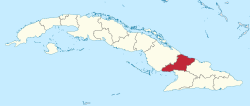
Las Tunas is one of the provinces of Cuba. Major towns include Puerto Padre, Amancio, and the capital city, Las Tunas (historically Victoria de Las Tunas).[3]
Las Tunas Province | |
|---|---|
Province of Cuba | |
 Coat of arms | |
 | |
| Country | Cuba |
| Capital | Las Tunas |
| Area | |
| • Total | 6,595.25 km2 (2,546.44 sq mi) |
| Population (2010-12-31)[1] | |
| • Total | 536,027 |
| • Density | 81/km2 (210/sq mi) |
| Time zone | UTC-5 (EST) |
| Area code | +53-31 |
| HDI (2019) | 0.755[2] high · 16th of 16 |
| Website | https://www.lastunas.gob.cu/es/ |
Climate and agriculture
The southern coast, which opens onto the Gulf of Guacanayabo, is marshy and characterised by mangroves. This wet area is used to grow sugarcane, as the wet climate is well suited for the crop.
Cattle are also grazed in the province.
History
Las Tunas was part of the Oriente province, until that province was divided into five smaller provinces in 1975.
In the same year, a large development program was started to modernize the town of Las Tunas and connect it by road to Havana.[citation needed]
Municipalities
| Municipality | Population (2004) | Area (km²) | Location | Remarks |
|---|---|---|---|---|
| Amancio | 41,523 | 857 | 20.81972°N 77.58417°W | |
| Colombia | 32,942 | 563 | 20.99083°N 77.41583°W | |
| Jesús Menéndez | 51,002 | 638 | 21.16361°N 76.47722°W | |
| Jobabo | 49,403 | 884 | 20.90806°N 77.28306°W | |
| Las Tunas | 187,438 | 891 | 20.96000°N 76.95444°W | Provincial capital |
| Majibacoa | 40,264 | 621 | 20.91722°N 76.87611°W | Calixto |
| Manatí | 33,573 | 953 | 21.31472°N 76.93750°W | |
| Puerto Padre | 93,705 | 1,178 | 21.19528°N 76.60139°W | |
Demographics
In 2004, the province of Las Tunas had a population of 529,850.[4] With a total area of 6,587.75 km2 (2,543.54 sq mi),[6] the province had a population density of 80.4/km2 (208/sq mi).
See also
- Oriente Province
References
- "Lugar que ocupa el territorio según la superficie y la población" (PDF). Una MIRADA a Cuba (in Spanish). Oficina Nacional de Estadísticas. Cuba. 2010.
- "Sub-national HDI - Area Database - Global Data Lab". hdi.globaldatalab.org. Retrieved 2022-01-24.
- (in Spanish) Historical site of the city of Las Tunas Archived 2012-11-16 at the Wayback Machine
- Atenas.cu (2004). "2004 Population trends, by Province and Municipality" (in Spanish). Archived from the original on 2007-09-27. Retrieved 2007-10-06.
- Statoids (July 2003). "Municipios of Cuba". Retrieved 2007-10-06.
- Government of Cuba (2002). "Population by Province" (in Spanish). Archived from the original on 2007-09-28. Retrieved 2007-10-02.
External links
- Periodico 26 (Las Tunas Province newspaper)
- (in Spanish) Las Tunas portal
| Current provinces |
| ||||||
|---|---|---|---|---|---|---|---|
| Current special municipality | |||||||
| Historical provinces |
| ||||||
| |||||||
Authority control | |
|---|---|
| General |
|
| National libraries | |
| Other |
|
На других языках
- [en] Las Tunas Province
[ru] Лас-Тунас (провинция)
Лас-Тунас (исп. Las Tunas) — провинция Кубы, расположенная в восточной части острова. Граничит с Атлантическим океаном на севере, провинцией Камагуэй на западе, провинцией Ольгин на востоке, с Карибским морем и провинцией Гранма на юге.Другой контент может иметь иную лицензию. Перед использованием материалов сайта WikiSort.org внимательно изучите правила лицензирования конкретных элементов наполнения сайта.
WikiSort.org - проект по пересортировке и дополнению контента Википедии