world.wikisort.org - Cuba
La Sierpe is a municipality and town in the Sancti Spíritus Province of Cuba. It is located in the south-eastern part of the province, 30 kilometres (19 mi) from Sancti Spiritus, the provincial capital.
La Sierpe | |
|---|---|
Municipality | |
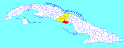 La Sierpe municipality (red) within Sancti Spíritus Province (yellow) and Cuba | |
| Coordinates: 21°45′38″N 79°14′36″W | |
| Country | Cuba |
| Province | Sancti Spíritus |
| Area | |
| • Total | 1,035 km2 (400 sq mi) |
| Elevation | 35 m (115 ft) |
| Population (2004)[2] | |
| • Total | 16,937 |
| • Density | 16.4/km2 (42/sq mi) |
| Time zone | UTC-5 (EST) |
| Area code | +53-41 |
| Website | https://lasierpe.gob.cu/ |
Geography
It borders the Gulf of Ana Maria of the Caribbean Sea to the south and the province of Ciego de Ávila to the east.
It is also located near the geographic center of the country.
Demographics
In 2004, the municipality of La Sierpe had a population of 16,937.[2] With a total area of 1,035 km2 (400 sq mi),[1] it has a population density of 16.4/km2 (42/sq mi).
See also
- Municipalities of Cuba
- List of cities in Cuba
References
- Statoids (July 2003). "Municipios of Cuba". Retrieved 2007-10-07.
- Atenas.cu (2004). "2004 Population trends, by Province and Municipality" (in Spanish). Retrieved 2007-10-07.[dead link]
External links
![]() Media related to La Sierpe, Cuba at Wikimedia Commons
Media related to La Sierpe, Cuba at Wikimedia Commons
Places adjacent to La Sierpe, Cuba | ||||||||||||||||
|---|---|---|---|---|---|---|---|---|---|---|---|---|---|---|---|---|
| ||||||||||||||||
Municipalities in Sancti Spíritus Province | ||
|---|---|---|
This Cuban location article is a stub. You can help Wikipedia by expanding it. |
На других языках
- [en] La Sierpe, Cuba
[ru] Ла-Сьерпе (Куба)
Ла-Сьерпе (исп. La Sierpe) — муниципалитет в провинции Санкти-Спиритус, Куба.Текст в блоке "Читать" взят с сайта "Википедия" и доступен по лицензии Creative Commons Attribution-ShareAlike; в отдельных случаях могут действовать дополнительные условия.
Другой контент может иметь иную лицензию. Перед использованием материалов сайта WikiSort.org внимательно изучите правила лицензирования конкретных элементов наполнения сайта.
Другой контент может иметь иную лицензию. Перед использованием материалов сайта WikiSort.org внимательно изучите правила лицензирования конкретных элементов наполнения сайта.
2019-2025
WikiSort.org - проект по пересортировке и дополнению контента Википедии
WikiSort.org - проект по пересортировке и дополнению контента Википедии