world.wikisort.org - Cuba
Imías is a municipality and town in the Guantánamo Province of Cuba. It is located on the southern coast of Cuba, bordering the Caribbean Sea to the south.
Imías | |
|---|---|
Municipality | |
 Memorial of José Martí landing of 11 April 1895 | |
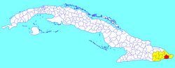 Imías municipality (red) within Guantánamo Province (yellow) and Cuba | |
| Coordinates: 20°04′36″N 74°39′7″W | |
| Country | Cuba |
| Province | Guantánamo |
| Area | |
| • Total | 524 km2 (202 sq mi) |
| Elevation | 30 m (100 ft) |
| Population (2004)[2] | |
| • Total | 20,959 |
| • Density | 40.0/km2 (104/sq mi) |
| Time zone | UTC-5 (EST) |
| Area code(s) | +53-21 |
| Website | https://www.imias.gob.cu/es/ |
Geography
The municipality of Imías borders with San Antonio del Sur, Baracoa and Maisí. The town is crossed by the Carretera Central, a west-east highway spanning the length of Cuba, and counts a little airport.[3]
Demographics
In 2004, the municipality of Imías had a population of 20,959.[2] With a total area of 524 km2 (202 sq mi),[1] it has a population density of 40.0/km2 (104/sq mi).
See also
- Municipalities of Cuba
- List of cities in Cuba
References
- Statoids. "Municipios of Cuba". Retrieved 2007-10-05.
- Atenas.cu (2004). "2004 Population trends, by Province and Municipality" (in Spanish). Archived from the original on September 27, 2007. Retrieved 2007-10-05.
- Imías Airport on Airport Database website
External links
![]() Media related to Imías at Wikimedia Commons
Media related to Imías at Wikimedia Commons
Places adjacent to Imías | |
|---|---|
Municipalities in Guantánamo Province | ||
|---|---|---|
| ||
This Cuban location article is a stub. You can help Wikipedia by expanding it. |
Текст в блоке "Читать" взят с сайта "Википедия" и доступен по лицензии Creative Commons Attribution-ShareAlike; в отдельных случаях могут действовать дополнительные условия.
Другой контент может иметь иную лицензию. Перед использованием материалов сайта WikiSort.org внимательно изучите правила лицензирования конкретных элементов наполнения сайта.
Другой контент может иметь иную лицензию. Перед использованием материалов сайта WikiSort.org внимательно изучите правила лицензирования конкретных элементов наполнения сайта.
2019-2026
WikiSort.org - проект по пересортировке и дополнению контента Википедии
WikiSort.org - проект по пересортировке и дополнению контента Википедии