world.wikisort.org - Croatia
Mohovo (Serbian Cyrillic: Мохово, Hungarian: Moha) is a village in Vukovar-Syrmia County in easternmost part of Croatia. It is administratively part of the town of Ilok.
Mohovo | |
|---|---|
Village (Selo) | |
   Mohovo | |
 | |
 Mohovo  Mohovo Mohovo | |
| Coordinates: 45°14′57″N 19°13′00″E | |
| Country | |
| County | |
| Municipality | Ilok |
| Elevation | 83 m (272 ft) |
| Population (2011)[1] | |
| • Total | 239 |
| Time zone | UTC+1 (CET) |
| • Summer (DST) | UTC+2 (CEST) |
| Postal code | 32234 Šarengrad |
| Area code(s) | +385 0(32) |
Geography
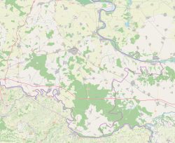
It is located by the Danube, connected by the D2 highway to Opatovac in the west and Šarengrad to the east.
Demographics
According to the 2011 census, Mohovo had 239 inhabitants.[2]
| Population[3] | |||||||||||||||
|---|---|---|---|---|---|---|---|---|---|---|---|---|---|---|---|
| 1857 | 1869 | 1880 | 1890 | 1900 | 1910 | 1921 | 1931 | 1948 | 1953 | 1961 | 1971 | 1981 | 1991 | 2001 | 2011 |
| 489 | 505 | 378 | 406 | 485 | 481 | 479 | 449 | 360 | 178 | 465 | 465 | 386 | 344 | 303 | 239 |
1991 census
| Mohovo[4] |
|---|
| 1991 |
total: 344 Croats 218 (63.37%) Serbs 115 (33.43%) Roma 4 (1.16%) Hungarians 1 (0.29%) Yugoslavs 1 (0.29%) nondeclared 5 (1.45%)
|
1910 census
| Mohovo[5] | |
|---|---|
| Population by language | Population by religion |
total: 481 East. Orthodox 462 (96.04%) Rom. Cath. 15 (3.11%) Calvinists 3 (0.62%) East. Catholics 1 (0.20%) - (-%) - (-%) - (-%)
| |
References
- "Vukovar-Srijem County - Town of Ilok". State Statistics Bureau of the Republic of Croatia. 2001. Retrieved 2010-09-13.
- "Državni zavod za statistiku Republike Hrvatske".
- - Republika Hrvatska - Državni zavod za statistiku: Naselja i stanovništvo Republike Hrvatske 1857.-2001.
- Book: "Ethnic and religious composition of population of Croatia, 1880-1991: by settlements", author: Jakov Gelo, publisher: Zagreb, Croatian bureau of statistics, 1998., ISBN 953-6667-07-X, ISBN 978-953-6667-07-9;
- Book: "Ethnic and religious composition of population of Croatia, 1880-1991: by settlements", author: Jakov Gelo, publisher: Zagreb, Croatian bureau of statistics, 1998., ISBN 953-6667-07-X, ISBN 978-953-6667-07-9;
External links
Wikimedia Commons has media related to Mohovo.
This Vukovar-Syrmia County geography article is a stub. You can help Wikipedia by expanding it. |
Текст в блоке "Читать" взят с сайта "Википедия" и доступен по лицензии Creative Commons Attribution-ShareAlike; в отдельных случаях могут действовать дополнительные условия.
Другой контент может иметь иную лицензию. Перед использованием материалов сайта WikiSort.org внимательно изучите правила лицензирования конкретных элементов наполнения сайта.
Другой контент может иметь иную лицензию. Перед использованием материалов сайта WikiSort.org внимательно изучите правила лицензирования конкретных элементов наполнения сайта.
2019-2026
WikiSort.org - проект по пересортировке и дополнению контента Википедии
WikiSort.org - проект по пересортировке и дополнению контента Википедии