world.wikisort.org - Croatia
Klis (Croatian: Klis, Italian: Clissa, Turkish: Kilis) is a Croatian municipality located around a mountain fortress bearing the same name. It is located in the region of Dalmatia, located just northeast of Solin and Split near the eponymous mountain pass.[1] It has a population of 3,001, totalling 4,801 together with the eight other villages in its municipality (2011 census).
Klis | |
|---|---|
Municipality | |
 | |
 | |
 Klis | |
| Coordinates: 43°34′N 16°31′E | |
| Country | |
| County | |
| Population (2011) | |
| • Total | 4.801 |
| Time zone | UTC+1 (CET) |
| Website | www.klis.hr |

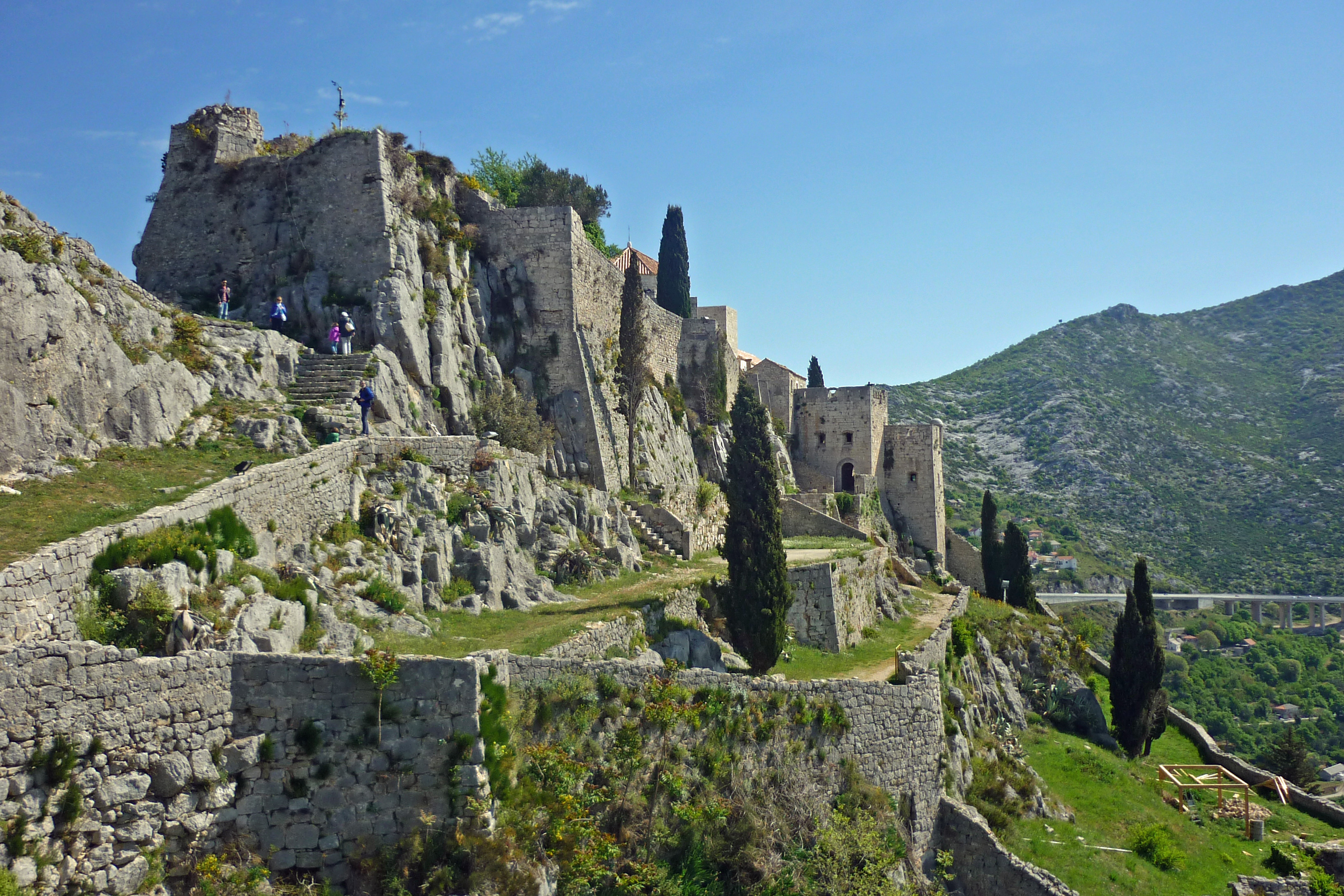
The Klis mountain pass separates the mountains Mosor and Kozjak at an altitude of 360m. It has had a major strategic value throughout history because any inland force passing through Klis would have been able to easily reach the entire region of Split and Kaštela. During the Ottoman wars in Europe an already existing Roman fortress on a nearby hill was expanded into Klis Fortress. It was the centre of a sanjak within the Province of Bosnia during Ottoman rule. Klis was also ruled by the Kingdom of Bosnia, the Venetian Republic,[2] and Austria-Hungary. Due to its geographical position Klis is also susceptible to a rather strong bura wind.
History
Read about history of Klis here: Historical Unit Kliški uskoci - History of Klis
In Klis area was first mentioned name of "Uskoks"[3]
Notable objects
- One of only three preserved Ottoman mosques on the territory of Croatia exists in the Klis fortress. The mosque was built shortly after the Ottoman conquest of Klis in year 1537. It was converted into a Catholic church after the Venetian conquest of Klis in year 1648, and it has been used for that purpose ever since.
- An old Turkish public water faucet exists in the town.
Transportation
The village is served by local bus from Split city centre.
See also
- Klis Fortress
- Petar Kružić
- Historical Unit Kliški uskoci
References
- The Rough Guide to Croatia by Jonathan Bousfield
- When Ethnicity did not Matter in the Balkans: by John Van Antwerp Fine.page 173.
- University Study of Pedagogy and History, The origin and military activity of the Uskoks, Hrvoje Sopta, 2017.https://repozitorij.ffos.hr/islandora/object/ffos%3A2247/datastream/PDF/view #page=3
External links
Subdivisions of Split-Dalmatia County | ||
|---|---|---|
| Cities and towns |
|  |
| Municipalities |
| |
Authority control | |
|---|---|
| General |
|
| National libraries | |
This Split-Dalmatia County geography article is a stub. You can help Wikipedia by expanding it. |
Другой контент может иметь иную лицензию. Перед использованием материалов сайта WikiSort.org внимательно изучите правила лицензирования конкретных элементов наполнения сайта.
WikiSort.org - проект по пересортировке и дополнению контента Википедии