world.wikisort.org - Colombia
Támara is a town and municipality in the Department of Casanare, Colombia. The urban centre is located at an altitude of 1,156 metres (3,793 ft) at a distance of 95 kilometres (59 mi) from the department capital Yopal. It borders in the north Sacama, in the east Pore and Paz de Ariporo, in the west Socotá of the department of Boyacá and in the south Nunchia and Paya, Boyacá.[1]
Támara | |
|---|---|
Municipality and town | |
 View of rural Támara | |
 Flag | |
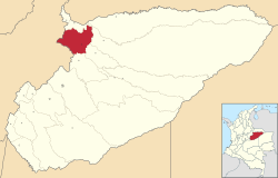 Location of the municipality and town of Tamara, Casanare in the Casanare Department of Colombia. | |
| Country | |
| Department | Casanare Department |
| Founded | 6 August 1628 |
| Founded by | José Dadey Pey |
| Government | |
| • Mayor | Leonel Rodríguez gualteros (2016-2019) |
| Area | |
| • Municipality and town | 1,181.81 km2 (456.30 sq mi) |
| • Urban | 0.99031 km2 (0.38236 sq mi) |
| Elevation | 1,156 m (3,793 ft) |
| Population (2015) | |
| • Municipality and town | 7,044 |
| • Density | 6.0/km2 (15/sq mi) |
| • Urban | 2,327 |
| Time zone | UTC-5 (Colombia Standard Time) |
| Website | Official website |
History
Támara before the Spanish conquest of the Muisca was an important cotton producing village.[1]
Modern Támara was founded on August 6, 1628, by José Dadey Pey.[1]
Economy
Main economical activities in Támara are agriculture; coffee, yuca, maize, bananas and sugarcane and livestock farming.[1]
References
- (in Spanish) Official website Támara
Municipalities in the Casanare Department | ||
|---|---|---|
| ||
На других языках
- [en] Támara, Casanare
[es] Támara
Támara es un municipio colombiano, ubicado en el departamento de Casanare. Se encuentra en el occidente del departamento, a 95 km de Yopal, la capital departamental.Текст в блоке "Читать" взят с сайта "Википедия" и доступен по лицензии Creative Commons Attribution-ShareAlike; в отдельных случаях могут действовать дополнительные условия.
Другой контент может иметь иную лицензию. Перед использованием материалов сайта WikiSort.org внимательно изучите правила лицензирования конкретных элементов наполнения сайта.
Другой контент может иметь иную лицензию. Перед использованием материалов сайта WikiSort.org внимательно изучите правила лицензирования конкретных элементов наполнения сайта.
2019-2025
WikiSort.org - проект по пересортировке и дополнению контента Википедии
WikiSort.org - проект по пересортировке и дополнению контента Википедии