world.wikisort.org - Colombia
Santuario (elevation 1575 m[3]) is a town and municipality in the Department of Risaralda, Colombia.
Santuario, Risaralda | |
|---|---|
Municipality and town | |
 | |
 Flag | |
| Nickname(s): Pearl of The Tatamá | |
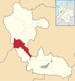 Location of the municipality and town of Santuario, Risaralda in the Risaralda Department of Colombia. | |
| Country | |
| Department | Risaralda Department |
| Area | |
| • Total | 201 km2 (78 sq mi) |
| Elevation | 1,565 m (5,135 ft) |
| Population (Census 2018[2]) | |
| • Total | 11,787 |
| • Density | 59/km2 (150/sq mi) |
| Time zone | UTC-5 (Colombia Standard Time) |
Tourism
One of the main characteristics of the town is the yearly observance of religious holidays and local fairs.
Sites of interest
- Tatama's National Park
- Maria Inmaculada's Church
- Calle Real
References
- "Municipalities of Colombia". statoids. Retrieved 28 April 2020.
- "Censo Nacional de Población y Vivienda 2018" (in Spanish). DANE. Retrieved 28 April 2020.
- M. Hermelin and G. Bedoya (2008). "Community participation in natural risk prevention: case histories from Columbia". In D. Liverman; C. Pereira; B. Marker (eds.). Communicating Environmental Geoscience. Geological Society. pp. 49. ISBN 978-1862392601.
{{cite book}}: CS1 maint: uses authors parameter (link)
Municipalities in the Risaralda Department | ||
|---|---|---|
| ||
This Colombian location article is a stub. You can help Wikipedia by expanding it. |
На других языках
- [en] Santuario, Risaralda
[es] Santuario (Risaralda)
Santuario es un municipio del departamento de Risaralda (Colombia), ubicado a 66 km de la capital departamental en la región centro-occidente del departamento, en el lado oriental de la cordillera Occidental.Текст в блоке "Читать" взят с сайта "Википедия" и доступен по лицензии Creative Commons Attribution-ShareAlike; в отдельных случаях могут действовать дополнительные условия.
Другой контент может иметь иную лицензию. Перед использованием материалов сайта WikiSort.org внимательно изучите правила лицензирования конкретных элементов наполнения сайта.
Другой контент может иметь иную лицензию. Перед использованием материалов сайта WikiSort.org внимательно изучите правила лицензирования конкретных элементов наполнения сайта.
2019-2026
WikiSort.org - проект по пересортировке и дополнению контента Википедии
WikiSort.org - проект по пересортировке и дополнению контента Википедии