world.wikisort.org - Colombia
La Tola is a town and municipality in the Nariño Department, Colombia.
La Tola | |
|---|---|
Municipality and town | |
 Flag | |
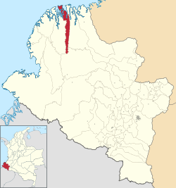 Location of the municipality and town of La Tola in the Nariño Department of Colombia. | |
| Country | |
| Department | Nariño Department |
| Area | |
| • Total | 128 km2 (49 sq mi) |
| Population (Census 2018[2]) | |
| • Total | 5,847 |
| • Density | 46/km2 (120/sq mi) |
| Time zone | UTC-5 (Colombia Standard Time) |
Climate
La Tola has a tropical rainforest climate (Köppen Af) with heavy to very heavy rainfall year-round.
| Climate data for La Tola | |||||||||||||
|---|---|---|---|---|---|---|---|---|---|---|---|---|---|
| Month | Jan | Feb | Mar | Apr | May | Jun | Jul | Aug | Sep | Oct | Nov | Dec | Year |
| Average high °C (°F) | 28.9 (84.0) |
29.9 (85.8) |
30.3 (86.5) |
30.0 (86.0) |
29.9 (85.8) |
29.9 (85.8) |
29.7 (85.5) |
29.5 (85.1) |
29.2 (84.6) |
28.6 (83.5) |
28.7 (83.7) |
29.1 (84.4) |
29.5 (85.1) |
| Daily mean °C (°F) | 25.6 (78.1) |
26.1 (79.0) |
26.4 (79.5) |
26.3 (79.3) |
26.4 (79.5) |
26.1 (79.0) |
26.0 (78.8) |
25.9 (78.6) |
25.8 (78.4) |
25.7 (78.3) |
25.7 (78.3) |
25.7 (78.3) |
26.0 (78.8) |
| Average low °C (°F) | 22.4 (72.3) |
22.3 (72.1) |
22.5 (72.5) |
22.7 (72.9) |
22.9 (73.2) |
22.3 (72.1) |
22.3 (72.1) |
22.4 (72.3) |
22.4 (72.3) |
22.8 (73.0) |
22.7 (72.9) |
22.3 (72.1) |
22.5 (72.5) |
| Average rainfall mm (inches) | 331 (13.0) |
300 (11.8) |
263 (10.4) |
349 (13.7) |
521 (20.5) |
492 (19.4) |
335 (13.2) |
295 (11.6) |
375 (14.8) |
361 (14.2) |
280 (11.0) |
254 (10.0) |
4,156 (163.6) |
| Source: Climate-Data.org[3] | |||||||||||||
References
- "Municipalities of Colombia". statoids. Retrieved 29 April 2020.
- "Censo Nacional de Población y Vivienda 2018" (in Spanish). DANE. Retrieved 29 April 2020.
- "Climate: La Tola". Climate-Data.org. Retrieved October 14, 2020.
Municipalities in the Nariño Department | ||
|---|---|---|
| ||
This Department of Nariño location article is a stub. You can help Wikipedia by expanding it. |
Текст в блоке "Читать" взят с сайта "Википедия" и доступен по лицензии Creative Commons Attribution-ShareAlike; в отдельных случаях могут действовать дополнительные условия.
Другой контент может иметь иную лицензию. Перед использованием материалов сайта WikiSort.org внимательно изучите правила лицензирования конкретных элементов наполнения сайта.
Другой контент может иметь иную лицензию. Перед использованием материалов сайта WikiSort.org внимательно изучите правила лицензирования конкретных элементов наполнения сайта.
2019-2026
WikiSort.org - проект по пересортировке и дополнению контента Википедии
WikiSort.org - проект по пересортировке и дополнению контента Википедии