world.wikisort.org - China
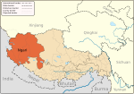
Tsosib Sumkyil (Tibetan: ཚོ་སྲིབ་གསུམ་དཀྱིལ, Wylie: tsho srib gsum dkyil, THL: tso sip sum kyil) or Churup Sumkhel (Tibetan: སུ་རུ་གསུམ་འཁྱིལ, Wylie: su ru gsum 'khyil, THL: su ru sum khyil) is the westernmost township of the Zanda County in the Ngari Prefecture, Tibet region of China.[1] It borders India's Spiti region in Himachal Pradesh as well as the Rupshu region of Ladakh. It is watered by the Pare Chu river, a tributary of the Spiti River and an upstream tributary of the Sutlej river. China has ongoing border disputes with India for the southern border of the township near Kaurik and the western border near Chumar.
Tsosib Sumkyil
ཚོ་སྲིབ་གསུམ་དཀྱིལ Churup Sumkhel, Chulusongjie | |
|---|---|
 Tsosib Sumkyil Location within Tibet Autonomous Region | |
| Coordinates: 32°6′N 78°42′E | |
| Country | China |
| Region | Tibet Autonomous Region |
| Prefecture | Ngari |
| County | Zanda |
| Population | |
| • Total |
|
| • Major Nationalities | Tibetan |
| • Regional dialect | Tibetan language |
| Time zone | +8 |

Name
The township is named after two villages, both of which appear to have two native names.
Tsosib (Tibetan: ཚོ་སྲིབ, Wylie: tsho srib, THL: tso sip, also spelt Tsosip, Cosib and Cosip) or Churup (Tibetan: སུ་རུ, Wylie: su ru, THL: su ru, also spelt Tsurup) is a border village on the bank of Pare Chu just before it enters the Indian Spiti district (32.1131°N 78.7114°E).
Sumkyil or Sumkhel (Tibetan: གསུམ་དཀྱིལ, Wylie: gsum dkyil, THL: sum kyil or Tibetan: གསུམ་འཁྱིལ, Wylie: gsum 'khyil, THL: sum khyil, also spelt Sumkyi, Sumgyi, Sonjie) is a farming village on a tributary of Pare Chu called Sumkyil Chu. (32.1467°N 78.7766°E).
The Sumkyil Chu stream is wide enough to support several farming villages along its course, including Manja (Chinese: 曼扎; pinyin: Màn zhā), Tuntun (Chinese: 顿堆; pinyin: Dùn duī) and Azire (Chinese: 阿孜热; pinyin: Ā zī rè). The reference to it in the name of the township possibly refers to the entire Sumkyil valley.
Geography
The region of the Tsosib Sumkyil Township is entirely mountainous, with the western parts belonging to the Zanskar Range (also called "Baralacha Range") and the eastern parts belonging to the Ladakh Range. The Pare Chu river flows between the two, after entering it from Rupshu. Several tributaries drain into the river from both the sides, with the Sumkhel Chu river being one of the last.
See also
- List of towns and villages in Tibet
Notes
References
- "Geographical names of Tibet AR (China): Ngari prefecture". KNAB Place Name Database. Institute of the Estonian Language. 2018-06-03.
Bibliography
- India, Ministry of External Affairs, ed. (1962), Report of the Officials of the Governments of India and the People's Republic of China on the Boundary Question, Government of India Press
- Strachey, Henry (1854), Physical Geography of Western Tibet, London: William Clows and Sons – via archive.org
Другой контент может иметь иную лицензию. Перед использованием материалов сайта WikiSort.org внимательно изучите правила лицензирования конкретных элементов наполнения сайта.
WikiSort.org - проект по пересортировке и дополнению контента Википедии
