world.wikisort.org - China
Tar Township (تار تاجىك يېزىسى[2] / Ta'er Chinese: 塔尔塔吉克族乡; pinyin: Tǎ'ěr Tǎjíkèzú Xiāng) is a Mountain Tajik Ethnic Township of Akto County in Xinjiang Uygur Autonomous Region, China. Located in the southernmost part of the county, the township covers an area of 1,009.7 square kilometers with a population of 5,408 (as of 2015[1]). It has 8 administrative villages under its jurisdiction. Its seat is at Bag Village (巴格村).[3]
Tar
تار تاجىك يېزىسى 塔尔塔吉克族乡 Tar Tajik Township | |
|---|---|
Township | |
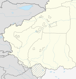 Tar Location of the township | |
| Coordinates: 37.8463413977°N 76.0611296948°E | |
| Country | People's Republic of China |
| Autonomous region | Xinjiang |
| Prefecture | Kizilsu |
| County | Akto |
| Area | |
| • Total | 1,009.7 km2 (389.8 sq mi) |
| Population (2015) | |
| • Total | 5,408 |
| [1] | |
| Time zone | UTC+8 (China Standard Time) |
| postal code | 845550 |
| Area code | 653022 210 |
| Website | www.xjakt.gov.cn |
Name
The name of Tar is from Sarikoli language, meaning "narrow" (狭窄). It was named for being located in a narrow river valley in the mountains.[4]
Geography and resources
Tar is the southernmost township of Akto County and located in the western Kunlun Mountains. It is bordered by Qarlung Township to the north and east, by Taxkorgan County to the south and west. It has an area of 1,009.7 square kilometers with the arable land area of 422.59 hectares. The seat of the township is away a road mileage of 420 kilometers from Akto Town. As of 2015, the township has 1,410 households with a population of 5,408.
Administrative divisions
The township has 8 administration villages[5][6] and 12 unincorporated villages under its jurisdiction.
- 8 administration villages
- Akkum Village (Akekumu 阿克库木村)
- Almalek Village (Alemaleke 阿勒玛勒克村)
- Bag Village (Bage 巴格村)
- Bagegiz Village (Bage'aigezi 巴格艾格孜村)
- Beldir Village (Bieledi'er 别勒迪尔村)
- Hoxabati Village (Huoxi'abati 霍西阿巴提村)
- Kuzu Village (库祖村[7])
- Tarabati Village (Ta'er'abati 塔尔阿巴提村)
- Unincorporated villages
- Kengsaz (康萨孜)
Demographics
| Year | Pop. | ±% p.a. |
|---|---|---|
| 2000 | 3,159 | — |
| 2010 | 5,059 | +4.82% |
| [8] | ||
References
- 塔尔塔吉克族乡(概况). xjakt.gov.cn. 2018-06-04. Retrieved 2019-11-12.
- مەلىكەم مەمەت, ed. (10 July 2019). شىنجاڭ خەلققە قولايلىق باج بېجىرىش يولىنىڭ « ئەڭ ئاخىرقى بىر كىلومېتىر »نى تۇتاشتۇردى. People's Daily (in Uyghur). Archived from the original on 20 September 2020. Retrieved 20 September 2020.
تار تاجىك يېزىسى
- 阿克陶县行政区划和居民地名称. xjkz.gov.cn. 2018-05-04. Retrieved 2019-11-12.
- 克孜勒阿克陶县民生地理. monseng.com. 2019-03-04. Archived from the original on 10 November 2019. Retrieved 2019-11-12.
- 2018年塔尔塔吉克族乡行政区划代码. National Bureau of Statistics of China. 2018-10-31. Retrieved 2019-11-12.
- 1997年阿克陶县行政区划 [1997 Akto County Administrative Divisions] (in Simplified Chinese). XZQH.org. 31 December 2010. Archived from the original on 19 August 2019. Retrieved 8 September 2020.
塔尔塔吉克族乡 1962年成立塔尔公社,1984年改设塔尔塔吉克族乡。位于县城南325千米,地处山区。面积1003平方千米,人口0.4万,均为塔吉克族。辖巴格、帕格孜、别勒迪尔、库孜、阿勒马勒克5个行政村。
- Sui Yunyan 隋云雁 (20 September 2020). 人心齐了——稳稳的幸福在身边. Xinhua News Agency (in Simplified Chinese). Archived from the original on 20 September 2020. Retrieved 20 September 2020.
阿克陶县塔尔塔吉克族乡库祖村村民塔依尔·卡吾里今年48岁,这位塔吉克族汉子
- 阿克陶县历史沿革. XZQH.org (in Simplified Chinese). 29 January 2019. Archived from the original on 19 August 2020. Retrieved 7 September 2020.
2000年第五次人口普查,阿克陶县常住总人口163024人,其中:{...}塔尔乡3159人、{...}2010年第六次人口普查,阿克陶县常住总人口199065人,其中:{...}塔尔乡5059人,{...
}
Другой контент может иметь иную лицензию. Перед использованием материалов сайта WikiSort.org внимательно изучите правила лицензирования конкретных элементов наполнения сайта.
WikiSort.org - проект по пересортировке и дополнению контента Википедии