world.wikisort.org - China
Lhatse County (also rendered as Liza County) is a county of Xigazê in the Tibet Autonomous Region. It was established in 1959, with Lhatse Town as the county seat. In 1968, Quxia Town became the county seat.[1]
Lhazê County
拉孜县 • ལྷ་རྩེ་རྫོང་། Lhatse | |
|---|---|
County | |
 Old Lhatse Monastery | |
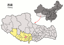 Location of Lhatse County (red) within Xigazê City (yellow) and Tibet | |
 Lhatse Location of the seat in Tibet | |
| Coordinates: 29°11′15″N 88°05′34″E | |
| Country | People's Republic of China |
| Autonomous region | Tibet |
| Prefecture-level city | Xigazê |
| Seat | Lhatse |
| Time zone | UTC+8 (China Standard) |
| Lhatse County | |||||||||||
|---|---|---|---|---|---|---|---|---|---|---|---|
| Chinese name | |||||||||||
| Simplified Chinese | 拉孜县 | ||||||||||
| Traditional Chinese | 拉孜縣 | ||||||||||
| |||||||||||
| Tibetan name | |||||||||||
| Tibetan | ལྷ་རྩེ་རྫོང་། | ||||||||||
| |||||||||||
Lhatse County, has a population of some 50,000 and is about 200 kilometers from Mount Everest (or Chomolungma). It is among the most impoverished counties in China.[2]
Geography

- Yarlung Zangbo River
| Climate data for Lhatse County (1981−2010) | |||||||||||||
|---|---|---|---|---|---|---|---|---|---|---|---|---|---|
| Month | Jan | Feb | Mar | Apr | May | Jun | Jul | Aug | Sep | Oct | Nov | Dec | Year |
| Record high °C (°F) | 17.9 (64.2) |
18.5 (65.3) |
21.6 (70.9) |
22.7 (72.9) |
27.5 (81.5) |
28.7 (83.7) |
28.9 (84.0) |
27.0 (80.6) |
24.1 (75.4) |
22.1 (71.8) |
20.1 (68.2) |
19.6 (67.3) |
28.9 (84.0) |
| Record low °C (°F) | −19.1 (−2.4) |
−16.8 (1.8) |
−12.7 (9.1) |
−8.0 (17.6) |
−4.4 (24.1) |
1.0 (33.8) |
2.7 (36.9) |
2.6 (36.7) |
0.5 (32.9) |
−7.2 (19.0) |
−13.3 (8.1) |
−16.9 (1.6) |
−19.1 (−2.4) |
| Source: China Meteorological Data Service Center[3] | |||||||||||||
Towns and townships
- Lhazê Town (ལྷ་རྩེ་, 拉孜镇)
- Quxar Town (ཆུ་ཤར་, 曲下镇)
- Tashi Dzom Township (བཀྲ་ཤིས་འཛོམས་, 扎西宗乡)
- Qoima Township (ཆོས་མ་, 曲玛乡)
- Püncogling Township (ཕུན་ཚོགས་གླིང་, 彭措林乡)
- Tashigang Township (བཀྲ་ཤིས་སྒང་, 扎西岗乡)
- Liu Township (སླེའུ་, 柳乡)
- Resa Township (རེ་ས་, 热萨乡)
- Mangpu Township (མང་ཕུ་, 芒普乡)
- Xiqên Township (གཞིས་ཆེན་, 锡钦乡)
- Chau Township (གྲའུ་, 查务乡)
- 482 natural villages [1]
Transport
The county is a juncture of China National Highway 219 (G219) which goes to Kashgar and China National Highway 318 (G318) which ends at the border with Nepal. To the west along the G318, a road splits off and runs to the Mount Everest base camp.
References
- "Lhatse, Lhatse County – Lhatse Trip". China Travel Blogs – Tour-Beijing.com. 2011-09-01. Retrieved 2013-10-20.
- "Move to hospital deliveries saves mothers, infants in Tibet". Xinhua Writers Bai Xu and Hu Xing. 25 Feb. 2009
- 中国地面气候标准值月值(1981-2010) (in Chinese (China)). China Meteorological Data Service Center. Retrieved 17 June 2022.
| County-level divisions |
|  | ||||
|---|---|---|---|---|---|---|
| Settlements | ||||||
| Landmarks |
| |||||
| Geography | ||||||
| Transport |
| |||||
This Shigatse, Tibet location article is a stub. You can help Wikipedia by expanding it. |
На других языках
- [en] Lhatse County
[ru] Лхадзе
Лхадзе (тиб. ལྷ་རྩེ་རྫོང, Вайли: lha rtse rdzong, кит. упр. 拉孜县, пиньинь Lāzī xiàn) — уезд городского округа Шигадзе, Тибетского автономного района, в Китае.Текст в блоке "Читать" взят с сайта "Википедия" и доступен по лицензии Creative Commons Attribution-ShareAlike; в отдельных случаях могут действовать дополнительные условия.
Другой контент может иметь иную лицензию. Перед использованием материалов сайта WikiSort.org внимательно изучите правила лицензирования конкретных элементов наполнения сайта.
Другой контент может иметь иную лицензию. Перед использованием материалов сайта WikiSort.org внимательно изучите правила лицензирования конкретных элементов наполнения сайта.
2019-2026
WikiSort.org - проект по пересортировке и дополнению контента Википедии
WikiSort.org - проект по пересортировке и дополнению контента Википедии