world.wikisort.org - Chile
Traiguén (Spanish pronunciation: [tɾajˈɣen]) is a Chilean city and commune in the Malleco Province, Araucanía Region.
This article may be expanded with text translated from the corresponding article in Spanish. (August 2010) Click [show] for important translation instructions.
|
Traiguén | |
|---|---|
City and Commune | |
|
 Coat of arms 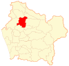 Location in the Araucanía Region  Traiguén Location in Chile | |
| Coordinates: 38°15′S 72°41′W | |
| Country | Chile |
| Region | Araucanía |
| Province | Malleco |
| Government | |
| • Type | Municipality |
| • Alcalde | Ricardo Sanhueza Pirce (Ind.) |
| Area | |
| • Total | 908.0 km2 (350.6 sq mi) |
| Elevation | 188 m (617 ft) |
| Population (2012 Census)[3] | |
| • Total | 17,164 |
| • Density | 19/km2 (49/sq mi) |
| • Urban | 14,140 |
| • Rural | 5,394 |
| Sex | |
| • Men | 9,734 |
| • Women | 9,800 |
| Time zone | UTC−4 (CLT) |
| • Summer (DST) | UTC−3 (CLST) |
| Area code(s) | country 56 + city 45 |
| Website | Municipality of Traiguén |
Demographics
According to the 2002 census of the National Statistics Institute, Traiguén spans an area of 908 km2 (351 sq mi) and has 19,534 inhabitants (9,734 men and 9,800 women). Of these, 14,140 (72.4%) lived in urban areas and 5,394 (27.6%) in rural areas. Between the 1992 and 2002 censuses, the population fell by 5.3% (1,088 persons).[3]
Administration
As a commune, Traiguén is a third-level administrative division of Chile administered by a municipal council, headed by an alcalde who is directly elected every four years. The 2012-2016 alcalde is Luis Alvarez (Ind.).And The municipal council 2012-2016 has the following members:[1][2]
- Ricardo Sanhueza Pirce PPD
- Essio Guidotti Vallejos PPD
- Eliecer Cerda Soto IND
- Pablo Mena Osses PRS
- Roberto Weidmann Ramirez UDI
- Rosanna Rathgeb Fuentes RN
Within the electoral divisions of Chile, Traiguén is represented in the Chamber of Deputies by Gonzalo Arenas (UDI) and Mario Venegas (PDC) as part of the 48th electoral district, together with Angol, Renaico, Collipulli, Ercilla, Los Sauces, Purén and Lumaco. The commune is represented in the Senate by Alberto Espina Otero (RN) and Jaime Quintana Leal (PPD) as part of the 14th senatorial constituency (Araucanía-North).
Climate
| Climate data for Traiguen | |||||||||||||
|---|---|---|---|---|---|---|---|---|---|---|---|---|---|
| Month | Jan | Feb | Mar | Apr | May | Jun | Jul | Aug | Sep | Oct | Nov | Dec | Year |
| Record high °C (°F) | 40 (104) |
40.7 (105.2) |
37.0 (98.6) |
32.0 (89.6) |
26.0 (78.8) |
20 (68) |
20 (68) |
22.0 (71.6) |
30 (86) |
30 (86) |
35 (95) |
37.0 (98.6) |
40.7 (105.2) |
| Average high °C (°F) | 27 (81) |
27 (80) |
23 (74) |
19 (66) |
14 (58) |
12 (53) |
12 (53) |
13 (55) |
16 (60) |
18 (65) |
21 (70) |
24 (76) |
19 (66) |
| Average low °C (°F) | 11 (51) |
11 (51) |
9 (48) |
7 (45) |
6 (42) |
5 (41) |
4 (39) |
4 (39) |
5 (41) |
6 (43) |
8 (46) |
9 (49) |
7 (45) |
| Record low °C (°F) | 2.0 (35.6) |
2.0 (35.6) |
1.0 (33.8) |
−1.0 (30.2) |
−3.0 (26.6) |
−4.0 (24.8) |
−8.1 (17.5) |
−5 (23) |
−2.0 (28.4) |
−2.0 (28.4) |
−1.0 (30.2) |
2.0 (35.6) |
−8.1 (17.5) |
| Average precipitation mm (inches) | 23 (0.9) |
30 (1.2) |
56 (2.2) |
86 (3.4) |
190 (7.5) |
210 (8.4) |
180 (7.2) |
160 (6.4) |
97 (3.8) |
61 (2.4) |
66 (2.6) |
41 (1.6) |
1,210 (47.6) |
| Average rainy days | 2.2 | 2.6 | 3.8 | 5.4 | 10.4 | 13.6 | 11.9 | 10.8 | 6.1 | 4.5 | 4.6 | 3.2 | 79.1 |
| Average relative humidity (%) | 49 | 50 | 49 | 47 | 45 | 44 | 42 | 42 | 43 | 45 | 47 | 48 | 46 |
| Source: Weatherbase [4] | |||||||||||||
Education
Previously the area had a German school, the Deutsche Schule Traiguén.[5]
References
- "Asociación Chilena de Municipalidades" (in Spanish). Archived from the original on 19 April 2011. Retrieved 23 February 2011.
- "Municipality of Traiguén" (in Spanish). Retrieved 23 February 2011.
- "National Statistics Institute" (in Spanish). Retrieved 7 February 2010.
- "Weatherbase: Historical Weather for Traiguen, Chile". Weatherbase. 2011. Retrieved on November 24, 2011.
- "Deutscher Bundestag 4. Wahlperiode Drucksache IV/3672" (Archive). Bundestag (West Germany). 23 June 1965. Retrieved on 12 March 2016. p. 24/51.
External links
< Communes and municipalities in Araucanía Region > | ||
|---|---|---|
| Cautín |
|  |
| Malleco |
| |
| Authority control |
|
|---|
На других языках
- [en] Traiguén
[ru] Трайген
Трайге́н[1] (исп. Traiguén) — город в Чили. Административный центр одноимённой коммуны. Население — 14 140 человек (2002). Город и коммуна входит в состав провинции Мальеко и области Араукания.Другой контент может иметь иную лицензию. Перед использованием материалов сайта WikiSort.org внимательно изучите правила лицензирования конкретных элементов наполнения сайта.
WikiSort.org - проект по пересортировке и дополнению контента Википедии