world.wikisort.org - Canada
Hope (prononcé en anglais : /hoʊp/) est une municipalité de district de Colombie-Britannique, au Canada, située à l'est de Vancouver, au confluent du Fraser et de son affluent, la rivière Coquihalla.
Pour les articles homonymes, voir Hope.
Cet article est une ébauche concernant une localité canadienne et la Colombie-Britannique.
Vous pouvez partager vos connaissances en l’améliorant (comment ?) selon les recommandations des projets correspondants.
| Hope | |||

| |||
| Administration | |||
|---|---|---|---|
| Pays | |||
| Province | |||
| Statut municipal | Municipalité de district | ||
| Constitution | |||
| Démographie | |||
| Population | 6 185 hab. (2006) | ||
| Densité | 149 hab./km2 | ||
| Géographie | |||
| Coordonnées | 49° 23′ 09″ nord, 121° 26′ 31″ ouest | ||
| Superficie | 4 142 ha = 41,42 km2 | ||
| Divers | |||
| Fuseau horaire | UTC-8 | ||
| Code géographique | 5909009 | ||
| Localisation | |||
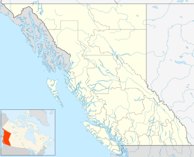
| Géolocalisation sur la carte : Colombie-Britannique
Géolocalisation sur la carte : Colombie-Britannique
| |||
| Liens | |||
| Site web | http://www.hope.ca/ | ||
| modifier |
|||

En 1981, la ville de Hope a servi de décor au film Rambo.
Démographie
Références
Lien externe
 Portail de la Colombie-Britannique
На других языках
[de] Hope (British Columbia)
Hope ist eine Kleinstadt mit fast 6.000 Einwohnern in der kanadischen Provinz British Columbia, die sich an der Grenze zwischen dem als Lower Mainland bezeichneten Küstengebiet und dem als Plateau bezeichneten trockenen Hinterland befindet. Sie liegt am Zusammenfluss von Fraser und Coquihalla River am Ende eines Engpasses, des Fraser Canyon, der bei Lytton beginnt. Hier beginnt flussabwärts die als Lower Mainland bezeichnete Region, die bis an die Küste nach Vancouver reicht. 2 km westlich vom Stadtzentrum im Ortsteil Silver Creek mündet der von Süden kommende Silverhope Creek in den Fraser River.[en] Hope, British Columbia
Hope is a district municipality at the confluence of the Fraser and Coquihalla rivers in the province of British Columbia, Canada. Hope is at the eastern end of both the Fraser Valley and the Lower Mainland region, and is at the southern end of the Fraser Canyon. To the east, over the Cascade Mountains, is the Interior region, beginning with the Similkameen Country on the farther side of the Allison Pass in Manning Park. Located 154 kilometres (96 mi) east of Vancouver, Hope is at the southern terminus of the Coquihalla Highway and the western terminus of the Crowsnest Highway, locally known as the Hope-Princeton (Highways 5 and 3, respectively), where they merge with the Trans-Canada Highway (Highway 1). Hope is at the eastern terminus of Highway 7. As it lies at the eastern end of the Fraser Valley in the windward Cascade foothills, the town gets very high amounts of rain and cloud cover – particularly throughout the autumn and winter.- [fr] Hope (Colombie-Britannique)
Текст в блоке "Читать" взят с сайта "Википедия" и доступен по лицензии Creative Commons Attribution-ShareAlike; в отдельных случаях могут действовать дополнительные условия.
Другой контент может иметь иную лицензию. Перед использованием материалов сайта WikiSort.org внимательно изучите правила лицензирования конкретных элементов наполнения сайта.
Другой контент может иметь иную лицензию. Перед использованием материалов сайта WikiSort.org внимательно изучите правила лицензирования конкретных элементов наполнения сайта.
2019-2026
WikiSort.org - проект по пересортировке и дополнению контента Википедии
WikiSort.org - проект по пересортировке и дополнению контента Википедии