world.wikisort.org - Canada
Le district municipal de Greenview No 16 (anglais : Greenview No. 16) est un district municipal de 5 299 habitants en 2011, situé dans la province d'Alberta, au Canada.
Cet article est une ébauche concernant l’Alberta.
Vous pouvez partager vos connaissances en l’améliorant (comment ?) selon les recommandations des projets correspondants.
| Greenview No 16 | |||

| |||
| Administration | |||
|---|---|---|---|
| Pays | |||
| Province | |||
| Région | Alberta du Nord | ||
| Statut municipal | district municipal | ||
| Maire | Dale Gervais | ||
| Constitution | 1994 | ||
| Démographie | |||
| Population | 5 299 hab. (2011) | ||
| Densité | 0,16 hab./km2 | ||
| Géographie | |||
| Coordonnées | 55° 04′ 07″ nord, 117° 16′ 05″ ouest | ||
| Superficie | 3 298 905 ha = 32 989,05 km2 | ||
| Divers | |||
| Fuseau horaire | UTC-7 | ||
| Code géographique | 4818015 | ||
| Localisation | |||
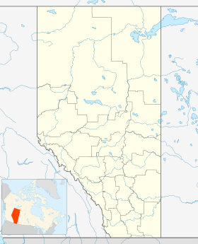
| Géolocalisation sur la carte : Alberta
Géolocalisation sur la carte : Alberta
| |||
| Liens | |||
| Site web | www.mdgreenview.ab.ca | ||
| modifier |
|||

Communautés et localités
- Bourgs
- Hameaux
- Localités
- Amundson
- Aspen Grove
- Botten
- Braaten
- Calais
- Clarkson Valley
- Crooked Creek
- Denard
- Dorscheid
- East Grove
- Goodwin
- Grande Cache Lake
- Grey
- Grizzly
- Hilltop
- Kaybob
- Latornell
- Little Smoky River
- Muskeg River
- New Fish Creek
- Owen
- Pass Creek
- Sturgeon Heights
- Sturgeon Lake Settlement
- Susa Creek
- Sweathouse Creek
- Thordarson
- Tolstad
- Two Creeks
- Wapiti
- Winniandy
- Autres
- Wanyandie Flats
Démographie

Références
- (en) Cet article est partiellement ou en totalité issu de l’article de Wikipédia en anglais intitulé « Greenview No. 16, Alberta » (voir la liste des auteurs).
Annexes
Articles connexes
- Liste des communautés d'Alberta
- Liste des districts municipaux d'Alberta
Liens externes
 Portail de l’Alberta
На других языках
[en] Municipal District of Greenview No. 16
The Municipal District of Greenview No. 16 is a municipal district (MD) in northwest Alberta, Canada. It covers the full extent of Census Division 18, and with an area of 32,984 km2 (12,735 sq mi), it is the largest municipal district in Alberta.[3] Its administrative office is located in the Town of Valleyview.- [fr] Greenview No 16
Текст в блоке "Читать" взят с сайта "Википедия" и доступен по лицензии Creative Commons Attribution-ShareAlike; в отдельных случаях могут действовать дополнительные условия.
Другой контент может иметь иную лицензию. Перед использованием материалов сайта WikiSort.org внимательно изучите правила лицензирования конкретных элементов наполнения сайта.
Другой контент может иметь иную лицензию. Перед использованием материалов сайта WikiSort.org внимательно изучите правила лицензирования конкретных элементов наполнения сайта.
2019-2026
WikiSort.org - проект по пересортировке и дополнению контента Википедии
WikiSort.org - проект по пересортировке и дополнению контента Википедии