world.wikisort.org - Canada
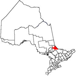
Unorganized North Nipissing District is an unorganized area in northeastern Ontario, Canada. It includes the unincorporated areas in northern Nipissing District north of the Mattawa River.
Unorganized North Nipissing District | |
|---|---|
Unorganized area | |
| Nipissing, Unorganized, North Part | |
 Eldee | |
 | |
| Coordinates: 46°40′N 79°30′W | |
| Country | |
| Province | |
| District | Nipissing |
| Government | |
| • Federal riding | Nipissing—Timiskaming |
| • Prov. riding | Timiskaming—Cochrane, Nipissing |
| Area | |
| • Land | 3,755.97 km2 (1,450.19 sq mi) |
| Population (2016)[1] | |
| • Total | 1,784 |
| • Density | 0.5/km2 (1/sq mi) |
| Time zone | UTC-5 (EST) |
| • Summer (DST) | UTC-4 (EDT) |
| Area code(s) | 705 |
Communities
- Balsam Creek
- Eldee
- Jocko
- Mulock
- Osborne
- Redbridge
- Songis
- Thorne
- Tomiko
- Tilden Lake
Geographic townships
- La Salle Township
- Mulock Township
- Osborne Township
- Stewart Township
- Gladman Township
Demographics
Canada census – Nipissing, Unorganized, North Part community profile
| 2016 | 2011 | |
|---|---|---|
| Population | 1784 (-3.7% from 2011) | 1853 (3.1% from 2006) |
| Land area | 3,755.97 km2 (1,450.19 sq mi) | 3,755.97 km2 (1,450.19 sq mi) |
| Population density | 0.5/km2 (1.3/sq mi) | 0.5/km2 (1.3/sq mi) |
| Median age | 50.9 (M: 51.5, F: 50.1) | |
| Total private dwellings | 794 | 1013 |
| Median household income | $61,054 |
Mother tongue (according to the Canada 2016 Census):[6]
- English as first language: 80.4%
- French as first language: 15.4%
- English and French as first language: 0.3%
- Other as first language: 0.2%
Population trend:[7]
- Population in 2016: 1784
- Population in 2011: 1853
- Population in 2006: 1798
- Population in 2001: 1856
- Population in 1996: 4149 (or 2016 when adjusted to 2001 boundaries)
- Population in 1991: 3911
See also
- List of townships in Ontario
References
- "Nipissing, Unorganized, North Part census profile". 2019 Census of Population. Statistics Canada. Retrieved 2012-02-10.
- "2016 Community Profiles". 2016 Canadian Census. Statistics Canada. August 12, 2021. Retrieved 2018-03-08.
- "2011 Community Profiles". 2011 Canadian Census. Statistics Canada. March 21, 2019. Retrieved 2012-02-10.
- "2006 Community Profiles". 2006 Canadian Census. Statistics Canada. August 20, 2019.
- "2001 Community Profiles". 2001 Canadian Census. Statistics Canada. July 18, 2021.
- Nipissing, Unorganized, North Part Census Profile (2016)
- Statistics Canada: 1996, 2001, 2006, 2011 census
Places adjacent to Unorganized North Nipissing District | ||||||||||||||||
|---|---|---|---|---|---|---|---|---|---|---|---|---|---|---|---|---|
| ||||||||||||||||
Nipissing District, Ontario | ||
|---|---|---|
| Cities |
|  |
| Towns |
| |
| Townships |
| |
| First Nations | ||
| Indian reserves | ||
| Unorganized areas |
| |
| Local services boards |
| |
| ||
This Northern Ontario geographical article is a stub. You can help Wikipedia by expanding it. |
Текст в блоке "Читать" взят с сайта "Википедия" и доступен по лицензии Creative Commons Attribution-ShareAlike; в отдельных случаях могут действовать дополнительные условия.
Другой контент может иметь иную лицензию. Перед использованием материалов сайта WikiSort.org внимательно изучите правила лицензирования конкретных элементов наполнения сайта.
Другой контент может иметь иную лицензию. Перед использованием материалов сайта WikiSort.org внимательно изучите правила лицензирования конкретных элементов наполнения сайта.
2019-2026
WikiSort.org - проект по пересортировке и дополнению контента Википедии
WikiSort.org - проект по пересортировке и дополнению контента Википедии