world.wikisort.org - Canada
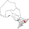
Tyendinaga is a township in the Canadian province of Ontario, located in Hastings County. The community takes its name from a variant spelling of Mohawk leader Joseph Brant's traditional Mohawk name, Thayendanegea.
Tyendinaga | |
|---|---|
Township (lower-tier) | |
| Township of Tyendinaga | |
 Marysville | |
 Tyendinaga | |
| Coordinates: 44°18′N 77°12′W | |
| Country | |
| Province | |
| County | Hastings |
| Incorporated | 1820 |
| Government | |
| • Type | Township |
| • Reeve | Rick Phillips |
| • Federal riding | Hastings—Lennox and Addington |
| • Prov. riding | Hastings—Lennox and Addington |
| Area | |
| • Land | 312.92 km2 (120.82 sq mi) |
| Population (2016)[1] | |
| • Total | 4,297 |
| • Density | 13.7/km2 (35/sq mi) |
| Time zone | UTC-5 (EST) |
| • Summer (DST) | UTC-4 (EDT) |
| Postal Code | K0K |
| Area code(s) | 613, 343 |
| Website | www.tyendinagatownship .com |
Communities
The township comprises the communities of Albert, Blessington, Chisholms Mills, Ebenezer, Halston, Kingsford, Lonsdale, Lonsdale Station, Melrose, Marysville, Milltown, Myrehall, Naphan, Read and Shannonville.
A radio transmitter for the Canadian Broadcasting Corporation is located in Read.[2] Saint Charles Borromeo Cemetery is also located in Read (Hastings County, Tyendinaga Township, Concession 5, Lot 16).[3]
Demographics
In the 2021 Census of Population conducted by Statistics Canada, Tyendinaga had a population of 4,538 living in 1,650 of its 1,730 total private dwellings, a change of 7.4% from its 2016 population of 4,226. With a land area of 312.42 km2 (120.63 sq mi), it had a population density of 14.5/km2 (37.6/sq mi) in 2021.[4]
| 2016 | 2011 | |
|---|---|---|
| Population | 4,297 (+3.5% from 2011) | 4,150 (+2.0% from 2006) |
| Land area | 312.92 km2 (120.82 sq mi) | 313.00 km2 (120.85 sq mi) |
| Population density | 13.7/km2 (35/sq mi) | 13.3/km2 (34/sq mi) |
| Median age | 42.5 (M: 42.5, F: 42.6) | |
| Total private dwellings | 1,631 | 1,547 |
| Median household income | $81,408 |
| Year | Pop. | ±% |
|---|---|---|
| 1991 | 3,118 | — |
| 1996 | 3,549 | +13.8% |
| 2001 | 3,769 | +6.2% |
| 2006 | 4,070 | +8.0% |
| 2011 | 4,150 | +2.0% |
| 2016 | 4,295 | +3.5% |
| [9][10][1] | ||
Mother tongue (2016 census):[1]
- English as first language: 97.4%
- French as first language: 0.7%
- Other as first language: 1.9%
See also
- List of townships in Ontario
References
- "Census Profile, 2016 Census: Tyendinaga, Township". Statistics Canada. 8 February 2017. Retrieved June 15, 2019.
- "CBC Channels and Frequencies". CBC Radio.
- "Saint Charles Borromeo Cemetery". Find a Grave.
- "Population and dwelling counts: Canada, provinces and territories, census divisions and census subdivisions (municipalities), Ontario". Statistics Canada. February 9, 2022. Retrieved April 2, 2022.
- "2016 Community Profiles". 2016 Canadian Census. Statistics Canada. August 12, 2021. Retrieved 2019-06-15.
- "2011 Community Profiles". 2011 Canadian Census. Statistics Canada. March 21, 2019. Retrieved 2012-03-02.
- "2006 Community Profiles". 2006 Canadian Census. Statistics Canada. August 20, 2019.
- "2001 Community Profiles". 2001 Canadian Census. Statistics Canada. July 18, 2021.
- Statistics Canada: 1996, 2001, 2006 census
- "Tyendinaga census profile". 2011 Census of Population. Statistics Canada. Retrieved 2012-03-02.
External links
Places adjacent to Tyendinaga, Ontario | ||||||||||||||||
|---|---|---|---|---|---|---|---|---|---|---|---|---|---|---|---|---|
| ||||||||||||||||
Hastings County, Ontario | ||
|---|---|---|
| Cities |
|  |
| Towns |
| |
| Townships |
| |
| First Nations |
| |
| Indian reserves | ||
| ||
This Ontario location article is a stub. You can help Wikipedia by expanding it. |
Другой контент может иметь иную лицензию. Перед использованием материалов сайта WikiSort.org внимательно изучите правила лицензирования конкретных элементов наполнения сайта.
WikiSort.org - проект по пересортировке и дополнению контента Википедии