world.wikisort.org - Canada
Snag is a village located on a small, dry-weather sideroad off the Alaska Highway, 25 kilometres (16 mi) east of Beaver Creek, Yukon, Canada. The village of Snag is located in a bowl-shaped valley of the White River and its tributaries, including Snag Creek. It was first settled during the Klondike Gold Rush. An aboriginal village was also located approximately 8 kilometres (5 mi) away. It was the site of a military airfield, established as part of the Northwest Staging Route, which closed in 1968. In 1947, the village of Snag boasted a population of eight to ten First Nation people and fur traders. An additional staff of fifteen to twenty airport personnel — meteorologists, radio operators, aircraft maintenance men — lived at the airport barracks.
Snag | |
|---|---|
 Location east of Beaver Creek, Yukon | |
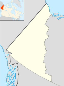 Snag Location of Snag  Snag Snag (Canada)  Snag Snag (North America) | |
| Coordinates: 62°23′0″N 140°22′0″W | |
| Country | Canada |
| Territory | Yukon |
| Population (2006) | |
| • Total | 0 (closed) |
| Time zone | UTC−07:00 (MST) |
| Area code(s) | 867 |
Climate
Snag has a subarctic climate (Köppen climate classification Dwc/Dfc) with mild summers and severely cold and long winters.
On February 3, 1947, the record-low temperature for continental North America was recorded in Snag: −63.0 °C (−81.4 °F).[1] That same winter, two previous records had already been set: one in December noted various phenomena, particularly sound such as voices being heard clearly miles from their source. There was a clear sky (except for some ice fog), and mild to little wind. There were 38.1 centimetres (15.0 in) of snow on the ground, but it was decreasing. Another town 180 km (112 mi) northeast of Snag, Fort Selkirk, claimed an even lower temperature of −65.0 °C (−85.0 °F), but the claim could not be confirmed.[2]
| Climate data for Snag (1944-1965) | |||||||||||||
|---|---|---|---|---|---|---|---|---|---|---|---|---|---|
| Month | Jan | Feb | Mar | Apr | May | Jun | Jul | Aug | Sep | Oct | Nov | Dec | Year |
| Record high °C (°F) | 7.8 (46.0) |
7.0 (44.6) |
13.3 (55.9) |
22.2 (72.0) |
30.0 (86.0) |
31.7 (89.1) |
31.7 (89.1) |
30.6 (87.1) |
27.2 (81.0) |
18.3 (64.9) |
7.2 (45.0) |
4.4 (39.9) |
31.7 (89.1) |
| Average high °C (°F) | −20.7 (−5.3) |
−12.7 (9.1) |
−3.3 (26.1) |
6.2 (43.2) |
13.6 (56.5) |
19.0 (66.2) |
20.5 (68.9) |
18.1 (64.6) |
10.9 (51.6) |
−0.9 (30.4) |
−13.6 (7.5) |
−19.1 (−2.4) |
1.5 (34.7) |
| Daily mean °C (°F) | −25.5 (−13.9) |
−19.5 (−3.1) |
−12.4 (9.7) |
−1.3 (29.7) |
6.7 (44.1) |
12.2 (54.0) |
14.1 (57.4) |
11.3 (52.3) |
4.5 (40.1) |
−6.2 (20.8) |
−18.5 (−1.3) |
−23.8 (−10.8) |
−4.9 (23.3) |
| Average low °C (°F) | −30.8 (−23.4) |
−26.7 (−16.1) |
−21.5 (−6.7) |
−8.9 (16.0) |
−0.3 (31.5) |
5.4 (41.7) |
7.5 (45.5) |
4.5 (40.1) |
−1.9 (28.6) |
−11.5 (11.3) |
−23.6 (−10.5) |
−28.6 (−19.5) |
−11.4 (11.5) |
| Record low °C (°F) | −60.9 (−77.6) |
−63.0 (−81.4) |
−51.2 (−60.2) |
−46.1 (−51.0) |
−16.1 (3.0) |
−5.0 (23.0) |
−1.7 (28.9) |
−6.1 (21.0) |
−18.9 (−2.0) |
−33.3 (−27.9) |
−48.9 (−56.0) |
−56.1 (−69.0) |
−63.0 (−81.4) |
| Average precipitation mm (inches) | 12.9 (0.51) |
13.3 (0.52) |
12.5 (0.49) |
8.9 (0.35) |
36.1 (1.42) |
74.6 (2.94) |
100.0 (3.94) |
56.3 (2.22) |
36.4 (1.43) |
26.4 (1.04) |
19.3 (0.76) |
13.4 (0.53) |
410.1 (16.15) |
| Average precipitation days (≥ 1 mm) | 4.5 | 3.7 | 4.2 | 2.4 | 7.2 | 11.9 | 14.5 | 11.0 | 7.8 | 7.2 | 6.2 | 4.4 | 85 |
| Source: [3] Environment Canada (Extremes) [4] Meteo Climat (Average temperatures) | |||||||||||||
Disappearance of aircraft
On January 26, 1950, a Douglas C-54 Skymaster (tail number 42-72469) of the United States Air Force, with 34 service personnel, 2 civilians and a crew of 8, disappeared on a flight from Alaska to Montana. It was in the vicinity of Snag when last contact was made by radio at 17:09.[5] No wreckage or remains have ever been located.[6]
References
- "WMO Region 4 (North America): Lowest Temperature". Arizona State University. Archived from the original on March 4, 2016. Retrieved April 9, 2015.
- The Weather Doctor Keith C. Heidorn Weather Almanac for February 2002
- Canada, Environment and Climate Change (October 31, 2011). "Historical Data - Climate - Environment and Climate Change Canada". climate.weather.gc.ca.
- Snag, Yukon Monthly - Average temperatures
- Kennebec, Matt (2010). "Douglas DC-4 C-54D". Retrieved June 19, 2011.
- "Douglas C-54D-1-DC 42-72469 Snag, YT". Aviation Safety Network. Flight Safety Foundation. Retrieved June 19, 2011.
Subdivisions of Yukon | |
|---|---|
| Municipalities |
|
| Unorganized areas | |
| Communities (unincorporated) |
|
| Ghost towns |
|
| Parks |
|
| Regions |
|
| |
Другой контент может иметь иную лицензию. Перед использованием материалов сайта WikiSort.org внимательно изучите правила лицензирования конкретных элементов наполнения сайта.
WikiSort.org - проект по пересортировке и дополнению контента Википедии