world.wikisort.org - Canada
Sainte-Aurélie is a municipality in the Les Etchemins Regional County Municipality in the Chaudière-Appalaches region of Quebec, Canada. Its population is 856 as of the Canada 2021 Census. It is named after Sister Sainte-Aurélie, an Ursuline nun at the end of the 19th century.
Sainte-Aurélie | |
|---|---|
Municipality | |
 Dam over Abenaquis Lake. | |
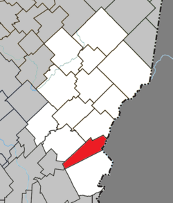 Location within Les Etchemins RCM. | |
 Sainte-Aurélie Location in southern Quebec. | |
| Coordinates: 46°11′N 70°22′W[1] | |
| Country | |
| Province | |
| Region | Chaudière-Appalaches |
| RCM | Les Etchemins |
| Constituted | April 3, 1909 |
| Government | |
| • Mayor | Gilles Gaudet |
| • Federal riding | Beauce |
| • Prov. riding | Beauce-Sud |
| Area | |
| • Total | 79.90 km2 (30.85 sq mi) |
| • Land | 78.25 km2 (30.21 sq mi) |
| Population (2021)[3] | |
| • Total | 856 |
| • Density | 10.9/km2 (28/sq mi) |
| • Pop 2016-2021 | |
| • Dwellings | 507 |
| Time zone | UTC−5 (EST) |
| • Summer (DST) | UTC−4 (EDT) |
| Postal code(s) | G0M 1M0 |
| Area code(s) | 418 and 581 |
| Highways | |
| Website | www |
Sainte-Aurélie has a small border crossing to the United States of America, Ste. Aurelie Station.
History
Sainte-Aurélie was founded by a Frenchman named Victor Vanier in 1909. It was originally known as Metgermette-Nord and was created by separating from what would become Saint-Zacharie. It would be in 1932 that Metgermette-Nord would take its current name of Sainte-Aurélie
References
- "Reference number 56059 in Banque de noms de lieux du Québec". toponymie.gouv.qc.ca (in French). Commission de toponymie du Québec.
- "Geographic code 28015 in the official Répertoire des municipalités". www.mamh.gouv.qc.ca (in French). Ministère des Affaires municipales et de l'Habitation.
- https://www12.statcan.gc.ca/census-recensement/2021/dp-pd/prof/details/page.cfm?Lang=E&SearchText=sainte%2Daurelie&GENDERlist=1&STATISTIClist=1,4&DGUIDlist=2021A00052428015
- Commission de toponymie du Québec
- Ministère des Affaires municipales, des Régions et de l'Occupation du territoire
- Canada Border Services Agency
Places adjacent to Sainte-Aurélie, Quebec | ||||||||||||||||
|---|---|---|---|---|---|---|---|---|---|---|---|---|---|---|---|---|
| ||||||||||||||||
| Municipalities |
|
|---|---|
| Parishes |
|
| |
| Authority control |
|
|---|
Текст в блоке "Читать" взят с сайта "Википедия" и доступен по лицензии Creative Commons Attribution-ShareAlike; в отдельных случаях могут действовать дополнительные условия.
Другой контент может иметь иную лицензию. Перед использованием материалов сайта WikiSort.org внимательно изучите правила лицензирования конкретных элементов наполнения сайта.
Другой контент может иметь иную лицензию. Перед использованием материалов сайта WikiSort.org внимательно изучите правила лицензирования конкретных элементов наполнения сайта.
2019-2025
WikiSort.org - проект по пересортировке и дополнению контента Википедии
WikiSort.org - проект по пересортировке и дополнению контента Википедии