world.wikisort.org - Canada
Saint-Valère is a municipality located in the Centre-du-Québec region of Quebec, Canada.
This article may be expanded with text translated from the corresponding article in French. (February 2016) Click [show] for important translation instructions.
|
Saint-Valère | |
|---|---|
Municipality | |
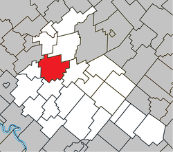 Location within Arthabaska RCM. | |
 Saint-Valère Location in southern Quebec. | |
| Coordinates: 46°04′N 72°06′W[1] | |
| Country | |
| Province | |
| Region | Centre-du-Québec |
| RCM | Arthabaska |
| Constituted | January 1, 1862 |
| Government | |
| • Mayor | Marc Plante |
| • Federal riding | Richmond—Arthabaska |
| • Prov. riding | Arthabaska |
| Area | |
| • Total | 108.80 km2 (42.01 sq mi) |
| • Land | 108.14 km2 (41.75 sq mi) |
| Population (2011)[3] | |
| • Total | 1,286 |
| • Density | 11.9/km2 (31/sq mi) |
| • Pop 2006-2011 | |
| Time zone | UTC−5 (EST) |
| • Summer (DST) | UTC−4 (EDT) |
| Postal code(s) | G0P 1M0 |
| Area code(s) | 819 |
| Highways | |
| Website | www |
References
- "Reference number 57736 in Banque de noms de lieux du Québec". toponymie.gouv.qc.ca (in French). Commission de toponymie du Québec.
- "Geographic code 39135 in the official Répertoire des municipalités". www.mamh.gouv.qc.ca (in French). Ministère des Affaires municipales et de l'Habitation.
- "(Code 2439135) Census Profile". 2011 census. Statistics Canada. 2012.
Places adjacent to Saint-Valère, Quebec | ||||||||||||||||
|---|---|---|---|---|---|---|---|---|---|---|---|---|---|---|---|---|
| ||||||||||||||||
| Cities |
|
|---|---|
| Municipalities |
|
| Parishes |
|
| Townships |
|
| |
This Quebec location article is a stub. You can help Wikipedia by expanding it. |
Текст в блоке "Читать" взят с сайта "Википедия" и доступен по лицензии Creative Commons Attribution-ShareAlike; в отдельных случаях могут действовать дополнительные условия.
Другой контент может иметь иную лицензию. Перед использованием материалов сайта WikiSort.org внимательно изучите правила лицензирования конкретных элементов наполнения сайта.
Другой контент может иметь иную лицензию. Перед использованием материалов сайта WikiSort.org внимательно изучите правила лицензирования конкретных элементов наполнения сайта.
2019-2025
WikiSort.org - проект по пересортировке и дополнению контента Википедии
WikiSort.org - проект по пересортировке и дополнению контента Википедии