world.wikisort.org - Canada
Saint-Paul-de-Montminy is a village of 849 people located in the Montmagny Regional County Municipality, Quebec. Geographically it is located in the Notre Dame Mountains, part of the Appalachian Mountains located in Canada. It was founded in 1862.
Saint-Paul-de-Montminy | |
|---|---|
Municipality | |
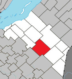 Location within Montmagny RCM. | |
 Saint-Paul-de-Montminy Location in province of Quebec. | |
| Coordinates: 46°44′N 70°22′W[1] | |
| Country | |
| Province | |
| Region | Chaudière-Appalaches |
| RCM | Montmagny |
| Constituted | January 1, 1862 |
| Government | |
| • Mayor | Émile Tanguay |
| • Federal riding | Montmagny—L'Islet— Kamouraska—Rivière- du-Loup |
| • Prov. riding | Côte-du-Sud |
| Area | |
| • Total | 163.80 km2 (63.24 sq mi) |
| • Land | 162.77 km2 (62.85 sq mi) |
| Population (2021)[3] | |
| • Total | 849 |
| • Density | 5.2/km2 (13/sq mi) |
| • Pop 2016-2021 | |
| • Dwellings | 520 |
| Time zone | UTC−5 (EST) |
| • Summer (DST) | UTC−4 (EDT) |
| Postal code(s) | G0R 3Y0 |
| Area code(s) | 418 and 581 |
| Highways | |
| Website | www.stpaul demontminy.com |
See also
- List of municipalities in Quebec
References
- Reference number 177565 of the Commission de toponymie du Québec (in French)
- Geographic code 18030 in the official Répertoire des municipalités (in French)
- "Data table, Census Profile, 2021 Census of Population - Saint-Paul-de-Montminy, Municipalité (MÉ) [Census subdivision], Quebec". 9 February 2022.
External links
Adjacent Municipal Subdivisions | ||||||||||||||||
|---|---|---|---|---|---|---|---|---|---|---|---|---|---|---|---|---|
| ||||||||||||||||
| Cities & Towns |
|
|---|---|
| Municipalities |
|
| Parishes |
|
| |
This Chaudière-Appalaches location article is a stub. You can help Wikipedia by expanding it. |
Текст в блоке "Читать" взят с сайта "Википедия" и доступен по лицензии Creative Commons Attribution-ShareAlike; в отдельных случаях могут действовать дополнительные условия.
Другой контент может иметь иную лицензию. Перед использованием материалов сайта WikiSort.org внимательно изучите правила лицензирования конкретных элементов наполнения сайта.
Другой контент может иметь иную лицензию. Перед использованием материалов сайта WikiSort.org внимательно изучите правила лицензирования конкретных элементов наполнения сайта.
2019-2025
WikiSort.org - проект по пересортировке и дополнению контента Википедии
WikiSort.org - проект по пересортировке и дополнению контента Википедии