world.wikisort.org - Canada
Saint-Antoine is a village in Kent County, New Brunswick, Canada. It is 35 km north of Moncton and 18 km Southwest of Bouctouche. Saint-Antoine's residents are Acadian; most speak French in its local variant, Chiac. Saint-Antoine is on Route 115 and Route 525. The village is called St. Anthony by English area residents.
Saint-Antoine
St. Anthony | |
|---|---|
Village | |
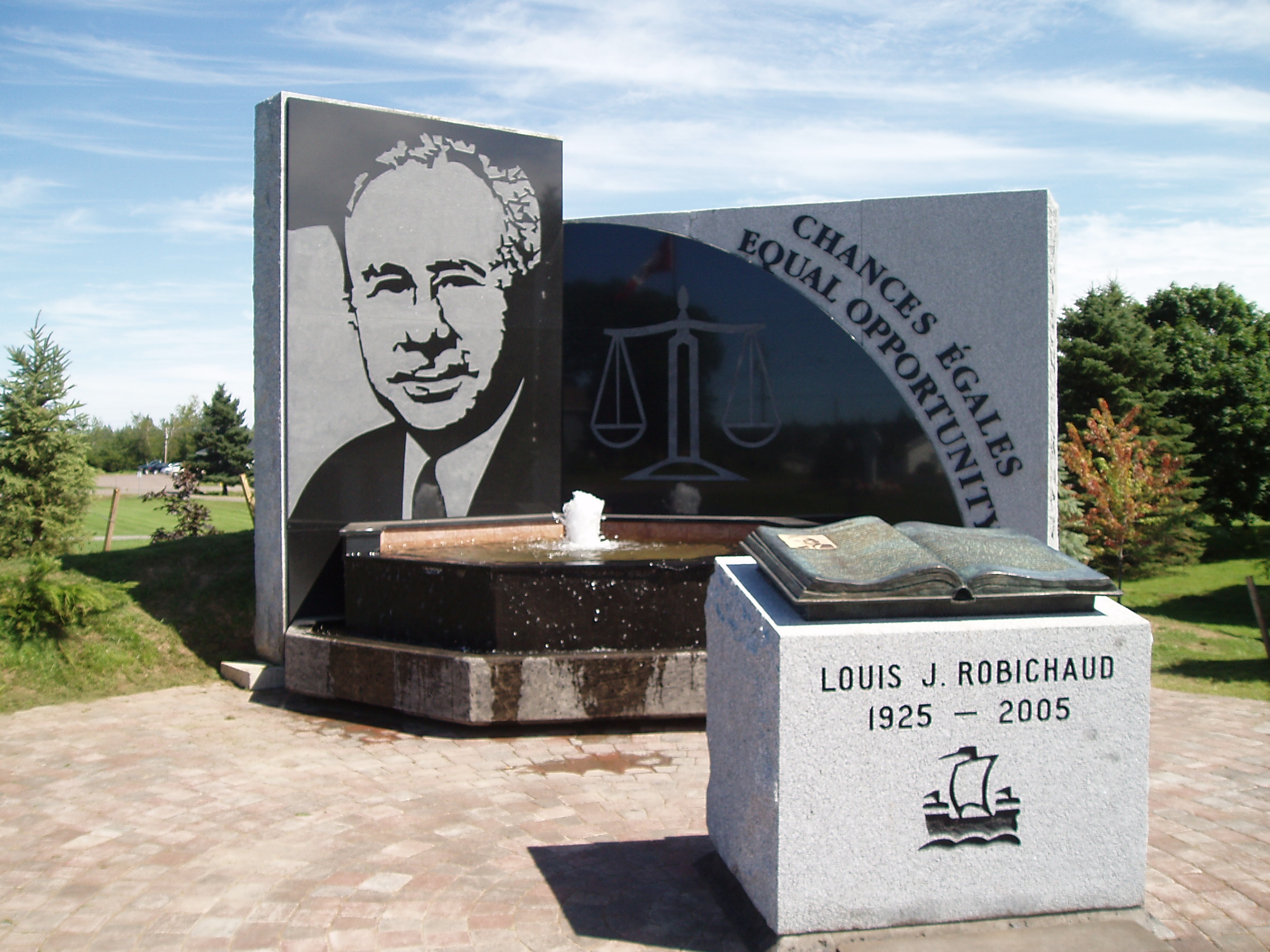 Louis J. Robichaud memorial | |
|
Coat of arms | |
| Motto(s): "P'tite ville en campagne" | |
 Saint-Antoine The location of Saint-Antoine within New Brunswick. | |
| Coordinates: 46.36286°N 64.75260°W | |
| Country | Canada |
| Province | New Brunswick |
| County | Kent County |
| Founded | 1832 |
| Incorporated | November 9, 1966 |
| Government | |
| • Mayor | Ricky Gautreau |
| • Governing Body | Saint-Antoine Village Council |
| Area | |
| • Total | 6.32 km2 (2.44 sq mi) |
| Population (2016)[1] | |
| • Total | 1,733 |
| • Density | 274.3/km2 (710/sq mi) |
| Time zone | UTC−4 (AST) |
| • Summer (DST) | UTC−3 (ADT) |
| Area code(s) | 506 |
History
The village is named in honour of Anthony the Great. From 1966, it was called St. Anthony until it was changed to Saint-Antoine in 1969. The village was originally called Higho Settlement. Saint-Antoine was the birthplace of Louis Robichaud, Canada's first elected Acadian provincial premier.
Demographics
In the 2021 Census of Population conducted by Statistics Canada, Saint-Antoine had a population of 1,791 living in 743 of its 779 total private dwellings, a change of 3.3% from its 2016 population of 1,733. With a land area of 6.32 km2 (2.44 sq mi), it had a population density of 283.4/km2 (734.0/sq mi) in 2021.[2]
|
Religious make-up (2001)
|
Income (2006)
|
Mother tongue (2016)[4]
|
Notable people
See also
- List of communities in New Brunswick
References
- "Census Profile, 2016 Census Saint-Antoine, Village [Census subdivision], New Brunswick". Statistics Canada. Retrieved September 13, 2019.
- "Population and dwelling counts: Canada, provinces and territories, census divisions and census subdivisions (municipalities), New Brunswick". Statistics Canada. February 9, 2022. Retrieved February 21, 2022.
- Statistics Canada: 1996, 2001, 2006 census
- Statistics Canada:
External links
Subdivisions of New Brunswick | |
|---|---|
| Subdivisions |
|
| Cities |
|
| Villages |
|
| |
Другой контент может иметь иную лицензию. Перед использованием материалов сайта WikiSort.org внимательно изучите правила лицензирования конкретных элементов наполнения сайта.
WikiSort.org - проект по пересортировке и дополнению контента Википедии