world.wikisort.org - Canada
Rivière-Patapédia-Est is an unorganized territory in the Bas-Saint-Laurent region of Quebec, Canada.
Rivière-Patapédia-Est | |
|---|---|
Unorganized territory | |
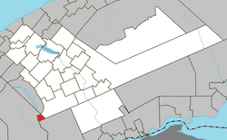 Location within La Matapédia RCM. | |
 Rivière-Patapédia-Est Location in eastern Quebec. | |
| Coordinates: 48°07′N 67°39′W[1] | |
| Country | |
| Province | |
| Region | Bas-Saint-Laurent |
| RCM | La Matapédia |
| Constituted | January 1, 1986 |
| Government | |
| • Federal riding | Haute-Gaspésie—La Mitis—Matane—Matapédia |
| • Prov. riding | Matane-Matapédia |
| Area | |
| • Total | 15.50 km2 (5.98 sq mi) |
| • Land | 15.97 km2 (6.17 sq mi) |
| There is an apparent contradiction between two authoritative sources | |
| Population (2011)[3] | |
| • Total | 0 |
| • Density | 0.0/km2 (0/sq mi) |
| • Pop 2006-2011 | |
| • Dwellings | 0 |
| Time zone | UTC-5 (EST) |
| • Summer (DST) | UTC-4 (EDT) |
| Highways | No major routes |
It is named after the East Patapedia River that forms the territory's western boundary. This river is the main outlet of Lake Supérieur and a tributary of the Patapédia River.
Demographics
Population trend:[4]
- Population in 2011: 0
- Population in 2006: 0
- Population in 2001: 0
- Population in 1996: 0
- Population in 1991: 0
See also
- List of unorganized territories in Quebec
References
- Reference number 149688 of the Commission de toponymie du Québec (in French)
- "Rivière-Patapédia-Est". Répertoire des municipalités (in French). Ministère des Affaires municipales, des Régions et de l'Occupation du territoire. Retrieved 2012-02-06.
- "Rivière-Patapédia-Est census profile". 2011 Census data. Statistics Canada. Retrieved 2012-02-06.
- Statistics Canada: 1996, 2001, 2006, 2011 census
Adjacent Municipal Subdivisions | ||||||||||||||||
|---|---|---|---|---|---|---|---|---|---|---|---|---|---|---|---|---|
| ||||||||||||||||
| Cities & Towns |
|
|---|---|
| Municipalities |
|
| Parishes |
|
| Villages |
|
| Unorganized territories |
|
| |
This Bas-Saint-Laurent location article is a stub. You can help Wikipedia by expanding it. |
Текст в блоке "Читать" взят с сайта "Википедия" и доступен по лицензии Creative Commons Attribution-ShareAlike; в отдельных случаях могут действовать дополнительные условия.
Другой контент может иметь иную лицензию. Перед использованием материалов сайта WikiSort.org внимательно изучите правила лицензирования конкретных элементов наполнения сайта.
Другой контент может иметь иную лицензию. Перед использованием материалов сайта WikiSort.org внимательно изучите правила лицензирования конкретных элементов наполнения сайта.
2019-2025
WikiSort.org - проект по пересортировке и дополнению контента Википедии
WikiSort.org - проект по пересортировке и дополнению контента Википедии