world.wikisort.org - Canada
Red Deer is a city in Alberta, Canada, located midway on the Calgary–Edmonton Corridor. Red Deer serves central Alberta,[10] and key industries include health care, retail trade, construction, oil and gas, hospitality, manufacturing and education.[11] It is surrounded by Red Deer County and borders on Lacombe County. The city is located in aspen parkland, a region of rolling hills, alongside the Red Deer River.
Red Deer | |
|---|---|
City | |
| City of Red Deer | |
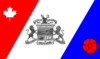 Flag 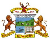 Coat of arms Logo | |
| Motto(s): Education, Industry and Progress | |
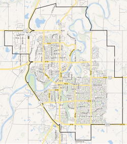 City boundaries | |
 Red Deer Location in Alberta  Red Deer Location in Canada  Red Deer Location in Red Deer County | |
| Coordinates: 52°16′05″N 113°48′40″W | |
| Country | Canada |
| Province | Alberta |
| Planning region | Red Deer |
| Municipal district | Red Deer County |
| Founded | 1882 |
| Incorporated[1] | |
| • Village | May 31, 1894 |
| • Town | June 12, 1901 |
| • City | March 25, 1913 |
| Named for | Red Deer River |
| Government | |
| • Mayor | Ken Johnston |
| • Governing body | Red Deer City Council
|
| • City Manager | Allan Seabrooke |
| • MPs | Earl Dreeshen (CPC), Blaine Calkins (CPC) |
| • MLAs | Jason Stephan (UCP), Adriana LaGrange (UCP) |
| Area (2021)[3] | |
| • Land | 104.34 km2 (40.29 sq mi) |
| • Urban | 65.93 km2 (25.46 sq mi) |
| • Metro | 104.34 km2 (40.29 sq mi) |
| Elevation | 855 m (2,805 ft) |
| Population | |
| • City | 100,844 |
| • Density | 966.5/km2 (2,503/sq mi) |
| • Urban | 99,846 |
| • Urban density | 1,514.4/km2 (3,922/sq mi) |
| • Metro | 100,844 |
| • Metro density | 966.5/km2 (2,503/sq mi) |
| • Municipal census (2019) | 101,002[7] |
| • Estimate (2020) | 106,736[8] |
| Demonym | Red Deerian[9] |
| Time zone | UTC−7 (MST) |
| • Summer (DST) | UTC−6 (MDT) |
| Forward sortation areas | T4N - T4R |
| Area code(s) | 403, 587, 825, 368 |
| Highways | 2, 2A, 11, 11A, 595 |
| Waterways | Red Deer River, Waskasoo Creek, Piper Creek |
| Website | reddeer.ca |


History
The area was inhabited by First Nations including the Blackfoot, Plains Cree and Stoney before the arrival of European fur traders in the late eighteenth century.[12] A First Nations trail ran from the Montana Territory across the Bow River near present-day Calgary and on to Fort Edmonton, later known as the Calgary and Edmonton Trail. The trail crossed the Red Deer River at a wide, stony shallows. The "Old Red Deer Crossing" is 7 kilometres (4.3 mi) upstream from the present-day city.
Cree people called the river Waskasoo Seepee, which means "Elk River." European arrivals sometimes called North American elk "red deer," after the related Eurasian species, and later named the community after the river. The name for the modern city in Plains Cree is a calque of the English name (mihkwâpisimosos, literally "red type of deer"), while the name of the river itself is still wâwâskêsiw-sîpiy or "elk river."
First Nations on the north side of the river entered into Treaty 6 in 1876 and on the south side Treaty 7 in 1877 Farmers and ranchers began to settle on the fertile lands
A trading post and stopping house were built at the Crossing in 1882 This became Fort Normandeau during the 1885 North-West Rebellion
- Leonard Gaetz
One early settler Leonard Gaetz gave a half-share of 1,240 acres (5.0 km2) he had acquired to the Calgary and Edmonton Railway to develop a bridge over the river and a townsite As a result the Crossing was gradually abandoned The first trains arrived in 1891
Gaetz founded the Westerner showgrounds and annual "Westerner Days," akin to the Calgary Stampede.
- 1900 to 1929
Following World War I, Red Deer emerged as a small, quiet, but prosperous, prairie city. Bird watcher and citizen scientist Elsie Cassels helped to establish the Gaetz Lakes bird sanctuary.[13]
- 1930 to 1945
During Great Depression of the 1930s, Central Alberta was not hit by severe drought. The city was virtually debt-free and profited from its ownership of the local public utilities.
In World War II, a large army training camp was located where Cormack Armoury, the Memorial Centre and Lindsay Thurber High School are now. Two training airfields were built south of the city at Penhold and Bowden.
- Post–Second World War
Red Deer expanded rapidly following the major discovery of hydrocarbons in Alberta in the late 1940s. Red Deer became a centre for oil and gas and related industries, such as the Joffre Cogeneration Plant.
Government and administrative services include a hospital, a courthouse and a provincial building.[14][15][16]
The railway moved to the outskirts and passenger train service ceased. The CPR bridge is now a walking trail.
Red Deer was Alberta's third largest city between 1981 and 2019, when Lethbridge regained this status.
Geography
Climate
Red Deer has a humid continental climate (Köppen Dfb), with something of a semi-arid influence due to city's location within Palliser's Triangle. The highest temperature ever recorded in Red Deer was 37.2 °C (99 °F) on 8 July 1906,[17] 2 July 1924,[18] and 28 & 29 June 1937.[19] The lowest recorded temperature was −50.6 °C (−59 °F) on 17 December 1924.[20] The city lies in the 4a plant hardiness zone.[21] Summers are typically warm and rainy with cool nights. Winters are typically long, cold, and very dry.
| Climate data for Red Deer, 1981−2010 normals, extremes 1904−present | |||||||||||||
|---|---|---|---|---|---|---|---|---|---|---|---|---|---|
| Month | Jan | Feb | Mar | Apr | May | Jun | Jul | Aug | Sep | Oct | Nov | Dec | Year |
| Record high humidex | 10.5 | 17.3 | 24.8 | 28.2 | 37.0 | 35.0 | 38.5 | 37.1 | 34.2 | 27.8 | 21.7 | 14.8 | 38.5 |
| Record high °C (°F) | 14.5 (58.1) |
18.0 (64.4) |
24.8 (76.6) |
32.8 (91.0) |
33.3 (91.9) |
37.2 (99.0) |
37.2 (99.0) |
36.1 (97.0) |
35.0 (95.0) |
29.4 (84.9) |
22.8 (73.0) |
16.5 (61.7) |
37.2 (99.0) |
| Average high °C (°F) | −4.5 (23.9) |
−1.7 (28.9) |
2.9 (37.2) |
11.3 (52.3) |
16.8 (62.2) |
20.5 (68.9) |
23.1 (73.6) |
22.5 (72.5) |
17.3 (63.1) |
11.2 (52.2) |
1.3 (34.3) |
−3.2 (26.2) |
9.8 (49.6) |
| Daily mean °C (°F) | −10.2 (13.6) |
−7.7 (18.1) |
−2.9 (26.8) |
4.8 (40.6) |
10.3 (50.5) |
14.5 (58.1) |
16.8 (62.2) |
15.9 (60.6) |
10.8 (51.4) |
5.0 (41.0) |
−3.8 (25.2) |
−8.5 (16.7) |
3.7 (38.7) |
| Average low °C (°F) | −16.0 (3.2) |
−13.7 (7.3) |
−8.7 (16.3) |
−1.7 (28.9) |
3.7 (38.7) |
8.4 (47.1) |
10.5 (50.9) |
9.2 (48.6) |
4.3 (39.7) |
−1.3 (29.7) |
−8.8 (16.2) |
−13.8 (7.2) |
−2.3 (27.9) |
| Record low °C (°F) | −46.7 (−52.1) |
−44.4 (−47.9) |
−40.6 (−41.1) |
−31.7 (−25.1) |
−12.8 (9.0) |
−6.1 (21.0) |
−1.1 (30.0) |
−5.6 (21.9) |
−12.8 (9.0) |
−26.1 (−15.0) |
−37.2 (−35.0) |
−50.6 (−59.1) |
−50.6 (−59.1) |
| Record low wind chill | −60.0 | −54.0 | −50.0 | −39.0 | −21.0 | −7.0 | 0.0 | −5.0 | −14.0 | −38.0 | −49.0 | −57.0 | −60.0 |
| Average precipitation mm (inches) | 22.2 (0.87) |
13.1 (0.52) |
21.2 (0.83) |
21.5 (0.85) |
55.8 (2.20) |
89.3 (3.52) |
96.6 (3.80) |
63.1 (2.48) |
51.1 (2.01) |
20.7 (0.81) |
17.7 (0.70) |
14.1 (0.56) |
486.3 (19.15) |
| Average rainfall mm (inches) | 0.1 (0.00) |
0.2 (0.01) |
0.8 (0.03) |
12.9 (0.51) |
51.9 (2.04) |
89.3 (3.52) |
96.6 (3.80) |
63.1 (2.48) |
48.7 (1.92) |
14.6 (0.57) |
1.8 (0.07) |
0.4 (0.02) |
380.4 (14.98) |
| Average snowfall cm (inches) | 22.1 (8.7) |
12.9 (5.1) |
20.4 (8.0) |
8.5 (3.3) |
3.9 (1.5) |
0.0 (0.0) |
0.0 (0.0) |
0.0 (0.0) |
2.4 (0.9) |
6.1 (2.4) |
15.8 (6.2) |
13.7 (5.4) |
105.9 (41.7) |
| Average precipitation days (≥ 0.2 mm) | 7.9 | 5.7 | 6.4 | 5.8 | 11.1 | 15.4 | 14.2 | 13.0 | 11.1 | 6.6 | 6.7 | 6.0 | 110.0 |
| Average rainy days (≥ 0.2 mm) | 0.08 | 0.15 | 0.54 | 4.0 | 10.6 | 15.4 | 14.2 | 13.0 | 10.9 | 4.9 | 0.96 | 0.19 | 74.9 |
| Average snowy days (≥ 0.2 cm) | 7.9 | 5.5 | 6.0 | 2.4 | 1.0 | 0.0 | 0.0 | 0.0 | 0.38 | 2.1 | 6.0 | 5.9 | 37.1 |
| Source: Environment Canada[22][17][18][20][19][23][24] Humidex/Windchill from Red Deer Regional Airport.[25] | |||||||||||||
Neighbourhoods
Red Deer includes the following neighbourhoods:[26]
- Anders Park
- Anders Park East
- Anders South
- Aspen Ridge
- Bower
- Bower Ponds Recreation Area
- Central Park
- Chiles Industrial Park
- Clearview Extension
- Clearview Meadows
- Clearview Ridge
- College Park
- Davenport
- Deer Park Estates
- Deer Park Village
- Devonshire
- Downtown
- East Burnt Lake
- Eastview
- Eastview Estates
- Edgar Industrial Park
- Evergreen
- Fairview
- Gaetz Lakes Sanctuary
- Garden Heights
- Glendale
- Glendale Park Estates
- Golden West
- Grandview
- Heritage Ranch
- Highland Green
- Highland Green Estates
- Inglewood
- Ironstone
- Johnstone Crossing
- Johnstone Park
- Kentwood East
- Kentwood West
- Kingsgate
- Lancaster Green
- Lancaster Meadows
- Laredo
- Lonsdale
- Maskepetoon Park
- McKenzie Trail Recreation Area
- Michener Hill
- Morrisroe
- Morrisroe Extension
- Mountview
- Normandeau
- Northlands Industrial Park
- Oriole Park
- Oriole Park West
- Parkvale
- Pines
- Queens Business Park
- Red Deer College
- Red Deer Golf and Country Club
- Riverlands
- Riverside Heavy Industrial Park
- Riverside Light Industrial Park
- Riverside Meadows
- Rosedale Estates
- Rosedale Meadows
- South Hill
- Southbrook
- Southpointe Junction
- Sunnybrook
- Sunnybrook Extension
- Three Mile Bend Recreation Area
- Timber Ridge
- Timberlands
- Timberstone
- Vanier Woods
- Vanier Woods East
- Waskasoo
- Waste Management Facility
- West Burnt Lake
- West Park
- West QE2
- Westerner Park
- Westlake
- Woodlea
Red Deer's corporate limits also includes the localities of College Park, Forth, Labuma, and North Red Deer.[27]
Demographics
| Year | Pop. | ±% |
|---|---|---|
| 1901 | 323 | — |
| 1906 | 1,418 | +339.0% |
| 1911 | 2,118 | +49.4% |
| 1916 | 2,203 | +4.0% |
| 1921 | 2,328 | +5.7% |
| 1926 | 2,021 | −13.2% |
| 1931 | 2,344 | +16.0% |
| 1936 | 2,384 | +1.7% |
| 1941 | 2,924 | +22.7% |
| 1946 | 4,042 | +38.2% |
| 1951 | 7,575 | +87.4% |
| 1956 | 12,338 | +62.9% |
| 1961 | 19,612 | +59.0% |
| 1966 | 26,171 | +33.4% |
| 1971 | 27,674 | +5.7% |
| 1976 | 32,184 | +16.3% |
| 1981 | 46,393 | +44.1% |
| 1986 | 54,425 | +17.3% |
| 1991 | 58,145 | +6.8% |
| 1996 | 60,075 | +3.3% |
| 2001 | 67,707 | +12.7% |
| 2006 | 82,772 | +22.3% |
| 2011 | 90,564 | +9.4% |
| 2016 | 100,418 | +10.9% |
| 2021 | 100,844 | +0.4% |
| Source: Statistics Canada [28][29][30][31][32][33][34][35][36][37][38] [39][40][41][42][43][44][45][46][47][48][49][50] | ||
In the 2021 Census of Population conducted by Statistics Canada, the City of Red Deer had a population of 100,844 living in 40,512 of its 43,404 total private dwellings, a change of 0.4% from its 2016 population of 100,418. With a land area of 104.34 km2 (40.29 sq mi), it had a population density of 966.5/km2 (2,503.2/sq mi) in 2021.[3]
At the census metropolitan area (CMA) level in the 2021 census, the Red Deer CMA similarly had a population of 100,844 living in 40,512 of its 43,404 total private dwellings, a change of 0.4% from its 2016 population of 100,418. With a land area of 104.34 km2 (40.29 sq mi), it had a population density of 966.5/km2 (2,503.2/sq mi) in 2021.[6]
The population of the City of Red Deer according to its 2019 municipal census is 101,002,[7] a change of 1.2% from its 2016 municipal census population of 99,832.[51]
In the 2016 Census of Population conducted by Statistics Canada, the City of Red Deer had a population of 100,418 living in 39,982 of its 42,285 total private dwellings, a change of 10.9% from its 2011 population of 90,564. With a land area of 104.73 km2 (40.44 sq mi), it had a population density of 958.8/km2 (2,483.4/sq mi) in 2016.[50]
Also in the 2016 census, 15.2% of the general population identified as visible minority (non-aboriginal), an increase of 55.9% over the previous five years.[52] A separate 7.1% reported North American Aboriginal Origins (4.2% First Nations and 3.1% Métis).[53]
Arts and culture
Red Deer hosts many arts and cultural groups, including: Central Alberta Theatre, Ignition Theatre, Red Deer Players Society, Bull Skit Comedy troupe, Central Music Festival, the Red Deer Symphony Orchestra, the Red Deer Museum + Art Gallery, the Red Deer Royals and other performing arts and fine arts organizations. The Red Deer Arts Council[54] is a member-based Multi-disciplinary Arts Service Organization and registered charity that serves the local and area community of visual, literary and performing artists.
Attractions
- Alberta Sports Hall of Fame
The Alberta Sports Hall of Fame is adjacent to the Queen Elizabeth II Highway (Highway 2) and the Greater Red Deer Visitor Centre.
- Canyon Ski Resort
The Canyon Ski Resort is located 7.5 km (4.7 mi) east of Red Deer.
The Centrium hosts sports events, concerts, trade shows and conventions. It is the home of the WHL’s Red Deer Rebels.
The 12,000 m2 (130,000 sq ft) G.H. Dawe Community Centre is shared by G.H. Dawe Community School, the G.H. Dawe Branch of the Red Deer Public Library, G.H. Dawe Centre Recreation Facility and St. Patrick's School.
The Greater Red Deer Visitor Centre is adjacent to the Queen Elizabeth II Highway (Highway 2) and the Alberta Sports Hall of Fame.
The Recreation Centre, located downtown, has indoor and outdoor pools, steam rooms and hot tubs among other features.
The Red Deer Museum has a permanent exhibit detailing the history of the region, and temporary exhibits that change every few months. It is also the venue of multiple educational programs for both adults and children.
Waskasoo Park meanders through Red Deer from its outskirts in the southwest, through the heart of the city, to its outskirts in the northeast along the Red Deer River. It includes over 80 kilometres (50 miles) of multi-use trails for biking, rollerblading, horseback riding, snowshoeing, cross-country skiing and walking. The park is one of the reasons Red Deer is known as "Park City."
The Westerner Exposition Grounds hosts events such as Agricon and Westerner Days. Held in early July, Westerner Days includes a rodeo, pony chuck-wagon racing, a fair, exhibitions and other events.
Sports
The Red Deer Rebels of the Western Hockey League play at the Peavey Mart Centrium. Red Deer hosted the 2022 Hlinka Gretzky Cup and co-hosted the 2018 Hlinka Gretzky Cup. Red Deer co-hosted the COVID-interrupted 2022 World Junior Ice Hockey Championships, later completed in Edmonton,[55][needs update] and the 1995 World Junior Ice Hockey Championships. In 2018, Red Deer replaced Edmonton as host of the Canadian Finals Rodeo.[56] The Rebels hosted the 2016 Memorial Cup.
Red Deer hosted the 2019 Canada Winter Games, leaving the Gary W. Harris Canada Games Centre[57] at Red Deer Polytechnic and the Downtown Servus Arena as legacy facilities.
The city is the hometown to well-known sporting personalities. Olympic gold medal pairs figure skater Jamie Salé and silver medal swimmer Rebecca Smith are from Red Deer. Olympic silver medalist speed skater Jeremy Wotherspoon also spent most of his childhood in Red Deer after being born in Saskatchewan. Olympic bronze medal aerialist Deidra Dionne grew up in Red Deer. Olympic bronze medal alpine skier Jan Hudec first immigrated to Red Deer for his father to ski coach. NHL players include Ron Anderson, Blake Wesley, Glen Wesley, Trent Hunter, Chris Mason, Randy Moller, Brandon Sutter, Paul Postma, Kris Russell, Colton Sceviour, Matt Fraser and Mark Tinordi. Hockey Night in Canada personality and Olympic host Ron MacLean calls Red Deer home.
Infrastructure
- Transportation
The Queen Elizabeth II Highway, Alberta's busiest and most economically important, links the North-South Calgary-Edmonton Corridor, including Wetaskiwin and Camrose, with Red Deer.
The David Thompson Highway links Rocky Mountain House in the West Country with Stettler in East-Central Alberta.
Red Deer Regional Airport, in Penhold, serves mostly general aviation. It is undergoing a significant expansion.[58][59]
Red Deer Transit provides local bus service throughout the city.
- Health care
Health care is provided at the Red Deer Regional Hospital.
- Water
Red Deer receives its drinking water supply from the Red Deer River which is treated and distributed throughout the city.[60] One distinct feature of the water distribution system is the Horton Water Spheroid which, at the time of its construction in 1957, was the world's largest spheroid shaped reservoir.[61] Water from the Red Deer water treatment plant is distributed to neighbouring communities including Red Deer County, Lacombe, Blackfalds and Ponoka as managed by the North Red Deer Regional Water Services Commission.[62] Wastewater is collected and sent to the City of Red Deer wastewater treatment plant which treats the sewage with a combination of grit traps, a primary clarifier, biological nutrient removal bioreactors, secondary clarifiers, and UV disinfection. Solids generated from the treatment process are treated using dissolved air flotation, anaerobic digestion, and biosolids lagoons.[63] Treated effluent is then discharged back into the Red Deer River downstream of the water treatment plant.
Education
Post-secondary
Red Deer Polytechnic (RDP), formerly Red Deer College, was founded in 1964 as Red Deer Junior College. RDP offers certificates, diplomas, advanced certificates, applied degrees, bachelor's degrees, academic upgrading and apprenticeship in over 75 different career and academic programs, including the creative and liberal arts, engineering, and trades.
Secondary
Three school authorities operate in Red Deer.
Founded in 1887, the Red Deer Public School District[64] serves 10,000 students in thirty schools. Offering a wide range of programming, including French Immersion from K-12, the district not only meets the needs of children and youth from the City of Red Deer and welcomes international students from around the world. Lindsay Thurber Comprehensive High School and Hunting Hills High School provide a large number of program options for students of high school age.
Founded in 1909, when the Daughters of Wisdom, a religious order from France, accepted the challenge of the Tinchebray Fathers, also from France, to offer Catholic schooling in Red Deer, Red Deer Catholic Regional Schools (RDCRS)[65] welcomes almost 7,000 students in five Central Alberta communities, including Red Deer. They operate École Secondaire Notre Dame High School and St. Joseph's High School.
Greater North Central Francophone Education Region No. 2's school École La Prairie is a French school located near downtown Red Deer that offers pre-kindergarten through grade 9 programs. It offers all courses in French to a population of 119 students[66] whose first language is French.
- Public schools
- Elementary
-
- Annie L. Gaetz Elementary (K–5)
- Aspen Heights Elementary (K–5)
- Barrie Wilson Elementary School (K–5)
- Don Campbell Elementary (K-5)
- Fairview Elementary (K–5)
- G.W. Smith Elementary (K–5)
- Gateway Christian School (K–5)
- G.H. Dawe Community School (K–8)
- Glendale School (K–8)
- Grandview Elementary (K–5)
- Joseph Welsh Elementary (K–5)
- Mattie McCullough Elementary (K–5)
- Mountview Elementary (K–5)
- Normandeau School (K–8)
- Oriole Park Elementary (K–5)
- Pines School (K–5)
- West Park Elementary (K–5)
- Middle school
-
- Central Middle School (6–8)
- Eastview Middle School (6–8)
- G.H. Dawe Community School (K–8)
- Gateway Christian School (6–8)
- Glendale School (K–8)
- Normandeau School (K–8)
- West Park Middle School (6–8)
- Secondary/high school
-
- École Secondaire Lindsay Thurber Comprehensive High School (9–12)
- Gateway Christian School (9–12)
- Hunting Hills High School (9–12)
- North Cottage High School (10–12)
- Catholic schools
- Elementary
-
- École Camille J. Lerouge School (PreK–9)
- École Mother Teresa School (K–5)
- École Our Lady of the Rosary School (K–2)
- Father Henri Voisin School (PreK–5)
- Holy Family School (PreK–5)
- Maryview School (PreK–5)
- St. Elizabeth Seton School (PreK–5)
- St. Marguerite Bourgeoys School (PreK–5)
- St. Martin de Porres School (PreK–5)
- St. Patrick's Community School (PreK–9)
- St. Teresa of Avila School (Prek-5)
- Middle school
-
- École Camille J. Lerouge School (PreK–9)
- St. Francis of Assisi Middle School (6–9)
- St Lorenzo Ruiz Middle School (Upcoming) (6-9)
- St. Patrick's Community School (PreK–9)
- St. Thomas Aquinas Middle School (6–9)
- Secondary/high school
-
- École Secondaire Notre Dame High School (10–12)
- St. Joseph's High School (10-12)
- Private schools
- Destiny Christian School Society (ECS, K–9)
- Koinonia Christian School – Red Deer (ECS, K–12)
- Parkland School Special Education (1–12)
- South Side Christian School (ECS, K–12)
Media
You can get the local news from Red Deer Advocate, rdnewsNOW and Today Ville. Edmonton CTV and Global News also carry Red Deer news. The City of Red Deer also releases regular updates.
See also
- List of cities in Alberta
- List of communities in Alberta
- Category:People from Red Deer, Alberta
References
- "Location and History Profile: City of Red Deer" (PDF). Alberta Municipal Affairs. June 17, 2016. p. 99. Retrieved June 18, 2016.
- "Municipal Officials Search". Alberta Municipal Affairs. May 9, 2019. Retrieved October 1, 2021.
- "Population and dwelling counts: Canada, provinces and territories, and census subdivisions (municipalities)". Statistics Canada. February 9, 2022. Retrieved February 9, 2022.
- "Alberta Private Sewage Systems 2009 Standard of Practice Handbook: Appendix A.3 Alberta Design Data (A.3.A. Alberta Climate Design Data by Town)" (PDF) (PDF). Safety Codes Council. January 2012. pp. 212–215 (PDF pages 226–229). Retrieved October 9, 2013.
- "Population and dwelling counts: Canada and population centres". Statistics Canada. February 9, 2022. Retrieved February 13, 2022.
- "Population and dwelling counts: Canada, provinces and territories, census metropolitan areas and census agglomerations". Statistics Canada. February 9, 2022. Retrieved February 13, 2022.
- "Red Deer is home to 101,002 residents". City of Red Deer. June 24, 2019. Retrieved July 1, 2021.
- "Census Subdivision (Municipal) Population Estimates, July 1, 2016 to 2020, Alberta". Alberta Municipal Affairs. March 23, 2021. Retrieved October 7, 2021.
- "Red Deerian Comes Out on Top". City of Red Deer. 2009-07-08. Retrieved 2011-06-07.
- "Red Deer boasts an immediate trade area of over 312,700 people...""Why Red Deer," City of Red Deer. Retrieved May 8, 2022.
- City of Red Deer, "Key Industries," Retrieved May 8, 2022.
- "History of Red Deer". City of Red Deer. Archived from the original on December 4, 2013. Retrieved November 15, 2013.
- Fish, fur & feathers : fish and wildlife conservation in Alberta 1905-2005. Federation of Alberta Naturalists., Fish and Wildlife Historical Society. Edmonton: Fish and Wildlife Historical Society. 2005. ISBN 0-9696134-7-4. OCLC 62181407.
{{cite book}}: CS1 maint: others (link) - "Red Deer Regional Hospital Expansion". Government of Alberta. Retrieved May 6, 2022.
- "Red Deer Justice Centre". Government of Alberta. Retrieved May 6, 2022.
- "Maintenance Upgrades Continue at Red Deer Provincial Government Building," Red Deer News Now, May 5, 2020, Accessed May 7, 2022.
- "July 1906". Canadian Climate Data. Environment Canada. 31 October 2011. Retrieved 18 May 2016.
- "July 1924". Canadian Climate Data. Environment Canada. 31 October 2011. Retrieved 18 May 2016.
- "June 1937". Canadian Climate Data. Environment Canada. 31 October 2011. Retrieved 18 May 2016.
- "December 1924". Canadian Climate Data. Environment Canada. 31 October 2011. Retrieved 18 May 2016.
- "Plant Hardiness Zone by Municipality". Natural Resources Canada. Government of Canada. Retrieved October 19, 2019.
- "Red Deer". Canadian Climate Normals 1981–2010. Environment Canada. 31 October 2011. Retrieved May 14, 2014.
- "Red Deer (1904–1974)". Canadian Climate Data. Environment Canada. 31 October 2011. Retrieved 18 May 2016.
- "Red Deer A". Canadian Climate Normals 1981–2010. Environment Canada. 25 September 2013. Retrieved 18 May 2016.
- "Canadian Climate Normals 1981-2010 Station Data". Environment Canada. Environment Canada. 25 September 2013. Retrieved 22 May 2016.
- "Red Deer Open Data Catalogue: Neighbourhood Boundaries". City of Red Deer. Retrieved June 29, 2013.
- "Economic Regions - SGC 2006". Statistics Canada. August 10, 2021. Retrieved October 15, 2022.
- "Table IX: Population of cities, towns and incorporated villages in 1906 and 1901 as classed in 1906". Census of the Northwest Provinces, 1906. Vol. Sessional Paper No. 17a. Ottawa: Government of Canada. 1907. p. 100.
- "Table I: Area and Population of Canada by Provinces, Districts and Subdistricts in 1911 and Population in 1901". Census of Canada, 1911. Vol. I. Ottawa: Government of Canada. 1912. pp. 2–39.
- "Table I: Population of Manitoba, Saskatchewan, and Alberta by Districts, Townships, Cities, Towns, and Incorporated Villages in 1916, 1911, 1906, and 1901". Census of Prairie Provinces, 1916. Vol. Population and Agriculture. Ottawa: Government of Canada. 1918. pp. 77–140.
- "Table 8: Population by districts and sub-districts according to the Redistribution Act of 1914 and the amending act of 1915, compared for the census years 1921, 1911 and 1901". Census of Canada, 1921. Ottawa: Government of Canada. 1922. pp. 169–215.
- "Table 7: Population of cities, towns and villages for the province of Alberta in census years 1901-26, as classed in 1926". Census of Prairie Provinces, 1926. Vol. Census of Alberta, 1926. Ottawa: Government of Canada. 1927. pp. 565–567.
- "Table 12: Population of Canada by provinces, counties or census divisions and subdivisions, 1871-1931". Census of Canada, 1931. Ottawa: Government of Canada. 1932. pp. 98–102.
- "Table 4: Population in incorporated cities, towns and villages, 1901-1936". Census of the Prairie Provinces, 1936. Vol. I: Population and Agriculture. Ottawa: Dominion Bureau of Statistics. 1938. pp. 833–836.
- "Table 10: Population by census subdivisions, 1871–1941". Eighth Census of Canada, 1941. Vol. II: Population by Local Subdivisions. Ottawa: Dominion Bureau of Statistics. 1944. pp. 134–141.
- "Table 6: Population by census subdivisions, 1926-1946". Census of the Prairie Provinces, 1946. Vol. I: Population. Ottawa: Dominion Bureau of Statistics. 1949. pp. 401–414.
- "Table 6: Population by census subdivisions, 1871–1951". Ninth Census of Canada, 1951. Vol. I: Population, General Characteristics. Ottawa: Dominion Bureau of Statistics. 1953. p. 6.73–6.83.
- "Table 6: Population by sex, for census subdivisions, 1956 and 1951". Census of Canada, 1956. Vol. Population, Counties and Subdivisions. Ottawa: Dominion Bureau of Statistics. 1957. p. 6.50–6.53.
- "Table 6: Population by census subdivisions, 1901–1961". 1961 Census of Canada. Series 1.1: Historical, 1901–1961. Vol. I: Population. Ottawa: Dominion Bureau of Statistics. 1963. p. 6.77-6.83.
- "Population by specified age groups and sex, for census subdivisions, 1966". Census of Canada, 1966. Vol. Population, Specified Age Groups and Sex for Counties and Census Subdivisions, 1966. Ottawa: Dominion Bureau of Statistics. 1968. p. 6.50–6.53.
- "Table 2: Population of Census Subdivisions, 1921–1971". 1971 Census of Canada. Vol. I: Population, Census Subdivisions (Historical). Ottawa: Statistics Canada. 1973. p. 2.102-2.111.
- "Table 3: Population for census divisions and subdivisions, 1971 and 1976". 1976 Census of Canada. Census Divisions and Subdivisions, Western Provinces and the Territories. Vol. I: Population, Geographic Distributions. Ottawa: Statistics Canada. 1977. p. 3.40–3.43.
- "Table 4: Population and Total Occupied Dwellings, for Census Divisions and Subdivisions, 1976 and 1981". 1981 Census of Canada. Vol. II: Provincial series, Population, Geographic distributions (Alberta). Ottawa: Statistics Canada. 1982. p. 4.1–4.10. ISBN 0-660-51095-2.
- "Table 2: Census Divisions and Subdivisions – Population and Occupied Private Dwellings, 1981 and 1986". Census Canada 1986. Vol. Population and Dwelling Counts – Provinces and Territories (Alberta). Ottawa: Statistics Canada. 1987. p. 2.1–2.10. ISBN 0-660-53463-0.
- "Table 2: Population and Dwelling Counts, for Census Divisions and Census Subdivisions, 1986 and 1991 – 100% Data". 91 Census. Vol. Population and Dwelling Counts – Census Divisions and Census Subdivisions. Ottawa: Statistics Canada. 1992. pp. 100–108. ISBN 0-660-57115-3.
- "Table 10: Population and Dwelling Counts, for Census Divisions, Census Subdivisions (Municipalities) and Designated Places, 1991 and 1996 Censuses – 100% Data". 96 Census. Vol. A National Overview – Population and Dwelling Counts. Ottawa: Statistics Canada. 1997. pp. 136–146. ISBN 0-660-59283-5.
- "Population and Dwelling Counts, for Canada, Provinces and Territories, and Census Divisions, 2001 and 1996 Censuses - 100% Data (Alberta)". Statistics Canada. Retrieved 2012-04-01.
- "Population and dwelling counts, for Canada, provinces and territories, and census subdivisions (municipalities), 2006 and 2001 censuses - 100% data (Alberta)". Statistics Canada. 2010-01-06. Retrieved 2012-04-01.
- "Population and dwelling counts, for Canada, provinces and territories, and census subdivisions (municipalities), 2011 and 2006 censuses". Statistics Canada. 2012-02-08. Retrieved 2012-02-08.
- "Population and dwelling counts, for Canada, provinces and territories, and census subdivisions (municipalities), 2016 and 2011 censuses – 100% data (Alberta)". Statistics Canada. February 8, 2017. Retrieved February 8, 2017.
- 2016 Municipal Affairs Population List (PDF). Alberta Municipal Affairs. ISBN 978-1-4601-3127-5. Retrieved January 28, 2017.
- Red Deer - % visible minority, Government of Alberta, May 7, 2022
- "Ethnic Origin," Census Profile, 2016 Census Red Deer [Population centre], Alberta and Alberta [Province], Statistics Canada, May 7, 2022
- Hermary, Suzanne. "Coordinator". Red Deer Arts Council. Red Deer Arts Council. Retrieved 31 March 2021.
- Canadian Press, "Red Deer to hold Hlinka Gretzky Cup before World Juniors return to Edmonton in August," April 19, 2022, Retrieved May 7, 2022.
- "It's official: Red Deer will host the CFR for 10 years". CBC News. Retrieved 2018-06-01.
- Gary W. Harris Canada Games Centre, Red Deer Polytechnic, May 7, 2022
- CBC, Bryan Labby, "Alberta's smaller airports look to take off with expanded passenger service," November 12, 2019, Accessed May 7, 2022.
- Red Deer Advocate, "Red Deer County tweaking budget to meet $3.75 million airport commitment," April 4, 2022, Retrieved May 7, 2022.
- The City of Red Deer. "Water Quality". Water Quality. City of Red Deer. Archived from the original on 2015-09-17. Retrieved July 30, 2015.
- Mountview Heritage Sites Gallery. "Horton Water Spheroid". Retrieved July 30, 2015.
- City of Red Deer. "Water Conservation". Archived from the original on 2015-09-17. Retrieved July 30, 2015.
- The City of Red Deer. "Wastewater". Treating Your Wastewater. Archived from the original on 2015-05-12. Retrieved July 30, 2015.
- Red Deer Public School District
- "Red Deer Catholic Regional Division". Archived from the original on 2012-06-18. Retrieved 2012-06-25.
- "Student Population by Grade, School, and Authority, 2011, p. 31" (PDF). Alberta Education. Retrieved 2011-04-01.
Further reading
- Meeres, E. L. (1978). The homesteads that nurtured a city: the history of Red Deer, 1880-1905. [s.l. : s.n.]
External links
Subdivisions of Alberta | |
|---|---|
| Subdivisions |
|
| Communities |
|
| Cities and urban service areas | |
| |
| Cities | |
|---|---|
| Towns | |
| Villages | |
| Hamlets |
|
| Summer villages |
|
| Municipal districts | |
| Special areas | |
| Indian reserves |
|
| Other topics |
|
| |
Authority control | |
|---|---|
| General | |
| National libraries | |
| Other |
|
На других языках
[de] Red Deer
Red Deer ist eine Stadt (Gemeindestatus einer City)[2] in Alberta (Kanada) und liegt am namensgebenden Red Deer River. Sie liegt in der Aspen Parkland Region zwischen Calgary und Edmonton, am nördlichen Ende des Palliser-Dreiecks. Mit 100.418 Einwohnern ist sie hinter Calgary und Edmonton die drittgrößte Stadt der Provinz Alberta. Wirtschaftliches Rückgrat der Stadt sind Erdölgewinnung und Agrarindustrie. Die Gegend um die Stadt ist wichtiges Zentrum für die petrochemische Industrie.- [en] Red Deer, Alberta
[ru] Ред-Дир
Ред-Дир (англ. Red Deer — Благородный олень) — город в центральной Альберте (Канада) на реке Ред-Дир, благодаря которой и получил своё название. Расположен между городами Калгари и Эдмонтон, и после них является наиболее густонаселенным городом провинции. Площадь Ред-Дира — 69,23 км². Население согласно переписи 2010 года составляло 90 084 человека[2] (примерно по 1301,2 человек на один квадратный километр). Девиз города — Education, Industry and Progress (рус. Образование, Промышленность и прогресс).Другой контент может иметь иную лицензию. Перед использованием материалов сайта WikiSort.org внимательно изучите правила лицензирования конкретных элементов наполнения сайта.
WikiSort.org - проект по пересортировке и дополнению контента Википедии