world.wikisort.org - Canada
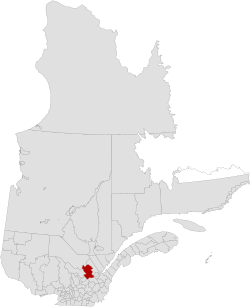
Portneuf is a regional county municipality (RCM) in the Capitale-Nationale administrative region of Quebec, Canada. RCM of Portneuf has been established on January 1, 1982. It is composed of 21 municipalities: nine cities, seven municipalities, two parishes and three unorganized territories. The county seat is located in Cap-Santé.
Portneuf | |
|---|---|
Regional county municipality | |
 | |
| Coordinates: 46°53′N 71°55′W[1] | |
| Country | |
| Province | |
| Region | Capitale-Nationale |
| Effective | January 1, 1982 |
| County seat | Cap-Santé |
| Municipalities | List
|
| Government | |
| • Type | Prefecture |
| • Prefect | Denis Langlois |
| Area | |
| • Total | 4,125.10 km2 (1,592.71 sq mi) |
| • Land | 3,923.70 km2 (1,514.95 sq mi) |
| Population (2016)[3] | |
| • Total | 53,008 |
| • Density | 13.5/km2 (35/sq mi) |
| • Change 2011-2016 | |
| • Dwellings | 26,586 |
| Time zone | UTC−5 (EST) |
| • Summer (DST) | UTC−4 (EDT) |
| Area code(s) | 418 and 581 |
| Website | www |
| [4] | |
History
The Regional County Municipality of Portneuf was constituted as a regional administrative entity on November 25, 1981, by a Provincial decree creating the supralocal Regional County Municipality administration based on the (...) and therefore replacing the previously existing historic Portneuf County Corporation. While the new administrative boundary included most of the communities from its previous historic limits, a few municipalities were merged with bordering entities: St-Augustin-de-Desmaures, Sainte-Catherine-de-Portneuf, Notre-Dame-de-Montauban, Quebec. Those municipalities yet remained within the Electoral Federal Riding of Portneuf District (all but Notre-Dame-de-Mautauban).
The administrative county seat remained in Cap-Santé while moving from the County Corporation building to a newly built one located further east on 185, Route 138 at a slight distance from the historic village of Cap-Santé.
Subdivisions
There are 21 subdivisions within the RCM:[2]
|
|
|
|
Transportation
Access Routes
Highways and numbered routes that run through the municipality, including external routes that start or finish at the county border:[5]
|
|
|
|
See also
- List of regional county municipalities and equivalent territories in Quebec
- Portneuf County, Quebec
References
- Reference number 141045 of the Commission de toponymie du Québec (in French)
- Geographic code 340 in the official Répertoire des municipalités (in French)
- "Census Profile, 2016 Census: Portneuf, Municipalité régionale de comté [Census division], Quebec". Statistics Canada. Retrieved December 12, 2019.
- Statistics Canada (March 10, 2009). "2011 Community profiles - MRC de Portneuf". Retrieved 2009-04-15.
- Official Transport Quebec Road Map
Adjacent Counties & Equivalent Territories | ||||||||||||||||
|---|---|---|---|---|---|---|---|---|---|---|---|---|---|---|---|---|
| ||||||||||||||||
| Regional county municipalities and equivalent territories |
|
|---|---|
| Municipalities |
|
Administrative divisions of Quebec | |
Другой контент может иметь иную лицензию. Перед использованием материалов сайта WikiSort.org внимательно изучите правила лицензирования конкретных элементов наполнения сайта.
WikiSort.org - проект по пересортировке и дополнению контента Википедии