world.wikisort.org - Canada
Pipestone, Manitoba is a community in southwestern Manitoba, Canada.
Pipestone | |
|---|---|
 Pipestone Location of Pipestone in Manitoba | |
| Coordinates: 49°33′28″N 100°56′44″W | |
| Country | |
| Province | |
| Region | Westman Region |
| Census Division | No. 6 |
| Government | |
| • Governing Body | Rural Municipality of Pipestone Council |
| • MP | Larry Maguire |
| • MLA | Doyle Piwniuk |
| Population (2006 Census[1]) | |
| • Total | 1,458 |
| Time zone | UTC−6 (CST) |
| • Summer (DST) | UTC−5 (CDT) |
| Postal Code | R0M 1T0 |
| Area code | 204 |
| NTS Map | 062F10 |
| GNBC Code | GAVTR |

Located at the corner of highways 2 and 83, Pipestone is approximately 35 km from either Virden or Melita, approximately 70 km (43 mi) to the United States border and approximately 36 km (22 mi) to the Saskatchewan border. It is mainly an agricultural area with some oil drilling nearby.
Pipestone is part of the Rural Municipality of Pipestone. The office for the municipality is located in Reston, approximately 10 kilometers west on Highway 2.
It was the birthplace of John Hamilton Roberts, who commanded the landing forces in the Dieppe Raid in 1942.
There is an amateur video of a large destructive tornado that passed through farm fields near Pipestone on June 23, 2007,[2] and another on July 23, 2008.[3]
An oil spill the size of two football fields was discovered near Pipestone in January 2012. More than 100,000 litres of oil seeped into surrounding farmland as a result of a broken pipe.[4]
See also
References
- "Population and dwelling counts, for Canada and census subdivisions (municipalities), 2006 and 2001 censuses - 100% data". Statistics Canada, 2006 Census of Population. 2008-11-05. Retrieved 2009-01-30.
- YouTube - Near Pipestone, Manitobia F4 Tornado
- "TornadoVideos.Net Incredible video of the July 23, 2008 Manitoba tornado". Archived from the original on July 24, 2011. Retrieved March 26, 2009.
- "Mar 2013: Tundra oil spill raises concerns".
- Geographical Names of Manitoba - Pipestone (page 214) - the Millennium Bureau of Canada
Places adjacent to Pipestone, Manitoba | |
|---|---|
| Towns | 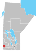 | ||
|---|---|---|---|
| Villages |
| ||
| Rural municipalities |
| ||
| First Nations |
| ||
| Unincorporated communities | |||
| |||
Другой контент может иметь иную лицензию. Перед использованием материалов сайта WikiSort.org внимательно изучите правила лицензирования конкретных элементов наполнения сайта.
WikiSort.org - проект по пересортировке и дополнению контента Википедии