world.wikisort.org - Canada
Osborne Village is a neighbourhood of Winnipeg, Manitoba. The area is bordered by the Assiniboine River on the north and west, Harkness Station on the east (see Winnipeg RT), and the Osborne Underpass on the south.[1]
This article has multiple issues. Please help improve it or discuss these issues on the talk page. (Learn how and when to remove these template messages)
|
Osborne Village | |
|---|---|
Neighbourhood | |
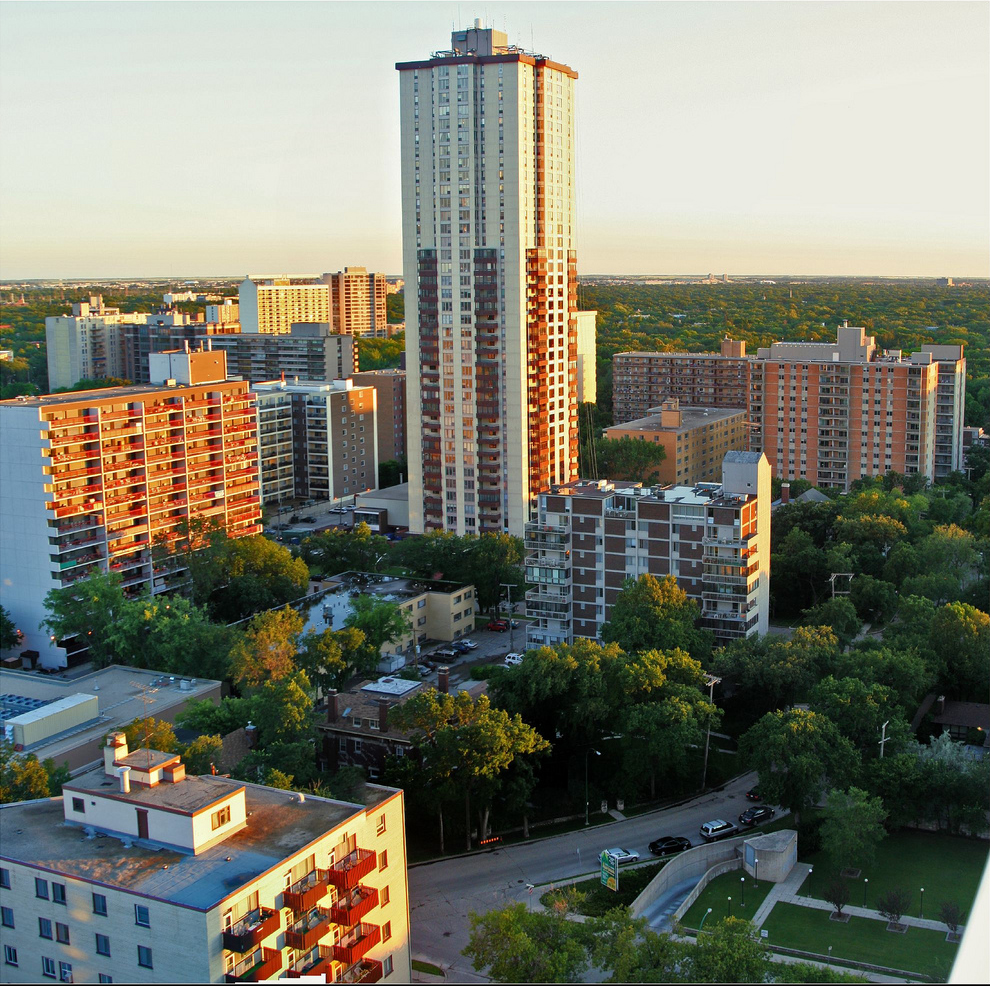
 Aerial shot of Osborne St and River Ave | |
| Country | |
| Province | |
| City | Winnipeg |
| Area | |
| • Neighbourhood | 93 ha (231 acres) |
| • Metro | 5,306.79 km2 (2,048.96 sq mi) |
| Population (2016) | |
| • Neighbourhood | 12,745 |
| • Density | 14,000/km2 (35,000/sq mi) |
| • Metro | 778,489 |
| Time zone | UTC-6 (Central Standard Time) |
| • Summer (DST) | UTC-5 (Central Daylight Time) |
| Postal Code | R3L |
| Area code(s) | 204, 431 |
History
Osborne Village derives its name from Osborne Street (Winnipeg Route 62), which runs through the centre of the village area. Osborne Street was named after Lieutenant Colonel William Osborne Smith (1831–1887) the first commanding officer of Military District 10, which included the City of Winnipeg.[2] North of the Assiniboine River, Osborne Street was adjacent to the first Fort Osborne Barracks, on the site of which is now the Provincial Legislature.
Osborne Village is part of the original Fort Rouge area, which became part of the City of Winnipeg as Ward 1 in 1882.[3] The Fort Rouge area started with a population of only 150, but grew to a population of tens of thousands by 1994.[3]
The Fort Rouge area began developing as a residential suburb of Winnipeg after the construction the Osborne Street Bridge in 1882.[3] In 1891, "The Parkline" became Winnipeg's first streetcar route, running down River Avenue from Main Street, then south on Osborne Street.[3] A major factor in the development of the Village was the construction of the three bridges over the Assiniboine River: the Osborne Street Bridge (1882), the Maryland Bridge (1894), and the Main Street Bridge (1897).[3]
In the early years of the 20th century, Osborne Village's Roslyn Road was developed as a wealthy residential enclave, and by 1911 was home to the mansions of a number of prominent Winnipeg families. Notable among these was the five-acre estate of A.M. Nanton and his family. In 1911, the Nanton estate had a staff of 12.[4] Elsewhere in neighbourhood, housing was less wealthy, but still predominantly middle class. The churches along Nassau Street are evidence of the area's predominantly English and Protestant population at the time.[3] The Victoria Hospital was built early in the century at the corner of Bole Street and River Avenue.[3] The second public park in the City, Assiniboine Park (later to be renamed Fort Rouge Park) was situated along River Avenue in 1894.[3]
As Winnipeg experienced significant population growth in the years following 1945, the Osborne Village area saw the development of large high-rise apartments on or near the Assiniboine riverfront.[3]
The Midtown bridge was constructed in 1954[3] and opened mid-September 1955.[5] The original Osborne Street bridge, which was built in 1882, reconstructed the 1920s and again in 1977, was refurbished in 2011/2012.[6] Each day, 42,000 vehicles travel over the Osborne Bridge.[6]
Osborne Village has changed greatly over the last hundred years but its rich history is still evident in the architectural details of many of its buildings, as well as in the overall pattern of settlement which has come to embody the neighbourhood.[citation needed]
Shoppers Drug Mart Expansion
In 2011, the Shoppers Drug Mart at 43 Osborne Street proposed a plan to expand which involved the purchase and takeover of the neighbouring building that housed Movie Village and Vi-Ann, a local Vietnamese restaurant.[7] The proposal would increase the 10,048-square-foot (933.5 m2) store's footprint by more than double.[7]
The city board approved the purchase in December 2011.[8] Area residents raised a campaign to appeal and block the purchase, collecting over 4,000 signatures,[9] but the purchase plans were upheld by a city appeals committee in February 2012.[9]
Today
The neighbourhood of Osborne Village covers 231 acres (93 ha) of land with a population of approximately 12,745,[10] making it the most densely populated neighbourhood in Winnipeg.[1][11] As of 2006, Osborne Village has close to 554 buildings, fulfilling uses spanning residences, commerce, institution, entertainment, recreation and offices.[1] Osborne Village is home to over 175 businesses.[12]
Approximately 67 acres (270,000 m2) (29%) of the land in the area is residential, with about 37 acres (150,000 m2) of the village being used as single-family residential buildings (16%).[1] 27 acres (110,000 m2) (12%) of the land is used for commercial purposes.[1] 10 acres (40,000 m2) (4.5%) are devoted to park space.[1]
Osborne Village is a complex urban community with a rich heritage and diverse built forms. It’s appreciated as a desirable location in which to live, work, and play. As such, it continues to experience development interest. The City of Winnipeg devised a neighbourhood plan for Osborne Village in 2006.[1]
Osborne Village is home to Winnipeg's tallest residential building outside of the downtown core: 55 Nassau Street North (see List of tallest buildings in Winnipeg).[13] Constructed between 1968 and 1970 the residential complex is 358 feet (109 m) tall.[13]
Osborne Village is home to many of Winnipeg's emerging and well-established artists. The city's first artists' collective makes its home in the Village, as well as many dance studios and venues for bands and musicians of all kinds.
In the summer months talented street performers perform all day long on the street corners, playing everything from guitars and drums to violins.
For the performing arts, Osborne Village is home to the Gas Station Arts Centre, a 235-seat rental venue with a licensed bar, patio, and large stage.
Demographics
| 2016 Pop. | Sq. Km. | |
|---|---|---|
| River-Osborne | 4,750 | 0.9 |
| Roslyn | 4,552 | 0.3 |
| McMillan | 3,445 | 0.6 |
| TOTAL | 12,745 | 1.8 |
Statistics Canada subdivides Osborne Village into three areas. River-Osborne, Roslyn, McMillan.The 2016 population of the whole of the Village is 12,745.[10]
Transportation
Winnipeg Transit routes that cross through the Village are: 16 Osborne-Selkirk, 18 North Main-Corydon, 60 Pembina, 68 Grosvenor and 635 Misericordia Centre (Replace 99 and 185).
Additionally, Osborne Village is served by two Transitway stations: Harkness and Osborne, with routes 64 Lindenwoods Express, 65 Grant Express, 66 Grant (local) and BLUE Line University of Manitoba/St. Norbert (Replacing 137, 160, 161, 162/170, 163, 180, 181 and 183).
Current plans are for a new bicycle-pedestrian bridge to connect McFadyen Park with Fort Rouge Park over the Assiniboine River. The bridge would be partly financed by a grant from the Winnipeg Foundation. There are three designs vying for final approval.[14]
Canada Day

Osborne Village's Canada Day Celebration, organized by the Osborne BIZ (Business Improvement Zone), was Winnipeg's largest and longest running street festival, drawing thousands of people from Winnipeg and the surrounding areas each year.[15] The two-day festival featured live music stages, food vendors, artisan booths, and kids' activities.[16] The street block of Osborne Village closed for the duration of the street party.[17] However, as of 2022, the festival was discontinued and was replaced by a weekly summer event called, Happy Fridays in the Village.[18]
Awards
- Voted the Best Place to Live in Uptown Magazine's 2008 Best of List.[19]
- Awarded "Canada's Great Neighbourhood" title for 2012 by Canadian Institute of Planners[20][21]
References
- "Osborne Village Neighbourhood Plan" (PDF). Planning, Property and Development Department Planning and Land Use Division, City of Winnipeg. June 2006. pp. 8–12. Retrieved 16 October 2012.
- Goldsborough, Gordon (21 April 2012). "Memorable Manitobans: William Osborne Smith (1831-1887)". Manitoba Historical Society. Retrieved 16 October 2012.
- Finnigan, Shaun (April 2, 2003). "Osborne Village Character Inventory Study" (PDF). City of Winnipeg, Planning, Property and Development Department. Retrieved 16 October 2012.
- Galston, Rob (June 19, 2009). "Lost Winnipeg: Osborne Village's gilded past". Uniter.ca. Retrieved March 28, 2018.
- "Bridge Opened: Another Needed". Winnipeg Free Press. September 15, 1955. p. 1.
- "Connection between Winnipeg's Downtown and Osborne Village complete". City of Winnipeg. 26 October 2012. Retrieved 26 October 2012.
- Martin, Melissa (12 June 2011). "Village Shoppers eyes huge expansion". Winnipeg Free Press. Retrieved 16 October 2012.
- "City board approves Shoppers expansion". Winnipeg Sun. 21 December 2011. Retrieved 16 October 2012.
- "Residents denied: Osborne Shoppers expansion beats appeal". Winnipeg Sun. 16 February 2012. Retrieved 16 October 2012.
- "River Heights East Neighbourhood Cluster". City of Winnipeg. February 7, 2019. Retrieved September 26, 2019.
- "Osborne named Canada's greatest neighbourhood". CBC News. 26 April 2012. Retrieved 16 October 2012.
- OsborneVillager.com Osborne Village Business Directory
- "55 Nassau North". Skyscraperpage.com. Retrieved 15 October 2012.
- Santin, Aldo; Turner, Randy (May 24, 2018). "City unveils three options for pedestrian/bike bridge over Assiniboine".
- "Osborne Village Canada Day Street Celebration". OsborneVillage.com. Retrieved 16 October 2012.
- Dacey, Elisha (1 July 2012). "What's happening for Canada Day in Winnipeg?". Metro News. Retrieved 16 October 2012.
- "Canada Day 2012 Festivities". Access Winnipeg. 27 June 2012. Retrieved 16 October 2012.
- "Canada Day street party in Osborne Village won't make post-COVID comeback". cbc.ca. June 10, 2022.
{{cite web}}:|first=missing|last=(help) - "Best of Winnipeg 2008!". Winnipeg Free Press - Uptown Magazine. May 15, 2008. Archived from the original on June 7, 2008.
- "Osborne Village honoured by Canadian Institute of Planners as Canada's Great Neighbourhood for 2012". City of Winnipeg. 3 July 2012. Retrieved 16 October 2012.
- "Announcing the Winners of Great Places in Canada!". Canadian Institute of Planners. Retrieved 16 October 2012.
External links
| Assiniboine South |
|
|---|---|
| Downtown |
|
| Fort Garry |
|
| Inkster |
|
| Point Douglas |
|
| River East |
|
| River Heights |
|
| Seven Oaks |
|
| St. Boniface |
|
| St. James-Assiniboia |
|
| St. Vital |
|
| Transcona |
|
| Others |
|
| |
Другой контент может иметь иную лицензию. Перед использованием материалов сайта WikiSort.org внимательно изучите правила лицензирования конкретных элементов наполнения сайта.
WikiSort.org - проект по пересортировке и дополнению контента Википедии