world.wikisort.org - Canada
Mont-Carmel is a municipality in the Canadian province of Quebec, located in the Kamouraska Regional County Municipality, on the Canada–United States border.
Mont-Carmel | |
|---|---|
Municipality | |
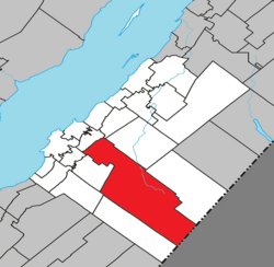 Location within Kamouraska RCM | |
 Mont-Carmel Location in eastern Quebec | |
| Coordinates: 47°26′23″N 69°51′31″W[1] | |
| Country | |
| Province | |
| Region | Bas-Saint-Laurent |
| RCM | Kamouraska |
| Constituted | July 1, 1855 |
| Government | |
| • Mayor | Denis Lévesque |
| • Federal riding | Montmagny—L'Islet—Kamouraska—Rivière-du-Loup |
| • Prov. riding | Côte-du-Sud |
| Area | |
| • Total | 438.60 km2 (169.34 sq mi) |
| • Land | 427.85 km2 (165.19 sq mi) |
| Population (2011)[3] | |
| • Total | 1,136 |
| • Density | 2.7/km2 (7/sq mi) |
| • Pop 2006-2011 | |
| • Dwellings | 662 |
| Time zone | UTC−5 (EST) |
| • Summer (DST) | UTC−4 (EDT) |
| Postal code(s) | G0L 1W0 |
| Area code(s) | 418 and 581 |
| Highways | |
| Website | www |
Geography
Spanning over 75% of the width of the Bas-Saint-Laurent region in which it resides, Mont-Carmel is the second largest subdivision within the Kamouraska Regional County Municipality and borders the United States at its southeast limit.
Communities and locations
The following designated areas reside within the municipality's boundaries:[1]
- Eatonville – a hamlet located at 47°20′16″N 69°41′01″W
- Lac-de-l'Est – a vacation cottage community located at 47°13′39″N 69°35′26″W
Municipal council
- Mayor: Denis Lévesque
- Councillors: Colette Beaulieu, Luc Forgues, Lauréat Jean, Karine St-Jean, Kathleen Saint-Jean, Pierre Saillant
See also
- List of municipalities in Quebec
References
- Reference number 42055 of the Commission de toponymie du Québec (in French)
- Geographic code 14005 in the official Répertoire des municipalités (in French)
- "(Code 2414005) Census Profile". 2011 census. Statistics Canada. 2012.
External links
 Media related to Mont-Carmel, Quebec at Wikimedia Commons
Adjacent Municipal Subdivisions | ||||||||||||||||
|---|---|---|---|---|---|---|---|---|---|---|---|---|---|---|---|---|
| ||||||||||||||||
| Cities and towns |
|
|---|---|
| Municipalities |
|
| Parishes |
|
| Unorganized territories |
|
| |
Authority control | |
|---|---|
| General |
|
| National libraries | |
Текст в блоке "Читать" взят с сайта "Википедия" и доступен по лицензии Creative Commons Attribution-ShareAlike; в отдельных случаях могут действовать дополнительные условия.
Другой контент может иметь иную лицензию. Перед использованием материалов сайта WikiSort.org внимательно изучите правила лицензирования конкретных элементов наполнения сайта.
Другой контент может иметь иную лицензию. Перед использованием материалов сайта WikiSort.org внимательно изучите правила лицензирования конкретных элементов наполнения сайта.
2019-2026
WikiSort.org - проект по пересортировке и дополнению контента Википедии
WikiSort.org - проект по пересортировке и дополнению контента Википедии