world.wikisort.org - Canada
Mapleton is a rural township in the Canadian province of Ontario, located within Wellington County.
Mapleton | |
|---|---|
Township (lower-tier) | |
| Township of Mapleton | |
 Drayton | |
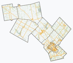 Mapleton  Mapleton | |
| Coordinates: 43.75°N 80.6667°W | |
| Country | |
| Province | |
| County | Wellington |
| Established | 1999 |
| Government | |
| • Type | Township |
| • Mayor | Gregg Davidson |
| • Governing Body | Mapleton Township Council |
| • Federal riding | Perth—Wellington |
| • Prov. riding | Perth—Wellington |
| Area | |
| • Land | 534.87 km2 (206.51 sq mi) |
| Population (2016)[1] | |
| • Total | 10,527 |
| • Density | 19.7/km2 (51/sq mi) |
| Time zone | UTC-5 (EST) |
| • Summer (DST) | UTC-4 (EDT) |
| Postal Code FSA | N0B |
| Area code(s) | 519, 226, 548 |
| Website | www.mapleton.ca |
Communities
The largest and central community in Mapleton is the village of Drayton, which contains the township offices and has the largest retail presence.
The township also contains the smaller communities of Alma, Bosworth, Dobbenville, Glen Allan, Goldstone, Hollen, Lebanon, Moorefield, Parker, Quarindale, Riverbank, Rothsay, Spruce Green, Stirton, Wyandot, and Yatton.[2]
History
The township was formed by the amalgamation of the townships of Maryborough and Peel, and the village of Drayton on January 1, 1999.
Demographics
| Year | Pop. | ±% |
|---|---|---|
| 1996 | 8,827 | — |
| 2001 | 9,303 | +5.4% |
| 2006 | 9,851 | +5.9% |
| 2011 | 9,989 | +1.4% |
| 2016 | 10,527 | +5.4% |
| [3][4][1] | ||
In the 2021 Census of Population conducted by Statistics Canada, Mapleton had a population of 10,839 living in 3,245 of its 3,633 total private dwellings, a change of 3% from its 2016 population of 10,527. With a land area of 535.56 km2 (206.78 sq mi), it had a population density of 20.2/km2 (52.4/sq mi) in 2021.[5]
Education
Mapleton is served by four public schools, administered by the Upper Grand District School Board. These are:
- Alma Public School
- Centre Peel Public School
- Drayton Heights Public School
- Maryborough Public School (Moorefield)
Secondary education is served by Norwell District Secondary School in Palmerston, in the adjacent township of Minto.
Mapleton is also served by one independent school
- Community Christian School (Drayton), which is connected to the Ontario Alliance of Christian Schools.
Recreation
Conestogo Lake is home to a reservoir and conservation area. It is part of the Conestogo River watershed.
See also
- List of townships in Ontario
References
- "Census Profile, 2016 Census: Mapleton, Township". Statistics Canada. Retrieved July 22, 2019.
- "Mapleton". Statistics Canada. Statistics Canada. November 2, 2016.
- Statistics Canada: 1996, 2001, 2006 census
- "Mapleton, Ontario (Code 3523033) census profile". 2011 Census of Population. Statistics Canada. Retrieved 2012-08-16.
- "Population and dwelling counts: Canada, provinces and territories, census divisions and census subdivisions (municipalities), Ontario". Statistics Canada. February 9, 2022. Retrieved April 2, 2022.
External links
Places adjacent to Mapleton, Ontario | ||||||||||||||||
|---|---|---|---|---|---|---|---|---|---|---|---|---|---|---|---|---|
| ||||||||||||||||
Другой контент может иметь иную лицензию. Перед использованием материалов сайта WikiSort.org внимательно изучите правила лицензирования конкретных элементов наполнения сайта.
WikiSort.org - проект по пересортировке и дополнению контента Википедии