world.wikisort.org - Canada
Lyster is a municipality in the Centre-du-Québec region of the province of Quebec in Canada. It was created with the fusion of the Sainte-Anastasie parish and the village of Lyster in 1976.
Lyster | |
|---|---|
Municipality | |
 | |
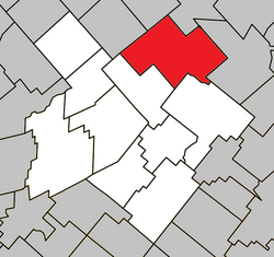 Location within L'Érable RCM | |
 Lyster Location in southern Quebec | |
| Coordinates: 46°22′N 71°37′W[1] | |
| Country | Canada |
| Province | Quebec |
| Region | Centre-du-Québec |
| RCM | L'Érable |
| Constituted | September 18, 1976 |
| Government | |
| • Mayor | Sylvain Labrecque |
| • Federal riding | Mégantic—L'Érable |
| • Prov. riding | Lotbinière |
| Area | |
| • Total | 167.80 km2 (64.79 sq mi) |
| • Land | 168.25 km2 (64.96 sq mi) |
| There is an apparent contradiction between two authoritative sources | |
| Population (2011)[3] | |
| • Total | 1,628 |
| • Density | 9.7/km2 (25/sq mi) |
| • Pop 2006-2011 | |
| • Dwellings | 753 |
| Time zone | UTC−5 (EST) |
| • Summer (DST) | UTC−4 (EDT) |
| Postal code(s) | G0S 1V0 |
| Area code(s) | 819 |
| Highways | |
| Website | www |
See also
- Lyster
References
- "Reference number 72467 in Banque de noms de lieux du Québec". toponymie.gouv.qc.ca (in French). Commission de toponymie du Québec.
- "Geographic code 32065 in the official Répertoire des municipalités". www.mamh.gouv.qc.ca (in French). Ministère des Affaires municipales et de l'Habitation.
- "(Code 2432065) Census Profile". 2011 census. Statistics Canada. 2012.
External links
![]() Media related to Lyster at Wikimedia Commons
Media related to Lyster at Wikimedia Commons
Places adjacent to Lyster, Quebec | ||||||||||||||||
|---|---|---|---|---|---|---|---|---|---|---|---|---|---|---|---|---|
| ||||||||||||||||
| Cities |
|
|---|---|
| Municipalities |
|
| Parishes |
|
| |
Authority control | |
|---|---|
| General | |
| National libraries | |
This Quebec location article is a stub. You can help Wikipedia by expanding it. |
Текст в блоке "Читать" взят с сайта "Википедия" и доступен по лицензии Creative Commons Attribution-ShareAlike; в отдельных случаях могут действовать дополнительные условия.
Другой контент может иметь иную лицензию. Перед использованием материалов сайта WikiSort.org внимательно изучите правила лицензирования конкретных элементов наполнения сайта.
Другой контент может иметь иную лицензию. Перед использованием материалов сайта WikiSort.org внимательно изучите правила лицензирования конкретных элементов наполнения сайта.
2019-2026
WikiSort.org - проект по пересортировке и дополнению контента Википедии
WikiSort.org - проект по пересортировке и дополнению контента Википедии