world.wikisort.org - Canada
Landrienne is a township municipality in the Canadian province of Quebec, located in the Abitibi Regional County Municipality. It is part of the census agglomeration of Amos.
Landrienne | |
|---|---|
Township municipality | |
 | |
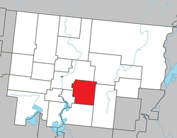 Location within Abitibi RCM. | |
 Landrienne Location in western Quebec. | |
| Coordinates: 48°33′N 77°57′W[1] | |
| Country | Canada |
| Province | Quebec |
| Region | Abitibi-Témiscamingue |
| RCM | Abitibi |
| Settled | 1910s |
| Constituted | July 15, 1918 |
| Government | |
| • Mayor | François Lemieux |
| • Federal riding | Abitibi—Témiscamingue |
| • Prov. riding | Abitibi-Ouest |
| Area | |
| • Total | 274.90 km2 (106.14 sq mi) |
| • Land | 275.93 km2 (106.54 sq mi) |
| There is an apparent contradiction between two authoritative sources | |
| Population (2021)[3] | |
| • Total | 897 |
| • Density | 3.3/km2 (9/sq mi) |
| • Pop 2016-2021 | |
| • Dwellings | 410 |
| Time zone | UTC−05:00 (EST) |
| • Summer (DST) | UTC−04:00 (EDT) |
| Postal code(s) | J0Y 1V0 |
| Area code | 819 |
| Highways | |
| Website | www |
Originally known as Saint-Barnabé-de-Landrienne, the place was named in honour of Jean-Marie Landriève Des Bordes (1712–1778), a French naval officer and administrative inspector.[1]
Demographics
In the 2021 Census of Population conducted by Statistics Canada, Landrienne had a population of 897 living in 398 of its 410 total private dwellings, a change of -7.2% from its 2016 population of 967. With a land area of 275.93 km2 (106.54 sq mi), it had a population density of 3.3/km2 (8.4/sq mi) in 2021.[4]
The township had a population of 897 as of the 2021 Canadian Census, and a land area of 275.93 km2 (106.54 sq mi). Private dwellings occupied by usual residents are 398, out of 410 total dwellings. The mother tongues are:[5]
- English as first language: 0%
- French as first language: 100%
- English and French as first language: 0%
- Other as first language: 0%
Population trend:[6]
- Population in 2021: 897 (2016 to 2011 population change: -7.2%)
- Population in 2016: 967
- Population in 2011: 977
- Population in 2006: 986
- Population in 2001: 1072
- Population in 1996: 1007
- Population in 1991: 1044
Municipal council
- Mayor: François Lemieux
- Councillors: Julie Auger, Maryse Bélanger, Réal Champagne, Steve Champagne, Richard Lecompte, Carole Perron
References
- "Reference number 33933 in Banque de noms de lieux du Québec". toponymie.gouv.qc.ca (in French). Commission de toponymie du Québec.
- "Landrienne". Répertoire des municipalités (in French). Ministère des Affaires municipales, des Régions et de l'Occupation du territoire. Archived from the original on 2012-06-04. Retrieved 2011-01-11.
- "Landrienne census profile". 2021 Census data. Statistics Canada. Retrieved 2022-04-19.
- "Population and dwelling counts: Canada, provinces and territories, and census subdivisions (municipalities), Quebec". Statistics Canada. February 9, 2022. Retrieved August 28, 2022.
- "Landrienne community profile". 2006 Census data. Statistics Canada. Retrieved 2011-01-11.
- Statistics Canada: 1996, 2001, 2006, 2011, 2016, 2021 census
Adjacent Municipal Subdivisions | ||||||||||||||||
|---|---|---|---|---|---|---|---|---|---|---|---|---|---|---|---|---|
| ||||||||||||||||
| Towns | |
|---|---|
| Municipalities | |
| Townships |
|
| Parishes |
|
| Unorganized territories |
|
| |
Другой контент может иметь иную лицензию. Перед использованием материалов сайта WikiSort.org внимательно изучите правила лицензирования конкретных элементов наполнения сайта.
WikiSort.org - проект по пересортировке и дополнению контента Википедии