world.wikisort.org - Canada
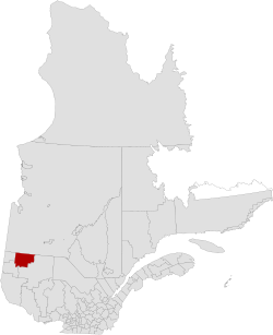
Abitibi Regional County Municipality is a regional county municipality in the Abitibi-Témiscamingue region of Quebec. The seat is Amos.[2]
Abitibi | |
|---|---|
Regional county municipality | |
 | |
| Coordinates: 48°34′N 78°00′W[1] | |
| Country | |
| Province | |
| Region | Abitibi-Témiscamingue |
| Effective | January 1, 1983 |
| County seat | Amos |
| Government | |
| • Type | Prefecture |
| • Prefect | Jacques Riopel |
| Area | |
| • Total | 7,862.70 km2 (3,035.81 sq mi) |
| • Land | 7,677.01 km2 (2,964.11 sq mi) |
| Population (2016)[3] | |
| • Total | 24,639 |
| • Density | 3.2/km2 (8/sq mi) |
| • Change 2011-2016 | |
| • Dwellings | 11,374 |
| Time zone | UTC−5 (EST) |
| • Summer (DST) | UTC−4 (EDT) |
| Area code | 819 |
| Website | www |
| [4] | |
Subdivisions
There are 19 subdivisions within the RCM:[2]
|
|
|
|
|
|
Demographics
Population
Canada census – Abitibi Regional County Municipality community profile
| 2021 | 2016 | 2011 | |
|---|---|---|---|
| Population | 24764 (+0.5% from 2016) | 24,639 (+1.2% from 2011) | 24,354 (+0.3% from 2006) |
| Land area | 7,627.63 km2 (2,945.04 sq mi) | 7,679.36 km2 (2,965.02 sq mi) | 7,677.01 km2 (2,964.11 sq mi) |
| Population density | 3.2/km2 (8.3/sq mi) | 3.2/km2 (8.3/sq mi) | 3.2/km2 (8.3/sq mi) |
| Median age | 44 (M: 43.2, F: 44.4) | 43.0 (M: 42.4, F: 43.7) | 42.2 (M: 41.7, F: 42.7) |
| Total private dwellings | 10945 | 11,374 | 11,109 |
| Median household income | $64,064 | $54,465 |
|
| ||||||||||||||||||||||||
| [10][3] | |||||||||||||||||||||||||
Language
| Canada Census Mother Tongue - Abitibi Regional County Municipality, Quebec[10] | ||||||||||||||||||
|---|---|---|---|---|---|---|---|---|---|---|---|---|---|---|---|---|---|---|
| Census | Total | French |
English |
French & English |
Other | |||||||||||||
| Year | Responses | Count | Trend | Pop % | Count | Trend | Pop % | Count | Trend | Pop % | Count | Trend | Pop % | |||||
2016 |
24,400 |
23,690 | 97.09% | 235 | 0.96% | 70 | 0.29% | 405 | 1.66% | |||||||||
2011 |
24,020 |
23,360 | 97.25% | 215 | 0.90% | 70 | 0.29% | 375 | 1.56% | |||||||||
2006 |
23,915 |
23,170 | 96.88% | 345 | 1.44% | 15 | 0.07% | 385 | 1.61% | |||||||||
2001 |
24,275 |
23,620 | 97.30% | 225 | 0.93% | 60 | 0.25% | 370 | 1.52% | |||||||||
1996 |
25,050 |
24,435 | n/a | 97.54% | 245 | n/a | 0.98% | 50 | n/a | 0.20% | 320 | n/a | 1.28% | |||||
Transportation
Access Routes
Highways and numbered routes that run through the municipality, including external routes that start or finish at the county border:[11]
|
|
|
|
Protected areas
- Aiguebelle National Park
Attractions and other areas
- Alphonse-Normadin Covered Bridge [1950] (Saint-Dominique-du-Rosaire)
- Amos Airport (Trecesson)
- Exposition de la Maison de la culture Centre (Amos)
- Garde Dispensary (La Corne)
- Grazie Gadens (La Motte)
- l'Arche-de-Noe Covered Bridge [1937] (Rochebaucourt)
- l'Harricana Ferme d'autruches Slope (Saint-Mathieu-d'Harricana)
- l'Original Covered Bridge [1942] (Rochebaucourt)
- Mont-Video (Barraute)
- Pageau Refuge (Amos)
- Poste Museum (Saint-Marc-de-Figuery)
See also
- List of regional county municipalities and equivalent territories in Quebec
References
- "Reference number 141126 in Banque de noms de lieux du Québec". toponymie.gouv.qc.ca (in French). Commission de toponymie du Québec.
- "Geographic code 880 in the official Répertoire des municipalités". www.mamh.gouv.qc.ca (in French). Ministère des Affaires municipales et de l'Habitation.
- "Census Profile, 2016 Census: Abitibi, Municipalité régionale de comté [Census division], Quebec". Statistics Canada. Retrieved December 2, 2019.
- "(Code 2488) Census Profile". 2011 census. Statistics Canada. 2012.
- "2021 Community Profiles". 2021 Canadian Census. Statistics Canada. February 4, 2022. Retrieved 2022-04-27.
- "2016 Community Profiles". 2016 Canadian Census. Statistics Canada. August 12, 2021. Retrieved 2019-12-02.
- "2011 Community Profiles". 2011 Canadian Census. Statistics Canada. March 21, 2019. Retrieved 2014-02-18.
- "2006 Community Profiles". 2006 Canadian Census. Statistics Canada. August 20, 2019.
- "2001 Community Profiles". 2001 Canadian Census. Statistics Canada. July 18, 2021.
- Statistics Canada: 1996, 2001, 2006, 2011 census
- Official Transport Quebec Road Map
Adjacent Counties & Equivalent Territories | ||||||||||||||||
|---|---|---|---|---|---|---|---|---|---|---|---|---|---|---|---|---|
| ||||||||||||||||
| Regional county municipalities and equivalent territories | |
|---|---|
| Municipalities |
|
Administrative divisions of Quebec | |
Authority control | |
|---|---|
| General | |
| National libraries | |
| Other | |
На других языках
[de] Abitibi (regionale Grafschaftsgemeinde)
Abitibi ist eine regionale Grafschaftsgemeinde (französisch municipalité régionale du comté, MRC) in der kanadischen Provinz Québec.- [en] Abitibi Regional County Municipality
Текст в блоке "Читать" взят с сайта "Википедия" и доступен по лицензии Creative Commons Attribution-ShareAlike; в отдельных случаях могут действовать дополнительные условия.
Другой контент может иметь иную лицензию. Перед использованием материалов сайта WikiSort.org внимательно изучите правила лицензирования конкретных элементов наполнения сайта.
Другой контент может иметь иную лицензию. Перед использованием материалов сайта WikiSort.org внимательно изучите правила лицензирования конкретных элементов наполнения сайта.
2019-2026
WikiSort.org - проект по пересортировке и дополнению контента Википедии
WikiSort.org - проект по пересортировке и дополнению контента Википедии