world.wikisort.org - Canada
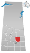
Hendon is a hamlet in the Rural Municipality of Lakeview No. 337, Saskatchewan, Canada. Listed as a designated place by Statistics Canada, the hamlet had a population of 20 in the Canada 2016 Census.[5]
Hendon | |
|---|---|
Organized hamlet | |
 Hendon | |
| Coordinates: 51°52′21″N 103°29′37″W | |
| Country | Canada |
| Province | Saskatchewan |
| Region | West Central Saskatchewan |
| Census division | 10 |
| Rural Municipality | Lakeview |
| Government | |
| • Governing body | Hendon Council |
| Area | |
| • Total | 0.34 km2 (0.13 sq mi) |
| Population (2016) | |
| • Total | 20 |
| • Density | 58.1/km2 (150/sq mi) |
| Time zone | CST |
| Postal code | S0E 0X0 |
| Area code | 306/639 |
| Highways | Highway 35, Highway 758 |
| Railways | Canadian Pacific Railway |
| [1][2][3][4] | |
Demographics
In the 2021 Census of Population conducted by Statistics Canada, Hendon had a population of 10 living in 6 of its 8 total private dwellings, a change of -50% from its 2016 population of 20. With a land area of 0.28 km2 (0.11 sq mi), it had a population density of 35.7/km2 (92.5/sq mi) in 2021.[6]
Canada census – Hendon, Saskatchewan community profile
| 2016 | |
|---|---|
| Population | 20 (+ 100.0% from 2011) |
| Land area | 0.34 km2 (0.13 sq mi) |
| Population density | 58.1/km2 (150/sq mi) |
| Median age | |
| Total private dwellings | 8 |
| Median household income | $N/A |
See also
- List of communities in Saskatchewan
- Hamlets of Saskatchewan
- Designated place
References
- National Archives, Archivia Net, Post Offices and Postmasters, archived from the original on 2006-10-06, retrieved 2018-03-05
- Government of Saskatchewan, MRD Home, Municipal Directory System, archived from the original on November 21, 2008
- Canadian Textiles Institute. (2005), CTI Determine your provincial constituency, archived from the original on 2007-09-11
- Commissioner of Canada Elections, Chief Electoral Officer of Canada (2005), Elections Canada On-line, archived from the original on 2007-04-21
- Canada 2016 Census: Designated places in Saskatchewan
- "Population and dwelling counts: Canada and designated places". Statistics Canada. February 9, 2022. Retrieved Aug 31, 2022.
- "2016 Community Profiles". 2016 Canadian Census. Statistics Canada. August 12, 2021.
- "2006 Community Profiles". 2006 Canadian Census. Statistics Canada. August 20, 2019.
- "2001 Community Profiles". 2001 Canadian Census. Statistics Canada. July 18, 2021.
Текст в блоке "Читать" взят с сайта "Википедия" и доступен по лицензии Creative Commons Attribution-ShareAlike; в отдельных случаях могут действовать дополнительные условия.
Другой контент может иметь иную лицензию. Перед использованием материалов сайта WikiSort.org внимательно изучите правила лицензирования конкретных элементов наполнения сайта.
Другой контент может иметь иную лицензию. Перед использованием материалов сайта WikiSort.org внимательно изучите правила лицензирования конкретных элементов наполнения сайта.
2019-2025
WikiSort.org - проект по пересортировке и дополнению контента Википедии
WikiSort.org - проект по пересортировке и дополнению контента Википедии
