world.wikisort.org - Canada
Hammond is a civil parish in Kings County, New Brunswick, Canada.[2]
Hammond | |
|---|---|
Parish | |
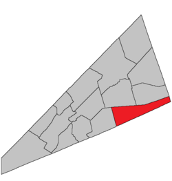 Location within Kings County, New Brunswick. | |
| Coordinates: 45.84°N 64.59°W | |
| Country | |
| Province | |
| County | Kings County |
| Erected | 1858 |
| Area | |
| • Land | 244.24 km2 (94.30 sq mi) |
| Population (2021)[1] | |
| • Total | 276 |
| • Density | 1.1/km2 (3/sq mi) |
| • Change 2016-2021 | |
| • Dwellings | 159 |
| Time zone | UTC-4 (AST) |
| • Summer (DST) | UTC-3 (ADT) |
The local service district is a member of Regional Service Commission 8 (RSC8).[3]
Origin of name
The parish was named for the Hammond River, which in turn took its name from Sir Andrew Snape Hamond, former Governor of Nova Scotia, who received a land grant on the river in 1787.[4]
History
Hammond was erected in 1858 from the eastern part of Upham Parish.[5]
In 1875 the boundary with Sussex and Waterford Parishes was adjusted.[6]
Boundaries
Hammond Parish is bounded:[2][7][8][9]
- on the north by a line beginning at a point 825 metres north of the western end of Cassidy Lake at the prolongation of the eastern line of a grant to Samuel Deforest southwest of the lake, then easterly in a direct line to the northeastern corner of a grant to William Thompson, about 450 metres south of the southern tip of Walton Lake and about 150 metres west of the Creek Road, then running south 88º east[lower-alpha 1] to a point on the Albert County line about 1.65 kilometres south-southeast from Route 114;
- on the east by the Albert County line;
- on the south by the Saint John County line;
- on the west by the eastern line of the Deforest grant, part of which runs along a straight stretch of Route 865, prolonged southerly to the Saint John County line and northerly to the starting point.
Governance
The entire parish forms the local service district of the parish of Hammond, established in 1968 to assess for fire protection. First aid and ambulance services were added to the assessment in 1972. Recreational facilities were added to the assessment in 1994, with first aid and ambulance services being removed at the same time.
Communities
Communities at least partly within the parish;[7][8][9]
- Devine Corner
- Hammondvale
- Hillsdale
- Londonderry
- Poodiac
Bodies of water
Bodies of water[lower-alpha 2] at least partly in the parish:[7][8][9]
- Big Salmon River
- Hammond River
- Little Salmon River
- Point Wolfe River
- Quiddy River
- Cassidy Lake
- more than a dozen other officially named lakes
Other notable places
Parks, historic sites, and other noteworthy places at least partly in the parish.[7][8][9][11]
- Fundy National Park
- McManus Hill Protected Natural Area
- Point Wolfe River Gorge Protected Natural Area
- Saddleback Brook Protected Natural Area
Demographics
Population
|
LanguageMother tongue (2016)[14]
|
Access Routes
Highways and numbered routes that run through the parish, including external routes that start or finish at the parish limits:[15]
|
|
|
|
See also
- List of parishes in New Brunswick
Notes
References
- "Census Profile". Statistics Canada. 26 October 2022. Retrieved 29 October 2022.
- "Chapter T-3 Territorial Division Act". Government of New Brunswick. Retrieved 13 November 2020.
- "Communities in each of the 12 Regional Service Commissions (RSC) / Les communautés dans chacune des 12 Commissions de services régionaux (CSR)" (PDF), Government of New Brunswick, July 2017, retrieved 2 February 2021
- Ganong, William F. (1896). A Monograph of the Place-Nomenclature of the Province of New Brunswick. Royal Society of Canada. p. 239. Retrieved 17 March 2021.
- "21 Vic. c. 40 An Act to authorize the division of the Parish of Upham into two Parishes.". Acts of the General Assembly of Her Majesty's Province of New Brunswick, Passed in March and April 1858. Fredericton: Government of New Brunswick. 1858. pp. 90–91. Retrieved 27 March 2021.
- "38 Vic. c. 114 An Act to establish the division line between the Parish of Hammond and the Parishes of Sussex and Waterford, in King's County.". Acts of the General Assembly of Her Majesty's Province of New Brunswick. Passed in the Month of April 1875. Fredericton: Government of New Brunswick. 1875. pp. 388–389. Available as a free ebook from Google Books.
- "No. 150". Provincial Archives of New Brunswick. Department of Natural Resources and Energy Development. Retrieved 14 June 2021. Remainder of parish on maps 151 and 152 at same site.
- "434" (PDF). Transportation and Infrastructure. Government of New Brunswick. Retrieved 14 June 2021. Remainder of parish on mapbooks 435, 448–450, and 463 at same site.
- "Search the Canadian Geographical Names Database (CGNDB)". Government of Canada. Retrieved 14 June 2021.
- "Historical Magnetic Declination". National Oceanic and Atmospheric Administration. Retrieved 2 March 2021.
- "Explore New Brunswick's Protected Natural Areas". GeoNB. Retrieved 2 July 2021.
- Statistics Canada: 2001, 2006 census
- 2011 Statistics Canada Census Profile: Hammond Parish, New Brunswick
- "Census Profile, 2016 Census: Hammond, Parish [Census subdivision], New Brunswick". Statistics Canada. Retrieved 19 September 2019.
- Atlantic Canada Back Road Atlas ISBN 978-1-55368-618-7
Places adjacent to Hammond Parish, New Brunswick | ||||||||||||||||
|---|---|---|---|---|---|---|---|---|---|---|---|---|---|---|---|---|
| ||||||||||||||||
Subdivisions of New Brunswick | |
|---|---|
| Subdivisions |
|
| Cities | |
| Counties | |
| |
Другой контент может иметь иную лицензию. Перед использованием материалов сайта WikiSort.org внимательно изучите правила лицензирования конкретных элементов наполнения сайта.
WikiSort.org - проект по пересортировке и дополнению контента Википедии