world.wikisort.org - Canada
Coronach /ˈkɒrənæk/ is a community in southern Saskatchewan, Canada near the Canada–US border. It was founded in 1926 by the Canadian Pacific Railway and named after Coronach, the horse who had just won The Derby in England that year. Coronach was officially incorporated in 1928.
Coronach | |
|---|---|
Town | |
| Town of Coronach | |
 Poplar River Power Station | |
 Coronach 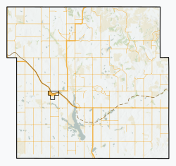 Coronach | |
| Coordinates: 49.1119°N 105.5195°W | |
| Country | Canada |
| Province | Saskatchewan |
| Rural municipality | Hart Butte No. 11 |
| Incorporated | 1928 |
| Government | |
| • Mayor | Calvin Martin |
| Population (2016) | |
| • Total | 643 |
| Postal code | S0H 0Z0 |
| Website | townofcoronach.ca |
History
After its incorporation in 1928 the town's population teetered in and around 300, until about 1974 when the town discovered that they were to receive the Poplar River Power Project. This project brought many new citizens to the town to help with the building and operation of the Power Plant. The Poplar River Power Plant can be seen from a distance with the large smoke stack extending above the town. With the Poplar River Power Project also came the development of the Coronach Coal Mine, which provides the coal/fuel to the Power Plant. The Coal mine has had a few locations and a variety of owners; it is currently owned by Westmoreland Coal Company.
Demographics
In the 2021 Census of Population conducted by Statistics Canada, Coronach had a population of 612 living in 272 of its 351 total private dwellings, a change of -4.8% from its 2016 population of 643. With a land area of 2.34 km2 (0.90 sq mi), it had a population density of 261.5/km2 (677.4/sq mi) in 2021.[1]
According to the 2016 Census, Coronach had a median age of 43.0 years.[2]
Climate
| Climate data for Coronach, Saskatchewan, 1981–2010 normals, extremes 1980–present | |||||||||||||
|---|---|---|---|---|---|---|---|---|---|---|---|---|---|
| Month | Jan | Feb | Mar | Apr | May | Jun | Jul | Aug | Sep | Oct | Nov | Dec | Year |
| Record high °C (°F) | 15.0 (59.0) |
19.0 (66.2) |
24.0 (75.2) |
31.5 (88.7) |
36.0 (96.8) |
40.0 (104.0) |
42.1 (107.8) |
38.0 (100.4) |
37.3 (99.1) |
34.0 (93.2) |
24.5 (76.1) |
13.7 (56.7) |
42.1 (107.8) |
| Average high °C (°F) | −5.5 (22.1) |
−2.6 (27.3) |
3.3 (37.9) |
12.3 (54.1) |
18.4 (65.1) |
22.9 (73.2) |
26.9 (80.4) |
26.6 (79.9) |
19.9 (67.8) |
12.1 (53.8) |
2.2 (36.0) |
−4.0 (24.8) |
11.0 (51.9) |
| Daily mean °C (°F) | −11.2 (11.8) |
−8.2 (17.2) |
−2.4 (27.7) |
5.1 (41.2) |
11.2 (52.2) |
16.0 (60.8) |
19.1 (66.4) |
18.4 (65.1) |
12.1 (53.8) |
5.2 (41.4) |
−3.5 (25.7) |
−9.6 (14.7) |
4.4 (39.8) |
| Average low °C (°F) | −16.8 (1.8) |
−13.6 (7.5) |
−8.0 (17.6) |
−2.1 (28.2) |
3.9 (39.0) |
9.2 (48.6) |
11.3 (52.3) |
10.2 (50.4) |
4.4 (39.9) |
−1.9 (28.6) |
−9.2 (15.4) |
−15.1 (4.8) |
−2.3 (27.9) |
| Record low °C (°F) | −40.0 (−40.0) |
−41.0 (−41.8) |
−35.3 (−31.5) |
−21.6 (−6.9) |
−11.9 (10.6) |
−4.0 (24.8) |
2.4 (36.3) |
−1.5 (29.3) |
−9.7 (14.5) |
−22.0 (−7.6) |
−35.0 (−31.0) |
−40.0 (−40.0) |
−41.0 (−41.8) |
| Average precipitation mm (inches) | 13.5 (0.53) |
8.6 (0.34) |
18.3 (0.72) |
21.4 (0.84) |
51.1 (2.01) |
73.5 (2.89) |
55.6 (2.19) |
31.3 (1.23) |
18.9 (0.74) |
17.9 (0.70) |
13.3 (0.52) |
15.9 (0.63) |
339.3 (13.34) |
| Average snowfall cm (inches) | 13.2 (5.2) |
6.9 (2.7) |
12.0 (4.7) |
4.5 (1.8) |
2.5 (1.0) |
0.0 (0.0) |
0.0 (0.0) |
0.0 (0.0) |
0.6 (0.2) |
2.7 (1.1) |
11.3 (4.4) |
15.8 (6.2) |
69.5 (27.3) |
| Source: Environment Canada [3](September record high)[4] | |||||||||||||
Services and attractions
- A variety of restaurants, and places to stay
- Restaurants - Rustic Tavern, Deb's Country Kitchen, RC's Chinese, Coronach Hotel and The Nook Bakery & Coffee Shop
- Accommodations - Country Boy Motel, Coronach Hotel, Country Flavour B & B, Coronach Bunkhouse
- Camping - Poolside Park Campground, Poplar River Community Park, East Side Campground
- Coronach Sportsplex (which includes a regulation-size artificial ice rink, four artificial ice sheets for curling, and a heated outdoor swimming pool for the summer months)
- Fully equipped campsites
- Four baseball diamonds
- Coronach Golf Club with a 9-hole, 3000 yard grass greens course
- Coronach Medical Center
- Coronach Museum - was established in 1987 to tell the story of the founding, settlement and development of the Coronach district from the year 1900. There is a hospital room, a schoolroom, communication room, shop, parlour, library, town office, bedroom, store, kitchen, toy room, church, sewing and textiles, and bathroom to display artifacts that shaped our history
- K-12 school and Daycare
- An array of different businesses (gas station, grocery store, pharmacy, holistic health, confectionery, Canada Post, Insurance agency, Craft store, Giftware stores, Offsale, second hand store), and services (banks, hairdressers, massage, fitness gym, library, Mechanic Shop, Tire Shop, Plumbing Shop, Embroidery/heat press business, horse/roping arena, laundromat, car wash)
Transportation
The Town of Coronach is a part owner of the Fife Lake Railway.[5]
See also
Scobey–Coronach Border Crossing
References
- "Population and dwelling counts: Canada, provinces and territories, census divisions and census subdivisions (municipalities), Saskatchewan". Statistics Canada. 9 February 2022. Retrieved 1 April 2022.
- "2016 Census of Canada". census profile 2016. Statistics Canada. Retrieved 30 May 2017.
- "Canadian Climate Normals 1981-2010". Environment and Climate Change Canada. Retrieved September 7, 2022
- "Daily Data Report for September 2022". Canadian Climate Data. Environment and Climate Change Canada. Retrieved 7 September 2022.
- Fife Lake Railway Project Best Practice Report
| Towns |
|  | |||||
|---|---|---|---|---|---|---|---|
| Villages | |||||||
| Rural municipalities | |||||||
| First Nations |
| ||||||
| Indian reserves |
| ||||||
| Unincorporated communities |
| ||||||
| |||||||
This article about a location in the Census Division No. 3 of Saskatchewan is a stub. You can help Wikipedia by expanding it. |
Другой контент может иметь иную лицензию. Перед использованием материалов сайта WikiSort.org внимательно изучите правила лицензирования конкретных элементов наполнения сайта.
WikiSort.org - проект по пересортировке и дополнению контента Википедии