world.wikisort.org - Canada
Clarendon is a civil parish in Charlotte County, New Brunswick, Canada,[2] located in the interior to the north of Point Lepreau and southwest of CFB Gagetown. It comprises a single local service district (LSD), which is a member of Regional Service Commission 11 (RSC11).[3]
Clarendon Parish
Paroisse de Clarendon | |
|---|---|
Parish | |
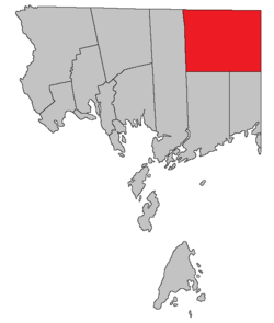 Location within Charlotte County. | |
| Country | |
| Province | |
| County | Charlotte County |
| Erected | 1869 |
| Named for | George Villiers, 4th Earl of Clarendon |
| Government | |
| • Type | Local service district |
| Area | |
| • Land | 492.11 km2 (190.00 sq mi) |
| Population (2021)[1] | |
| • Total | 66 |
| • Density | 0.1/km2 (0.3/sq mi) |
| • Change 2016-2021 | |
| • Dwellings | 64 |
| Time zone | UTC-4 (AST) |
| • Summer (DST) | UTC-3 (ADT) |
The Census subdivision of the same name shared the parish's boundaries.[4]
Origin of name
The parish was named for Clarendon Settlement, which in turn was named in honour of the Earl of Clarendon, British Secretary of State for Foreign Affairs at the time of it being laid out.[5]
History
Clarendon was erected in 1869 from Lepreau and Pennfield Parishes.[6]
The area was first laid out for settlement in 1856,[7] with the Clarendon Settlement being largest. Much of the parish was never surveyed for settlement, most of the surveyed lots were never granted, and many granted lots were later reconveyed to the Crown.[8]
In 1868 the Clarendon District was created as a polling district taking in the northern part of Lepreau and Pennfield Parishes.[9]
Boundaries
Clarendon Parish is bounded:[2][10][11]
- on the north by the Sunbury and Queens County lines;
- on the east by Queens County;
- on the south by a due west line from the southernmost corner of Queens County;
- and on the west by the prolongation of the eastern line of grants that cross Lake Utopia.
Local service district
The local service district of the parish of Clarendon comprises the entire parish.[12]
The LSD was established in 1975 to assess for fire protection;[13] recreational and sport facilities was added in 2008.[14]
Today the LSD assesses for community & recreation services in addition to the basic LSD services of fire protection, police services, land use planning, emergency measures, and dog control.[15] The taxing authority is 507.00 Clarendon.
Communities
Communities at least partly within the parish.[10][11][16] italics indicate a name no longer in official use
- Back Clarendon
- Pleasington
Bodies of water
Bodies of water[lower-alpha 1] at least partly within the parish.[10][11][16]
|
|
Islands
Islands at least partly within the parish.[10][11][16]
- Bradt Island (in McDougall Lake)
- Horse Island (in South Oromocto Lake)
Other notable places
Parks, historic sites, and other noteworthy places at least partly within the parish.[10][11][16]
Demographics
Population
| 2016 | 2011 | |
|---|---|---|
| Population | 63 (+21.2% from 2011) | 52 (-26.8% from 2006) |
| Land area | 492.19 km2 (190.04 sq mi) | 492.91 km2 (190.31 sq mi) |
| Population density | 0.1/km2 (0.26/sq mi) | 0.1/km2 (0.26/sq mi) |
| Median age | 59.2 (M: 59.8, F: 57.7) | 58.0 (M: 59.5, F: 56.5) |
| Total private dwellings | 90 | 76 |
| Median household income | $44,928 | $.N/A |
|
|
| |||||||||||||||||||||||||||
| [23][4] | |||||||||||||||||||||||||||||
Language
| Canada Census Mother Tongue - Clarendon Parish, New Brunswick[23] 2001 & 2006 language data for this area has been suppressed for data quality or confidentiality reasons. | ||||||||||||||||||
|---|---|---|---|---|---|---|---|---|---|---|---|---|---|---|---|---|---|---|
| Census | Total | French |
English |
French & English |
Other | |||||||||||||
| Year | Responses | Count | Trend | Pop % | Count | Trend | Pop % | Count | Trend | Pop % | Count | Trend | Pop % | |||||
2011 |
50 |
50 | 100.00% | 0 | 0.00% | 0 | 0.00% | 0 | 0.00% | |||||||||
1996 |
50 |
50 | n/a | 100.00% | 0 | n/a | 0.00% | 0 | n/a | 0.00% | 0 | n/a | 0.00% | |||||
Access Routes
Highways and numbered routes that run through the parish, including external routes that start or finish at the parish limits:[24]
|
|
|
|
Notes
- Not including brooks, ponds or coves.
References
- "Census Profile". Statistics Canada. 26 October 2022. Retrieved 29 October 2022.
- "Chapter T-3 Territorial Division Act". Government of New Brunswick. Retrieved 1 August 2020.
- "Communities in each of the 12 Regional Service Commissions (RSC) / Les communautés dans chacune des 12 Commissions de services régionaux (CSR)" (PDF), Government of New Brunswick, July 2017, retrieved 2 February 2021
- "Census Profile, 2016 Census: Clarendon, Parish [Census subdivision], New Brunswick". Statistics Canada. Retrieved 8 September 2019.
- Ganong, William F. (1896). A Monograph of the Place-Nomenclature of the Province of New Brunswick. Royal Society of Canada. p. 227. Retrieved 17 March 2021.
- "32 Vic. c. 51 An Act to erect part of the Parishes of Lepreaux and Pennfield, in the County of Charlotte, into a separate Town or Parish.". Acts of the General Assembly of Her Majesty's Province of New Brunswick. Passed in the Month of April 1869. Fredericton: Government of New Brunswick. 1869. pp. 96–97. Available as a free ebook from Google Books.
- Ganong, p. 208
- "No. 155". Provincial Archives of New Brunswick. Department of Natural Resources and Energy Development. Retrieved 13 November 2020.
- "31 Vic. c. 51 An Act to establish an additional Polling place in the County of Charlotte.". Acts of the General Assembly of Her Majesty's Province of New Brunswick. Passed in the Month of March 1868. Fredericton: Government of New Brunswick. 1868. p. 84. Available as a free ebook from Google Books.
- "No. 147". Provincial Archives of New Brunswick. Department of Natural Resources and Energy Development. Retrieved 3 July 2021. Remainder of parish on maps 155, 156, 162, and 163 at same site.
- "442" (PDF). Transportation and Infrastructure. Government of New Brunswick. Retrieved 3 July 2021. Remainder of parish on mapbooks 457, 458, 470, and 471 at same site.
- "New Brunswick Regulation 84-168 under the Municipalities Act (O.C. 84-582)". Government of New Brunswick. Retrieved 6 February 2021.
- "Regulation 75–4 under the Municipalities Act (O. C. 75–33)". The Royal Gazette. Fredericton. 133: 80. 29 January 1975.
- "Regulation 2008-157 under the Municipalities Act (O. C. 2008-553)" (PDF). The Royal Gazette. Fredericton. 167: 96–97. 14 January 2009. ISSN 1714-9428.
- "2020 Local Government Statistics for New Brunswick" (PDF). Department of Environment and Local Government. p. 55. Retrieved 6 February 2021.
- "Search the Canadian Geographical Names Database (CGNDB)". Government of Canada. Retrieved 4 July 2021.
- "New Brunswick Regulation 94-43 under the Fish and Wildlife Act (O.C. 94-231)". Government of New Brunswick. 5 June 2006. Retrieved 8 July 2021.
- "Explore New Brunswick's Protected Natural Areas". GeoNB. Retrieved 4 July 2021.
- "2016 Community Profiles". 2016 Canadian Census. Statistics Canada. 12 August 2021. Retrieved 8 September 2019.
- "2011 Community Profiles". 2011 Canadian Census. Statistics Canada. 21 March 2019. Retrieved 15 March 2014.
- "2006 Community Profiles". 2006 Canadian Census. Statistics Canada. 20 August 2019.
- "2001 Community Profiles". 2001 Canadian Census. Statistics Canada. 18 July 2021.
- Statistics Canada: 1996, 2001, 2006, 2011 census
- Atlantic Canada Back Road Atlas ISBN 978-1-55368-618-7 Pages 4, 12
Places adjacent to Clarendon Parish, New Brunswick | |
|---|---|
Subdivisions of New Brunswick | |
|---|---|
| Subdivisions |
|
| Cities | |
| Counties | |
| |
Другой контент может иметь иную лицензию. Перед использованием материалов сайта WikiSort.org внимательно изучите правила лицензирования конкретных элементов наполнения сайта.
WikiSort.org - проект по пересортировке и дополнению контента Википедии