world.wikisort.org - Canada
Charlesville is a community in the Canadian province of Nova Scotia, located in the Municipality of the District of Barrington of Shelburne County.[2]
Charlesville | |
|---|---|
Community | |
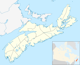 Location of Charlesville, Nova Scotia | |
| Coordinates: 43.5825°N 65.778889°W[1] | |
| Country | |
| Province | |
| County | Shelburne |
| Municipal district | Barrington |
| Time zone | UTC-4 (AST) |
| • Summer (DST) | UTC-3 (ADT) |
| Area code(s) | 902 |
| Access Routes | |
Climate
Charlesville experiences an oceanic climate (Köppen: Cfb) with cold, snowy winters and mild summers.
| Climate data for Charlesville (1981–2010) | |||||||||||||
|---|---|---|---|---|---|---|---|---|---|---|---|---|---|
| Month | Jan | Feb | Mar | Apr | May | Jun | Jul | Aug | Sep | Oct | Nov | Dec | Year |
| Record high °C (°F) | 14.0 (57.2) |
12.5 (54.5) |
16.5 (61.7) |
23.5 (74.3) |
25.0 (77.0) |
29.0 (84.2) |
30.0 (86.0) |
29.0 (84.2) |
27.0 (80.6) |
27.5 (81.5) |
18.5 (65.3) |
15.5 (59.9) |
30.0 (86.0) |
| Average high °C (°F) | 1.7 (35.1) |
1.9 (35.4) |
4.2 (39.6) |
8.2 (46.8) |
12.4 (54.3) |
16.3 (61.3) |
18.5 (65.3) |
19.3 (66.7) |
17.7 (63.9) |
13.5 (56.3) |
9.1 (48.4) |
4.4 (39.9) |
10.6 (51.1) |
| Daily mean °C (°F) | −2 (28) |
−1.7 (28.9) |
0.8 (33.4) |
4.9 (40.8) |
8.9 (48.0) |
12.7 (54.9) |
15.1 (59.2) |
15.8 (60.4) |
14.2 (57.6) |
10.2 (50.4) |
5.8 (42.4) |
0.9 (33.6) |
7.1 (44.8) |
| Average low °C (°F) | −5.6 (21.9) |
−5.2 (22.6) |
−2.6 (27.3) |
1.6 (34.9) |
5.4 (41.7) |
9.0 (48.2) |
11.7 (53.1) |
12.2 (54.0) |
10.6 (51.1) |
6.8 (44.2) |
2.5 (36.5) |
−2.6 (27.3) |
3.7 (38.7) |
| Record low °C (°F) | −21.0 (−5.8) |
−19.0 (−2.2) |
−17.5 (0.5) |
−10.5 (13.1) |
−2.5 (27.5) |
0.0 (32.0) |
4.5 (40.1) |
3.0 (37.4) |
−3.0 (26.6) |
−5.5 (22.1) |
−12.0 (10.4) |
−20.0 (−4.0) |
−21.0 (−5.8) |
| Average precipitation mm (inches) | 120.8 (4.76) |
89.2 (3.51) |
123.9 (4.88) |
106.2 (4.18) |
107.3 (4.22) |
95.1 (3.74) |
111.4 (4.39) |
82.1 (3.23) |
99.5 (3.92) |
100.2 (3.94) |
129.9 (5.11) |
117.7 (4.63) |
1,283.3 (50.52) |
| Average rainfall mm (inches) | 86.3 (3.40) |
69.7 (2.74) |
111.3 (4.38) |
104.0 (4.09) |
107.3 (4.22) |
95.1 (3.74) |
111.4 (4.39) |
82.1 (3.23) |
99.5 (3.92) |
100.2 (3.94) |
125.9 (4.96) |
95.5 (3.76) |
1,188.3 (46.78) |
| Average snowfall cm (inches) | 34.5 (13.6) |
19.5 (7.7) |
12.6 (5.0) |
2.2 (0.9) |
0.0 (0.0) |
0.0 (0.0) |
0.0 (0.0) |
0.0 (0.0) |
0.0 (0.0) |
0.0 (0.0) |
4.1 (1.6) |
22.2 (8.7) |
95.1 (37.4) |
| Average precipitation days (≥ 0.2 mm) | 15.8 | 12.8 | 15.3 | 17.5 | 18.3 | 16.6 | 17.4 | 16.8 | 15.8 | 17.1 | 17.6 | 18.7 | 199.7 |
| Average rainy days (≥ 0.2 mm) | 10.7 | 8.8 | 13.0 | 17.1 | 18.3 | 16.6 | 17.4 | 16.8 | 15.8 | 17.1 | 16.9 | 14.3 | 182.7 |
| Average snowy days (≥ 0.2 cm) | 6.8 | 4.9 | 3.1 | 0.83 | 0.0 | 0.0 | 0.0 | 0.0 | 0.0 | 0.0 | 0.80 | 5.6 | 22.0 |
| Mean monthly sunshine hours | 78.9 | 96.2 | 134.1 | 145.2 | 169.8 | 175.3 | 192.0 | 178.4 | 170.7 | 141.6 | 88.7 | 64.0 | 1,634.7 |
| Percent possible sunshine | 27.2 | 32.6 | 36.3 | 36.1 | 37.3 | 38.0 | 41.1 | 41.1 | 45.4 | 41.3 | 30.4 | 22.9 | 35.8 |
| Source: Environment Canada[3][4] | |||||||||||||
See also
- List of communities in Nova Scotia
References
- Nova Scotia Geographical Names: Charlesville[permanent dead link]
- Government of Nova Scotia website: Community Counts
- "Charlesville, Nova Scotia". Canadian Climate Normals 1981–2010. Environment Canada. Retrieved 12 April 2015.
- "Charlesville, Nova Scotia". Canadian Climate Normals 1981–2010. Environment Canada. Archived from the original on 2020-10-31. Retrieved 12 April 2015.
External links
Places adjacent to Charlesville, Nova Scotia | ||||||||||||||||
|---|---|---|---|---|---|---|---|---|---|---|---|---|---|---|---|---|
| ||||||||||||||||
Subdivisions of Nova Scotia | |
|---|---|
| Counties |
|
| County municipalities |
|
| Regional municipalities |
|
| District municipalities |
|
| Towns |
|
| Villages | |
| Economic regions |
|
| Lists |
|
| |
This Shelburne County, Nova Scotia location article is a stub. You can help Wikipedia by expanding it. |
Текст в блоке "Читать" взят с сайта "Википедия" и доступен по лицензии Creative Commons Attribution-ShareAlike; в отдельных случаях могут действовать дополнительные условия.
Другой контент может иметь иную лицензию. Перед использованием материалов сайта WikiSort.org внимательно изучите правила лицензирования конкретных элементов наполнения сайта.
Другой контент может иметь иную лицензию. Перед использованием материалов сайта WikiSort.org внимательно изучите правила лицензирования конкретных элементов наполнения сайта.
2019-2025
WikiSort.org - проект по пересортировке и дополнению контента Википедии
WikiSort.org - проект по пересортировке и дополнению контента Википедии