world.wikisort.org - Canada
Beaverlodge is a town in northern Alberta, Canada. It is located on Highway 43, 43 km (27 mi) west of Grande Prairie and 48 km (30 mi) east of the British Columbia border.
Beaverlodge | |
|---|---|
Town | |
| Town of Beaverlodge | |
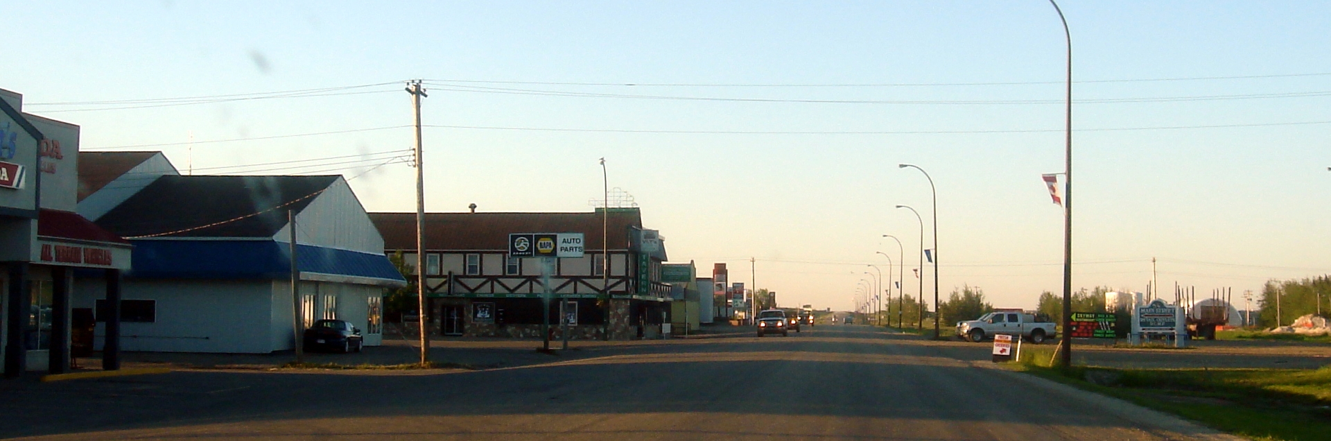 Highway 43 passing through Beaverlodge | |
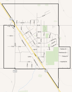 Town boundaries | |
 Beaverlodge Location in Alberta  Beaverlodge Location in Grande Prairie County | |
| Coordinates: 55°12′34″N 119°25′45″W | |
| Country | Canada |
| Province | Alberta |
| Region | Northern Alberta |
| Planning region | Upper Peace |
| Municipal district | County of Grande Prairie No. 1 |
| Incorporated[1] | |
| • Village | July 31, 1929 |
| • Town | January 24, 1956 |
| Government | |
| • Mayor | Gary Rycroft |
| • Governing body | Beaverlodge Town Council |
| Area (2021)[2] | |
| • Land | 5.38 km2 (2.08 sq mi) |
| Elevation | 730 m (2,400 ft) |
| Population | |
| • Total | 2,271 |
| • Density | 421.9/km2 (1,093/sq mi) |
| Time zone | UTC−7 (MST) |
| • Summer (DST) | UTC−6 (MDT) |
| Highways | Highway 43 |
| Waterways | Beaverlodge River |
| Website | Official website |
History
The town was named for the Beaverlodge River, which was known as Uz-i-pa ("temporary lodge") by members of the Beaver First Nation. The first European-Canadian settlers arrived in 1909.[5]
Geography
Climate
Beaverlodge experiences a subarctic climate (Köppen climate classification Dfc) that borders on a humid continental climate (Köppen Dfb).
| Climate data for Beaverlodge (1981–2010) | |||||||||||||
|---|---|---|---|---|---|---|---|---|---|---|---|---|---|
| Month | Jan | Feb | Mar | Apr | May | Jun | Jul | Aug | Sep | Oct | Nov | Dec | Year |
| Record high °C (°F) | 16.7 (62.1) |
16.1 (61.0) |
16.1 (61.0) |
28.9 (84.0) |
32.8 (91.0) |
37.5 (99.5) |
36.7 (98.1) |
34.5 (94.1) |
31.7 (89.1) |
27.8 (82.0) |
21.7 (71.1) |
16.7 (62.1) |
37.5 (99.5) |
| Average high °C (°F) | −7 (19) |
−3.3 (26.1) |
1.4 (34.5) |
9.6 (49.3) |
16.1 (61.0) |
19.7 (67.5) |
21.7 (71.1) |
21.2 (70.2) |
15.9 (60.6) |
8.8 (47.8) |
−1.3 (29.7) |
−5.1 (22.8) |
8.1 (46.6) |
| Daily mean °C (°F) | −11.7 (10.9) |
−8.4 (16.9) |
−3.7 (25.3) |
3.9 (39.0) |
9.7 (49.5) |
13.6 (56.5) |
15.5 (59.9) |
14.7 (58.5) |
9.9 (49.8) |
3.7 (38.7) |
−5.5 (22.1) |
−9.8 (14.4) |
2.7 (36.9) |
| Average low °C (°F) | −16.3 (2.7) |
−13.3 (8.1) |
−8.9 (16.0) |
−1.8 (28.8) |
3.2 (37.8) |
7.5 (45.5) |
9.1 (48.4) |
8.2 (46.8) |
3.9 (39.0) |
−1.4 (29.5) |
−9.7 (14.5) |
−14.4 (6.1) |
−2.8 (27.0) |
| Record low °C (°F) | −47.8 (−54.0) |
−47.2 (−53.0) |
−38.9 (−38.0) |
−35 (−31) |
−12.2 (10.0) |
−6.7 (19.9) |
−5 (23) |
−3 (27) |
−11.7 (10.9) |
−29 (−20) |
−40.5 (−40.9) |
−43.3 (−45.9) |
−47.8 (−54.0) |
| Average precipitation mm (inches) | 29.4 (1.16) |
18.0 (0.71) |
15.8 (0.62) |
19.9 (0.78) |
36.9 (1.45) |
71.7 (2.82) |
69.7 (2.74) |
56.5 (2.22) |
42.2 (1.66) |
24.4 (0.96) |
26.5 (1.04) |
22.2 (0.87) |
433.1 (17.05) |
| Average rainfall mm (inches) | 1.3 (0.05) |
0.6 (0.02) |
1.1 (0.04) |
10.4 (0.41) |
33.7 (1.33) |
71.7 (2.82) |
69.7 (2.74) |
56.4 (2.22) |
41.6 (1.64) |
14.8 (0.58) |
2.8 (0.11) |
0.4 (0.02) |
304.6 (11.99) |
| Average snowfall cm (inches) | 31.7 (12.5) |
19.1 (7.5) |
16.0 (6.3) |
8.7 (3.4) |
2.8 (1.1) |
0.0 (0.0) |
0.0 (0.0) |
0.1 (0.0) |
0.6 (0.2) |
9.1 (3.6) |
25.3 (10.0) |
23.9 (9.4) |
137.2 (54.0) |
| Average precipitation days (≥ 0.2 mm) | 9.6 | 7.8 | 7.2 | 6.8 | 10.7 | 13.7 | 14.0 | 12.5 | 13.1 | 10.9 | 9.4 | 8.3 | 124.0 |
| Average rainy days (≥ 0.2 mm) | 1.2 | 0.58 | 0.95 | 4.4 | 10.6 | 13.7 | 14.0 | 12.5 | 12.9 | 8.1 | 1.8 | 0.43 | 81.1 |
| Average snowy days (≥ 0.2 cm) | 8.6 | 6.8 | 6.0 | 2.8 | 0.76 | 0.0 | 0.0 | 0.04 | 0.42 | 3.1 | 7.7 | 8.1 | 44.3 |
| Mean monthly sunshine hours | 76.7 | 104.4 | 172.8 | 220.0 | 264.6 | 281.2 | 298.4 | 267.1 | 177.3 | 131.8 | 78.1 | 68.6 | 2,141 |
| Percent possible sunshine | 31.7 | 38.4 | 47.2 | 52.0 | 52.8 | 54.2 | 57.3 | 57.5 | 46.2 | 40.4 | 30.9 | 30.5 | 44.9 |
| Source: Environment Canada[6] | |||||||||||||
Demographics
| Year | Pop. | ±% |
|---|---|---|
| 1931 | 211 | — |
| 1936 | 203 | −3.8% |
| 1941 | 331 | +63.1% |
| 1946 | 443 | +33.8% |
| 1951 | 514 | +16.0% |
| 1956 | 768 | +49.4% |
| 1961 | 897 | +16.8% |
| 1966 | 1,083 | +20.7% |
| 1971 | 1,172 | +8.2% |
| 1976 | 1,332 | +13.7% |
| 1981 | 1,937 | +45.4% |
| 1986 | 1,808 | −6.7% |
| 1991 | 1,779 | −1.6% |
| 1996 | 1,997 | +12.3% |
| 2001 | 2,110 | +5.7% |
| 2006 | 2,264 | +7.3% |
| 2011 | 2,365 | +4.5% |
| 2016 | 2,465 | +4.2% |
| Source: Statistics Canada [7][8][9][10][11][12][13][14][15] | ||
In the 2021 Census of Population conducted by Statistics Canada, the Town of Beaverlodge had a population of 2,271 living in 923 of its 1,022 total private dwellings, a change of -7.9% from its 2016 population of 2,465. With a land area of 5.38 km2 (2.08 sq mi), it had a population density of 422.1/km2 (1,093.3/sq mi) in 2021.[2]
In the 2016 Census of Population conducted by Statistics Canada, the Town of Beaverlodge recorded a population of 2,465 living in 953 of its 1,024 total private dwellings, a 4.2% change from its 2011 population of 2,365. With a land area of 5.73 km2 (2.21 sq mi), it had a population density of 430.2/km2 (1,114.2/sq mi) in 2016.[15]
Attractions

In 2004, a Giant Beaver statue was unveiled in the town's park, which can be seen from Highway 43.[16]
Sports
The town is the home of the Beaverlodge Blades, a hockey team in the North West Junior Hockey League (NWJHL). The team plays out of the Beaverlodge Arena and was established in 2000.[citation needed]
Amenities
The town has an arena, a public library, an indoor swimming pool and play parks.[17]
Education
There is an elementary school, grade K-6, Junior High students are bused to Hythe for grades 7–9, St. Mary's Catholic School is available for students attending grades 1–9. The high school, Beaverlodge Regional High School (BRHS), is attended by students from Wembley, Valhalla, Hythe, Horse Lakes No. 152B (Indian reserve), Kelly Lake (Metis settlement), Elmworth and St. Mary's in addition to the local Beaverlodge students.
Notable people
- Jerry Holland, ice hockey player
- Simon Hoogewerf, middle-distance runner
- Mel Knight, politician
- Chris Schmidt, ice hockey player
- Geoff Walker, curler
- Matt Walker, ice hockey player
- Brian Walker, ice hockey player
- Euphemia McNaught, impressionist painter
See also
- List of communities in Alberta
- List of towns in Alberta
- CFS Beaverlodge
- South Peace Centennial Museum
References
- "Location and History Profile: Town of Beaverlodge" (PDF). Alberta Municipal Affairs. October 7, 2016. p. 43. Retrieved October 13, 2016.
- "Population and dwelling counts: Canada, provinces and territories, and census subdivisions (municipalities)". Statistics Canada. February 9, 2022. Retrieved February 9, 2022.
- "Alberta Private Sewage Systems 2009 Standard of Practice Handbook: Appendix A.3 Alberta Design Data (A.3.A. Alberta Climate Design Data by Town)" (PDF) (PDF). Safety Codes Council. January 2012. pp. 212–215 (PDF pages 226–229). Archived from the original (PDF) on October 16, 2013. Retrieved October 8, 2013.
- "Population and dwelling counts: Canada and population centres". Statistics Canada. February 9, 2022. Retrieved February 13, 2022.
- "Beaverlodge | The Canadian Encyclopedia". www.thecanadianencyclopedia.ca. Retrieved July 30, 2020.
- "Beaverlodge CDA". Canadian Climate Normals 1981–2010. Environment Canada. October 31, 2011. Retrieved September 21, 2015.
- "Table 5: Population of urban centres, 1916-1946, with guide to locations". Census of the Prairie Provinces, 1946. Vol. I: Population. Ottawa: Dominion Bureau of Statistics. 1949. pp. 397–400.
- "Table 6: Population by sex, for census subdivisions, 1956 and 1951". Census of Canada, 1956. Vol. I: Population. Ottawa: Dominion Bureau of Statistics. 1958.
- "Table 9: Population by census subdivisions, 1966 by sex, and 1961". 1966 Census of Canada. Western Provinces. Vol. Population: Divisions and Subdivisions. Ottawa: Dominion Bureau of Statistics. 1967.
- "Table 3: Population for census divisions and subdivisions, 1971 and 1976". 1976 Census of Canada. Census Divisions and Subdivisions, Western Provinces and the Territories. Vol. Population: Geographic Distributions. Ottawa: Statistics Canada. 1977.
- "Table 2: Census Subdivisions in Alphabetical Order, Showing Population Rank, Canada, 1981". 1981 Census of Canada. Vol. Census subdivisions in decreasing population order. Ottawa: Statistics Canada. 1982. ISBN 0-660-51563-6.
- "Table 2: Population and Dwelling Counts, for Census Divisions and Census Subdivisions, 1986 and 1991 – 100% Data". 91 Census. Vol. Population and Dwelling Counts – Census Divisions and Census Subdivisions. Ottawa: Statistics Canada. 1992. pp. 100–108. ISBN 0-660-57115-3.
- "Population and Dwelling Counts, for Canada, Provinces and Territories, and Census Divisions, 2001 and 1996 Censuses – 100% Data (Alberta)". Statistics Canada. Retrieved May 25, 2019.
- "Population and dwelling counts, for Canada, provinces and territories, and census subdivisions (municipalities), 2006 and 2001 censuses – 100% data (Alberta)". Statistics Canada. January 6, 2010. Retrieved May 25, 2019.
- "Population and dwelling counts, for Canada, provinces and territories, and census subdivisions (municipalities), 2016 and 2011 censuses – 100% data (Alberta)". Statistics Canada. February 8, 2017. Retrieved February 8, 2017.
- "Giant Beaver Sculpture". Town of Beaverlodge. Archived from the original on December 19, 2012. Retrieved November 1, 2012.
- "Attractions & Facilities". Town of Beaverlodge. Archived from the original on December 19, 2012. Retrieved February 19, 2013.
External links
Places adjacent to Beaverlodge | ||||||||||||||||
|---|---|---|---|---|---|---|---|---|---|---|---|---|---|---|---|---|
| ||||||||||||||||
Subdivisions of Alberta | |
|---|---|
| Subdivisions |
|
| Communities |
|
| Cities and urban service areas |
|
| Specialized municipalities |
|
| Towns |
|
| |
| Cities |
|
|---|---|
| Towns |
|
| Villages |
|
| Hamlets |
|
| Municipal districts |
|
| Improvement districts |
|
| Indian reserves |
|
| Provincial parks |
|
| Other topics |
|
| |
Authority control | |
|---|---|
| General |
|
| National libraries | |
На других языках
[de] Beaverlodge
Beaverlodge ist eine Kleinstadt im nördlichen Alberta, Kanada.- [en] Beaverlodge
[ru] Биверлодж
Биверлодж (англ. Beaverlodge) — город на севере провинции Альберта в Канаде. Город находится на Шоссе № 43 (англ. Highway 43).Другой контент может иметь иную лицензию. Перед использованием материалов сайта WikiSort.org внимательно изучите правила лицензирования конкретных элементов наполнения сайта.
WikiSort.org - проект по пересортировке и дополнению контента Википедии