world.wikisort.org - Canada
Alma (2011 Town population: 30,904; CA Population 33,018; UA Population 26,016) is a town in Saguenay–Lac-Saint-Jean, in the Canadian province of Quebec.
Alma | |
|---|---|
Town | |
 | |
 Coat of arms | |
| Motto: La ville de l'hospitalité | |
 | |
 Alma Location in Saguenay–Lac-Saint-Jean Quebec | |
| Coordinates: 48°33′N 71°39′W[1] | |
| Country | Canada |
| Province | Quebec |
| Region | Saguenay–Lac-Saint-Jean |
| RCM | Lac-Saint-Jean-Est |
| Amalgamation | 1962 (of Isle-Maligne, Naudville, Riverbend and St-Joseph d'Alma.) |
| Constituted | February 21, 2001 (amalgamation with Delisle) |
| Government | |
| • Mayor | Sylvie Beaumont |
| • Federal riding | Lac-Saint-Jean |
| • Prov. riding | Lac-Saint-Jean |
| Area | |
| • Town | 230.30 km2 (88.92 sq mi) |
| • Land | 195.59 km2 (75.52 sq mi) |
| • Urban | 41.10 km2 (15.87 sq mi) |
| • Metro | 340.35 km2 (131.41 sq mi) |
| Population (2011)[3] | |
| • Town | 30,904 |
| • Density | 158.0/km2 (409/sq mi) |
| • Urban | 26,016 |
| • Urban density | 633.0/km2 (1,639/sq mi) |
| • Metro | 33,018 |
| • Metro density | 97.0/km2 (251/sq mi) |
| • Pop 2006-2011 | |
| • Dwellings | 13,884 |
| Time zone | UTC−5 (EST) |
| • Summer (DST) | UTC−4 (EDT) |
| Postal code(s) | G8B, G8C & G8E |
| Area codes | 418 and 581 |
| Highways | |
| Telephone Exchanges | 212, 321, 480-2, 487, 662, 668-9, 719, 720, 769 |
| NTS Map | 22D12 Alma |
| GNBC Code | EFHQD[6] |
| Website | www |
Geography
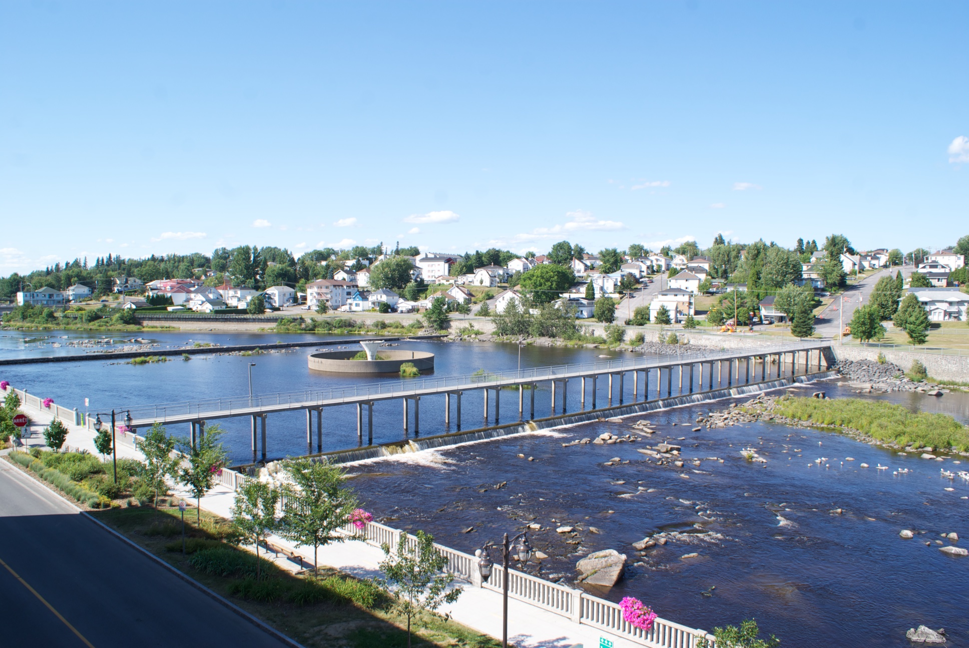
Alma is located on the southeast coast of Lac Saint-Jean where it flows into the Saguenay River, in the Saguenay–Lac-Saint-Jean region of Quebec, Canada, approximately 175 km north of Quebec City. Alma is the seat of Lac-Saint-Jean-Est Regional County Municipality. Alma is the second city in population in the Saguenay-Lac-Saint-Jean region after the city of Saguenay.
Alma is the seat of the judicial district of Alma.[7]
History
The present town of Alma was formed in 1962 from the merging of four villages: Isle-Maligne, Naudville, Riverbend and St-Joseph d'Alma. The oldest of the villages, St-Joseph-d'Alma, was founded in 1867 by Damase Boulanger. The area became an important industrial centre during the 1920s and 1930s with the construction of a hydro-electrical power station on the Grande-Décharge River, a paper mill (Price) and an aluminum smelting plant (Alcan), all of which are still in activity today.
In 2002, Alma merged with the Municipality of Delisle. Both modern day Alma and St-Joseph d'Alma are named after the Battle of the Alma.
Demographics
In the 2021 Census of Population conducted by Statistics Canada, Alma had a population of 30,331 living in 13,815 of its 14,493 total private dwellings, a change of -1.4% from its 2016 population of 30,771. With a land area of 194.92 km2 (75.26 sq mi), it had a population density of 155.6/km2 (403.0/sq mi) in 2021.[8]
Population trend:[9]
- Population in 2021: 30,915 [10]
- Population in 2011: 30,904 (2006 to 2011 population change: 3%)
- Population in 2006: 29,998
- Population total in 2001: 30,126
- Alma (ville): 25,918
- Delisle (municipality): 4,208
- Population in 1996:
- Alma (ville): 26,127
- Delisle (municipality): 4,256
- Population in 1991:
- Alma (ville): 25,910
- Delisle (municipality): 4,281
Mother tongue:[11]
- English as first language: 0.5%
- French as first language: 98.5%
- English and French as first language: 0.1%
- Other as first language: 0.9%
| Visible minority and Aboriginal population (Canada 2006 Census) | |||
|---|---|---|---|
| Population group | Population | % of total population | |
| White | 29,025 | 97.7% | |
| Visible minority group Source:[12] | South Asian | 0 | 0% |
| Chinese | 45 | 0.2% | |
| Black | 40 | 0.1% | |
| Filipino | 0 | 0% | |
| Latin American | 20 | 0.1% | |
| Arab | 15 | 0.1% | |
| Southeast Asian | 60 | 0.2% | |
| West Asian | 0 | 0% | |
| Korean | 0 | 0% | |
| Japanese | 10 | 0% | |
| Visible minority, n.i.e. | 0 | 0% | |
| Multiple visible minority | 0 | 0% | |
| Total visible minority population | 200 | 0.7% | |
| Aboriginal group Source:[13] | First Nations | 125 | 0.4% |
| Métis | 335 | 1.1% | |
| Inuit | 0 | 0% | |
| Aboriginal, n.i.e. | 10 | 0% | |
| Multiple Aboriginal identity | 0 | 0% | |
| Total Aboriginal population | 480 | 1.6% | |
| Total population | 29,705 | 100% | |
Transportation
Alma is serviced by the Alma Airport, located 4.1 km to the south of the town.
Notable people
- Camille Bedard, hockey player
- Chris Boucher, basketball player for the Toronto Raptors
- Lucien Bouchard, former premier of Québec
- Guy Cloutier, producer and artist manager
- Guillaume Desbiens, hockey player
- Charles Hudon, hockey player for the Montreal Canadiens
- Pierre Lapointe, singer
- Émilie Fortin Tremblay (1872-1949), one of the first white women to cross the Chilkoot on the way to the Yukon gold fields
- François-Louis Tremblay, Olympic gold medallist short-track speed skater
- Mario Tremblay, hockey player and former coach of the Montreal Canadiens
See also
- List of cities in Quebec
References
- "Reference number 1013 in Banque de noms de lieux du Québec". toponymie.gouv.qc.ca (in French). Commission de toponymie du Québec.
- Ministère des Affaires municipales, des Régions et de l'Occupation du territoire - Répertoire des municipalités: Alma Archived 2012-01-15 at the Wayback Machine
- "Alma census profile". 2011 Census data. Statistics Canada. 8 February 2012. Retrieved 2012-05-24.
- "Alma (Population centre) community profile". 2011 Census data. Statistics Canada. 8 February 2012. Retrieved 2012-05-24.
- "Alma (Census agglomeration) community profile". 2011 Census data. Statistics Canada. 8 February 2012. Retrieved 2012-05-24. The census agglomeration consists of Alma and Saint-Nazaire. In the 2006 census, the census agglomeration had also included Saint-Henri-de-Taillon.
- "Alma". Geographical Names Data Base. Natural Resources Canada.
- Territorial Division Act. Revised Statutes of Quebec D-11.
- "Population and dwelling counts: Canada, provinces and territories, and census subdivisions (municipalities), Quebec". Statistics Canada. February 9, 2022. Retrieved August 29, 2022.
- Statistics Canada: 1996, 2001, 2006, 2011 census
- "Décret de population".
- "Alma community profile". 2006 Census data. Statistics Canada. 13 March 2007. Retrieved 2010-11-10.
- , Community Profiles from the 2006 Census, Statistics Canada - Census Subdivision
- , Aboriginal Population Profile from the 2006 Census, Statistics Canada - Census Subdivision
External links
- (in French) Ville d'Alma
Adjacent Municipal Subdivisions | |
|---|---|
| Cities | |
|---|---|
| Municipalities |
|
| Parishes | |
| Villages | |
| Unorganized territories | |
| |
Authority control | |
|---|---|
| General | |
| National libraries | |
| Other |
|
На других языках
[de] Alma (Québec)
Alma ist eine Stadt im Zentrum der kanadischen Provinz Québec. Sie liegt in der Verwaltungsregion Saguenay–Lac-Saint-Jean, etwa 200 km nördlich der Provinzhauptstadt Québec. Der Verwaltungssitz der regionalen Grafschaftsgemeinde (municipalité régionale du comté) Lac-Saint-Jean-Est hat eine Fläche von 196,54 km² und zählt 30.776 Einwohner (Stand: 2016).- [en] Alma, Quebec
[ru] Альма (Квебек)
Альма (фр. Alma) — город в провинции Квебек в Канаде, в регионе Сагеней — Озеро Сен-Жана. Город-побратим — Фалез во Франции.Другой контент может иметь иную лицензию. Перед использованием материалов сайта WikiSort.org внимательно изучите правила лицензирования конкретных элементов наполнения сайта.
WikiSort.org - проект по пересортировке и дополнению контента Википедии