world.wikisort.org - Brasile
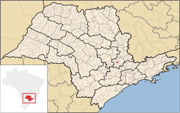
Hortolândia è un comune del Brasile nello Stato di San Paolo, parte della mesoregione di Campinas e della microregione omonima.
| Hortolândia comune | |||
|---|---|---|---|
| |||
 | |||
| Localizzazione | |||
| Stato | |||
| Stato federato | |||
| Mesoregione | Campinas | ||
| Microregione | Campinas | ||
| Amministrazione | |||
| Sindaco | Antonio Meira | ||
| Territorio | |||
| Coordinate | 22°51′22″S 47°12′39″W | ||
| Altitudine | 587 m s.l.m. | ||
| Superficie | 62,416 km² | ||
| Abitanti | 192 692[1] (2010) | ||
| Densità | 3 087,22 ab./km² | ||
| Altre informazioni | |||
| Prefisso | 19 | ||
| Fuso orario | UTC-3 | ||
| Codice IBGE | 3519071 | ||
| Nome abitanti | hortolandense | ||
| Area metropolitana | Regione Metropolitana di Campinas | ||
| Cartografia | |||
 Hortolândia | |||
 | |||
| Sito istituzionale | |||


Note
- (PT) Scheda del comune dall'IBGE - Censimento 2010, su cod.ibge.gov.br. URL consultato il 29 agosto 2015.
Altri progetti
 Wikimedia Commons contiene immagini o altri file su Hortolândia
Collegamenti esterni
- Sito ufficiale, su hortolandia.sp.gov.br.
На других языках
[de] Hortolândia
Hortolândia ist eine Gemeinde im Landesinneren des brasilianischen Bundesstaates São Paulo. Im Jahr 2018 lebten nach offizieller Schätzung etwa 227.400 Menschen in Hortolândia.[1][en] Hortolândia
Hortolândia is a Brazilian municipality in the interior of the state of São Paulo. It is part of the Metropolitan Region of Campinas[4] and the Mesoregion and Microregion of Campinas. It is located northwest of the state capital, about 110 km away. It is part of the São Paulo macrometropolis, which exceeds 29 million inhabitants and makes up approximately 75 percent of the state's population. The metropolitan regions of Campinas and São Paulo form the first megalopolis in the southern hemisphere.[5] It is bordered by Sumaré, to the north; Monte Mor, to the south and west; and Campinas, to the east.[6][fr] Hortolândia
Hortolândia est une commune brésilienne de l'État de São Paulo.- [it] Hortolândia
[ru] Ортоландия
Ортоландия (порт. Hortolândia) — муниципалитет в Бразилии, входит в штат Сан-Паулу. Составная часть мезорегиона Кампинас. Находится в составе крупной городской агломерации Агломерация Кампинас. Входит в экономико-статистический микрорегион Кампинас. Население составляет 190 781 человек на 2007 год. Занимает площадь 62,224 км². Плотность населения — 3.243,0 чел./км².Текст в блоке "Читать" взят с сайта "Википедия" и доступен по лицензии Creative Commons Attribution-ShareAlike; в отдельных случаях могут действовать дополнительные условия.
Другой контент может иметь иную лицензию. Перед использованием материалов сайта WikiSort.org внимательно изучите правила лицензирования конкретных элементов наполнения сайта.
Другой контент может иметь иную лицензию. Перед использованием материалов сайта WikiSort.org внимательно изучите правила лицензирования конкретных элементов наполнения сайта.
2019-2026
WikiSort.org - проект по пересортировке и дополнению контента Википедии
WikiSort.org - проект по пересортировке и дополнению контента Википедии