world.wikisort.org - Brésil
São Cristóvão (« Saint-Christophe » en français) est une ville brésilienne de l'est de l'État du Sergipe, fondée par Christophe de Barros (Cristóvão de Barros, en portugais).
Pour les articles homonymes, voir São Cristóvão.
| São Cristóvão | |
 Place São Francisco, São Cristóvão | |
| Administration | |
|---|---|
| Pays | |
| Région | Nord-Est |
| État | |
| Langue(s) | portugais |
| Maire | Alexsander Oliveira de Andrade (PDT) |
| Fuseau horaire | UTC-3 |
| Démographie | |
| Gentilé | sancristovense |
| Population | 71 931 hab.[1] (04/2007) |
| Densité | 165 hab./km2 |
| Géographie | |
| Coordonnées | 11° 00′ 54″ sud, 37° 12′ 21″ ouest |
| Altitude | 47 m |
| Superficie | 43 700 ha = 437 km2 |
| Divers | |
| Date de fondation | 1590 |
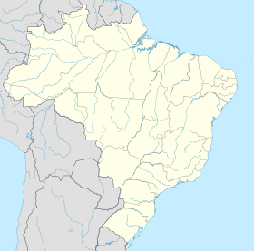
| Localisation | |
| modifier |
|
Généralités
São Cristóvão est la quatrième plus ancienne ville du Brésil de par sa fondation officielle. Elle est enregistrée comme patrimoine national par l'IPHAN (Instituto do Patrimônio Histórico e Artístico Nacional), le principal institut gouvernemental de protection du patrimoine culturel brésilien.
La place São Francisco et les édifices alentour ont été inscrits sur la liste du patrimoine mondial en 2010.
Géographie
São Cristóvão se situe par une latitude de 11° 00′ 54" sud et par une longitude de 37° 12′ 21″ ouest, à une altitude de 47 mètres.
La municipalité fait partie de la région métropolitaine d'Aracaju.
Sa population était de 71 931 habitants au recensement de 2007[2]. La municipalité s'étend sur 437 km2[3].
Elle fait partie de la microrégion d'Aracaju, dans la mésorégion Est du Sergipe.
Références
- Portail du patrimoine mondial
- Portail du Sergipe
На других языках
[de] São Cristóvão (Sergipe)
São Cristóvão, amtlich Município de São Cristóvão, ist eine Stadt im Nordosten von Brasilien. Sie liegt im Bundesstaat Sergipe, hatte 78.864 Einwohner bei der Volkszählung 2010 und hat eine Fläche von rund 438 km².[1] Die Bevölkerungszahl wurde zum 1. Juli 2021 auf 92.090 Einwohner geschätzt, die São-Cristovenser (são-cristovenses) genannt werden.[1] Sie liegt etwa 26 km südwestlich von Aracaju, der Hauptstadt des Bundesstaates. Seit 1995 ist sie Teil der Metropolregion Aracaju.[en] São Cristóvão
São Cristóvão (Portuguese pronunciation: [sɐ̃w kɾisˈtɔvɐ̃w], Saint Christopher) is a Brazilian municipality in the Northeastern state of Sergipe. Founded at the mouth of the Vaza-Barris River on January 1, 1590, the municipality is the fourth oldest settlement in Brazil. São Cristóvão is noted for its historic city square, São Francisco Square, and numerous early colonial-period buildings. The 3 hectares (7.4 acres) site was designated a UNESCO World Heritage Site in 2010.[3][4][5][6][7]- [fr] São Cristóvão (Sergipe)
[ru] Сан-Кристован (Сержипи)
Сан-Кристован (порт. São Cristóvão) — муниципалитет в Бразилии, входит в штат Сержипи. Составная часть мезорегиона Восток штата Сержипи. Входит в экономико-статистический микрорегион Аракажу. Население составляет 77 278 человек на 2006 год. Занимает площадь 432,4 км². Плотность населения — 178,8 чел./км².Другой контент может иметь иную лицензию. Перед использованием материалов сайта WikiSort.org внимательно изучите правила лицензирования конкретных элементов наполнения сайта.
WikiSort.org - проект по пересортировке и дополнению контента Википедии


