world.wikisort.org - Brésil
Serra do Navio est une municipalité du Centre de l'État de l'Amapá. Elle se situe dans la microrégion de Macapá et dans la mésorégion du sud de l'Amapá. Sa population est de 3 772 habitants (IBGE 04/2007), pour une superficie de 7 757 km2. Sa densité populationnelle est donc de 0,49 hab./km2.
| Serra do Navio | |
 Serra do Navio (1965) | |
| Administration | |
|---|---|
| Pays | |
| Région | Nord |
| État | |
| Langue(s) | portugais |
| Maire | Francimar Pereira da Silva Santos (PT) |
| Code postal | 68 914-000 |
| Fuseau horaireHeure d'été | UTC-3UTC-3 |
| Indicatif | 96 |
| Démographie | |
| Gentilé | serranaviense |
| Population | 3 772 hab.[1] (01-04-2007) |
| Densité | 0,49 hab./km2 |
| Géographie | |
| Coordonnées | 0° 54′ 05″ nord, 52° 00′ 08″ ouest |
| Altitude | 0 m |
| Superficie | 775 700 ha = 7 757 km2 |
| Divers | |
| Site(s) touristique(s) | écotourisme |
| FondateurDate de fondation | Loi 00071er mai 1992 |
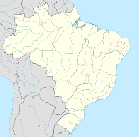
| Localisation | |
| modifier |
|
Elle fait limite avec Oiapoque au Nord, Calçoene à l'Est, Ferreira Gomes et Porto Grande au Sud-Est et Pedra Branca do Amapari à l'Ouest et au Sud.
La municipalité fut créée en 1993. Elle fait partie de la plus grande et plus ancienne zone d'extraction de manganèse du Brésil. De ce fait, son économie est tournée vers l'exportation.
Notes et références
- IBGE
- Portail de l'Amapá
- Portail de l’Amazonie
На других языках
[de] Serra do Navio
Serra do Navio, amtlich portugiesisch Município de Serra do Navio, ist eine Gemeinde im brasilianischen Bundesstaat Amapá. Die Bevölkerungszahl wurde zum 1. Juli 2020 auf 5488 Einwohner geschätzt, die auf einer Gemeindefläche von rund 7713 km² leben und Serranavienser (serranavienses) genannt werden. Sie steht an 14. Stelle der 16 Munizips des Bundesstaates.[1] Die Entfernung zur Hauptstadt Macapá beträgt rund 141 km. Sie ist wegen Manganfunden bekannt.[3][en] Serra do Navio
Serra do Navio (Portuguese pronunciation: [ˈsɛʁɐ du naˈviw]), (Mountain range of the Ship) is a municipality located in the center of the state of Amapá in Brazil. Its population is 5,488 (2020 est.)[1] and its area is 7,713 km².[2] In the 1947, Manganese was discovered in the area.[3] Serra do Navio[4] was built as a planned city to house the workers.[3] On 22 June 1993, the capital of the municipality was changed from Água Branca do Amapari to Serra do Novio.[4][5][es] Serra do Navio
Serra do Navio es un municipio de Brasil, situado en el centro del estado de Amapá.- [fr] Serra do Navio
[ru] Серра-ду-Навиу
Серра-ду-Навиу (порт. Serra do Navio) — муниципалитет в Бразилии, входит в штат Амапа. Составная часть мезорегиона Юг штата Амапа. Входит в экономико-статистический микрорегион Макапа. Население составляет 4 380 человек (2010 год). Занимает площадь 7 713,046 км². Плотность населения — 0,57 чел./км².Текст в блоке "Читать" взят с сайта "Википедия" и доступен по лицензии Creative Commons Attribution-ShareAlike; в отдельных случаях могут действовать дополнительные условия.
Другой контент может иметь иную лицензию. Перед использованием материалов сайта WikiSort.org внимательно изучите правила лицензирования конкретных элементов наполнения сайта.
Другой контент может иметь иную лицензию. Перед использованием материалов сайта WikiSort.org внимательно изучите правила лицензирования конкретных элементов наполнения сайта.
2019-2025
WikiSort.org - проект по пересортировке и дополнению контента Википедии
WikiSort.org - проект по пересортировке и дополнению контента Википедии


