world.wikisort.org - Brésil
Laranjal do Jari est une municipalité du Sud-Est de l'État de l'Amapá. Sa population était de 40 357 habitants en 2007[2], pour une superficie de 30 966 km2. Sa densité populationnelle est donc de 1,2 hab./km2.
Pour les articles homonymes, voir Jari.
| Laranjal do Jari | ||||
| Administration | ||||
|---|---|---|---|---|
| Pays | ||||
| Région | Nord | |||
| État | ||||
| Langue(s) | portugais | |||
| Maire | Euricelia Melo Cardoso (PP) | |||
| Code postal | 68 920-000 | |||
| Fuseau horaireHeure d'été | UTC-3UTC-3 | |||
| Indicatif | 96 | |||
| Démographie | ||||
| Gentilé | laranjalense ou jarinense |
|||
| Population | 40 357 hab.[1] (01-08-2009) | |||
| Densité | 1,3 hab./km2 | |||
| Géographie | ||||
| Coordonnées | 0° 50′ 31″ sud, 52° 30′ 59″ ouest | |||
| Altitude | 22 m |
|||
| Superficie | 3 096 600 ha = 30 966 km2 | |||
| Divers | ||||
| Site(s) touristique(s) | écotourisme | |||
| Date de fondation | 6 décembre 1987 | |||
| Localisation | ||||
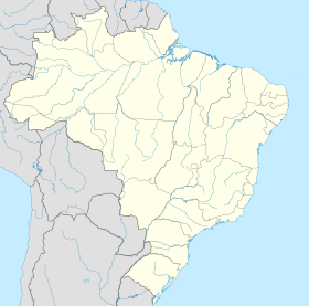
| Géolocalisation sur la carte : Amapá
Géolocalisation sur la carte : Brésil
Géolocalisation sur la carte : Brésil
| ||||
| modifier |
||||
Elle fait limite avec la Guyane française et le Suriname au Nord, Oiapoque et Pedra Branca do Amapari à l'Est, Mazagão au Sud-Est et Vitória do Jari au Sud ; dans l'État du Pará, Almeirim à l'Ouest.

Notes et références
- IBGE
- IBGE, août 2009.
- Portail de l'Amapá
- Portail de l’Amazonie
На других языках
[de] Laranjal do Jari
Laranjal do Jari, amtlich portugiesisch Município de Laranjal do Jari, ist eine Kleinstadt mit großem Gemeindegebiet im brasilianischen Bundesstaat Amapá in der Região Norte. Sie liegt am Rio Jari, der in den Amazonas mündet, und ist rund 275 km von der Hauptstadt Macapá entfernt. Die Bevölkerungszahl wurde zum 1. Juli 2021 auf 52.302 Einwohner geschätzt.[1] Die Einwohner, die auf dem fast wie das Bundesland Brandenburg etwa 30.783 km² großen Gebiet leben, werden Laranjalenser (portugiesisch laranjalenses) genannt. Die Bevölkerungsdichte lag 2010 bei 1,3 Personen pro km².[1][en] Laranjal do Jari
Laranjal do Jari (Portuguese pronunciation: [laɾɐ̃'ʒaw du ʒa'ɾi]) (Jari Orangery) is a municipality located in the west of the state of Amapá in Brazil. It is the only municipality in the west boundaries of Amapá, except for a small part of Vitória do Jari. Its population is 51,362 and its area is 30,783 km², which makes it the largest municipality of Amapá.[1][es] Laranjal do Jari
Laranjal do Jari es un municipio de Brasil, en el sudeste del estado de Amapá. La población estimada en 2014 era de 39.805 habitantes y su extensión de 29.699 km², lo que da una densidad de apenas 1 hab/km².- [fr] Laranjal do Jari
[ru] Ларанжал-ду-Жари
Ларанжал-ду-Жари (порт. Laranjal do Jari) — муниципалитет в Бразилии, входит в штат Амапа. Составная часть мезорегиона Юг штата Амапа. Входит в экономико-статистический микрорегион Мазаган. Население составляет 39 942 человека на 2010 год. Занимает площадь 30 783 км². Плотность населения — 1,3 чел./км².Текст в блоке "Читать" взят с сайта "Википедия" и доступен по лицензии Creative Commons Attribution-ShareAlike; в отдельных случаях могут действовать дополнительные условия.
Другой контент может иметь иную лицензию. Перед использованием материалов сайта WikiSort.org внимательно изучите правила лицензирования конкретных элементов наполнения сайта.
Другой контент может иметь иную лицензию. Перед использованием материалов сайта WikiSort.org внимательно изучите правила лицензирования конкретных элементов наполнения сайта.
2019-2025
WikiSort.org - проект по пересортировке и дополнению контента Википедии
WikiSort.org - проект по пересортировке и дополнению контента Википедии


