world.wikisort.org - Brésil
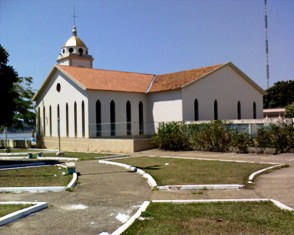
Humaitá est une municipalité brésilienne de l'État d'Amazonas dans la Microrégion du Madeira.
Pour les articles homonymes, voir Humaitá.
| Humaitá | ||||
 Héraldique |
 Drapeau |
|||
| ||||
| Administration | ||||
|---|---|---|---|---|
| Pays | ||||
| Région | Microrégion du Madeira | |||
| État | ||||
| Maire | José Cidenei Lobo do Nascimento | |||
| Code postal | 1301704 | |||
| Fuseau horaire | UTC-3 | |||
| Démographie | ||||
| Gentilé | humaitaense | |||
| Population | 44 227 hab.[1] (2010) | |||
| Densité | 1,3 hab./km2 | |||
| Géographie | ||||
| Coordonnées | 7° 30′ 22″ sud, 63° 01′ 38″ ouest | |||
| Altitude | 90 m |
|||
| Superficie | 3 307 166,7 ha = 33 071,667 km2 | |||
| Divers | ||||
| Date de fondation | 1890 | |||
| Localisation | ||||
| Géolocalisation sur la carte : Brésil
Géolocalisation sur la carte : Brésil
Géolocalisation sur la carte : Amazonas
| ||||
| Liens | ||||
| Site web | Site | |||
| modifier |
||||


Notes et références
- IBGE
 Portail de l’Amazonie
  Portail du Brésil
На других языках
[de] Humaitá (Amazonas)
Humaitá, amtlich Município de Humaitá, ist eine Gemeinde im Süden des brasilianischen Bundesstaates Amazonas. Humaitá liegt auf 90 Metern über dem Meeresspiegel und erstreckt sich über etwa 33.111 Quadratkilometer. Die Gemeinde zählte laut Schätzung des brasilianischen Statistikamts IBGE zum 1. Juli 2021 57.195 Einwohner, Humaitaenser genannt, und hat eine Bevölkerungsdichte von etwa 1,3 Personen pro km².[1] Sie liegt 675 km von der Hauptstadt Manaus entfernt und steht an 10. Stelle der 62 Munizipien des Bundesstaates. Der namengebende urban bebaute Sitz des Munizips umfasst etwa 8,6 km².[en] Humaitá, Amazonas
Humaitá is a municipality located in the Brazilian state of Amazonas. Its population was 56,144 (2020)[1] and its area is 33,072 km².[2] The city is located on the banks of the Madeira River.[es] Humaitá (Amazonas)
Humaitá es un municipio del estado de Amazonas, Brasil. Limita por el norte y el oriente con el también municipio de Manicoré; por el occidente con los municipios amazonenses de Canutama y Tapauá y; por el sur, con Porto Velho y Machadinho d'Oeste, estos dos municipios, del estado de Rondônia.- [fr] Humaitá (Amazonas)
[ru] Умайта (Амазонас)
Умайта (порт. Humaitá) — муниципалитет в Бразилии, входит в штат Амазонас. Составная часть мезорегиона Юг штата Амазонас. Входит в экономико-статистический микрорегион Мадейра. Население составляет 44 227 человек. Занимает площадь 33 121,56 км². Плотность населения — 1,34 чел./км².Текст в блоке "Читать" взят с сайта "Википедия" и доступен по лицензии Creative Commons Attribution-ShareAlike; в отдельных случаях могут действовать дополнительные условия.
Другой контент может иметь иную лицензию. Перед использованием материалов сайта WikiSort.org внимательно изучите правила лицензирования конкретных элементов наполнения сайта.
Другой контент может иметь иную лицензию. Перед использованием материалов сайта WikiSort.org внимательно изучите правила лицензирования конкретных элементов наполнения сайта.
2019-2026
WikiSort.org - проект по пересортировке и дополнению контента Википедии
WikiSort.org - проект по пересортировке и дополнению контента Википедии