world.wikisort.org - Brésil
Uberlândia est une commune brésilienne de l'ouest de l'État du Minas Gerais, localisée à 556 km au nord-ouest de Belo Horizonte.
Cet article est une ébauche concernant une localité brésilienne.
Vous pouvez partager vos connaissances en l’améliorant (comment ?) selon les recommandations des projets correspondants.
| Uberlândia Surnom : Portal do Cerrado Terra gentil que seduz | ||||
 Drapeau | ||||
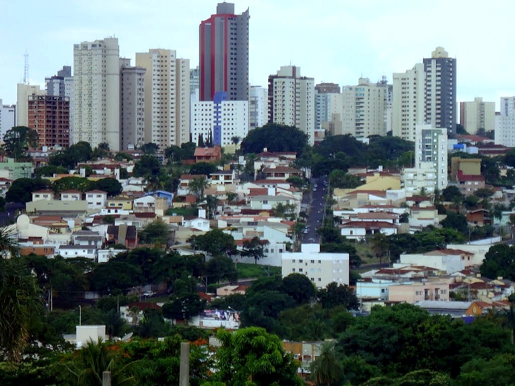 Centre-ville d'Uberlandia à la mi-novembre 2011 | ||||
| Administration | ||||
|---|---|---|---|---|
| Pays | ||||
| Région | Région Sud-Est | |||
| État | ||||
| Langue(s) | portugais | |||
| Maire | Odelmo Leão Carneiro (PP) | |||
| Code postal | 38400-000 | |||
| Fuseau horaire | UTC-3 | |||
| Indicatif | 34 | |||
| Démographie | ||||
| Gentilé | uberlandense | |||
| Population | 662 362 hab.[1] (2015) | |||
| Densité | 161 hab./km2 | |||
| Géographie | ||||
| Coordonnées | 18° 55′ 08″ sud, 48° 16′ 37″ ouest | |||
| Altitude | 863 m |
|||
| Superficie | 411 520,6 ha = 4 115,206 km2 | |||
| Divers | ||||
| Date de fondation | 31 août 1888 | |||
| Localisation | ||||
| Géolocalisation sur la carte : Brésil
Géolocalisation sur la carte : Brésil
Géolocalisation sur la carte : Minas Gerais
| ||||
| Liens | ||||
| Site web | http://www3.uberlandia.mg.gov.br/ | |||
| modifier |
||||


Géographie
Uberlândia se situe à une latitude de 18° 55′ 08″ sud et à une longitude de 48° 16′ 37″ ouest. L'altitude est de 863 mètres au centre-ville, mais elle varie de 622 à 930 mètres, et présente une moyenne de 887 mètres sur la commune.
Sa population était de 604 013 habitants au recensement de 2010 et de 662 362 habitants en 2015 selon l'estimation de l'Institut Brésilien de Géographie et Statistique. La commune s'étend sur 4 115,21 km2, dont 135,35 km2 sont situés en zone urbaine et 3 979,86 km2 .
Elle est la deuxième ville de l'État par la population et l'activité économique. Elle se situe dans le triangle Mineiro.
Communications
L'indicatif de Uberlândia (MG) est le 34 [2].
Toponyme
Le premier nom de la ville actuelle de Uberlândia fut São Pedro de Uberabinha, district de Uberaba en 1857. La loi de l'état no 23 du la rebaptisa simplement Uberabinha. Le , la ville prit son nom actuel de Uberlândia, un nom composé de deux mots d'origines différentes : « uber » et « lândia » :
- Uber provient du tupi 'yberaba (« eau brillante ») ;
- Lândia provient de l'allemand land (« terre »).
Personnalités liées à Uberlândia
- Grande Otelo (1915-1993) est natif de la ville et y est inhumé.
Références
- IBGE
- (pt) « DDD de Uberlândia (MG) », Códigos DDD (consulté le )
Liens externes
- (pt) Estimation de population - juillet 2015 - IBGE
- (pt) Informations de l'IBGE concernant chacune des communes brésiliennes
 Portail du Minas Gerais
На других языках
[de] Uberlândia
Uberlândia, amtlich portugiesisch Município de Uberlândia, ist eine Stadt im brasilianischen Bundesstaat Minas Gerais. Uberlândia liegt im Triângulo Mineiro, dem „Bergbau-Dreieck“, und ist nach Belo Horizonte die zweitgrößte Stadt in Minas Gerais und das wichtigste Wirtschaftszentrum der Region.[en] Uberlândia
Uberlândia (Portuguese pronunciation: [ubɛʁˈlɐ̃d͡ʒiɐ]) is a municipality in the state of Minas Gerais, southeastern Brazil. It is the second largest municipality in the state of Minas Gerais after the state capital Belo Horizonte. Its population in 2020 was 699,097, making it the fourth largest city of the interior region of Brazil. The city is located on the Brazilian Highlands 2,802 feet (854 m) above sea level. It is an important logistic hub between São Paulo and Brasília. The city sits within the Brazilian cerrado and has eight protected zones of tropical savanna vegetation.[4][es] Uberlândia
Uberlândia es un municipio brasileño del estado de Minas Gerais y con más de 691 305 habitantes (IBGE 2019), es el segundo mayor municipio del estado, solo después de Belo Horizonte, y de la región sudeste de Brasil. Es también el municipio más poblado de la región del Triángulo Minero. Posee una superficie de 4.115 km².- [fr] Uberlândia
[ru] Уберландия
Уберландия (порт. Uberlândia) — город и муниципалитет в Бразилии, входит в штат Минас-Жерайс. Составная часть мезорегиона Триангулу-Минейру-и-Алту-Паранаиба. Находится в составе крупной городской агломерации . Входит в экономико-статистический микрорегион Уберландия. Население составляет 608 369 человек на 2007 год. Занимает площадь 4 115,822 км². Плотность населения — 147,8 чел./км².Другой контент может иметь иную лицензию. Перед использованием материалов сайта WikiSort.org внимательно изучите правила лицензирования конкретных элементов наполнения сайта.
WikiSort.org - проект по пересортировке и дополнению контента Википедии